MyTopo
Hollis Oklahoma US Topo Map
Couldn't load pickup availability
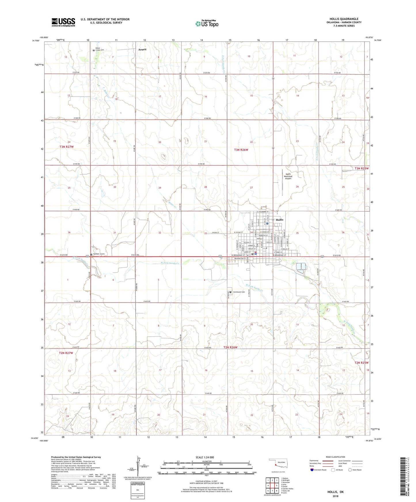
2018 topographic map quadrangle Hollis in the state of Oklahoma. Scale: 1:24000. Based on the newly updated USGS 7.5' US Topo map series, this map is in the following counties: Harmon. The map contains contour data, water features, and other items you are used to seeing on USGS maps, but also has updated roads and other features. This is the next generation of topographic maps. Printed on high-quality waterproof paper with UV fade-resistant inks.
Quads adjacent to this one:
West: Arlie
Northwest: Dodson
North: McKnight
Northeast: Shrewder
East: Gould
Southeast: Louis
South: Hollis SW
Southwest: Garden Valley
Contains the following named places: Abernathy Park, Antioch Church, Arnett, Bitter Creek, Bitter Creek Cemetery, Church of Christ, Church of God in Christ, Church of the Nazarene, City of Hollis, Fairmount Cemetery, First Assembly of God Church, First Baptist Church, First United Methodist Church, Harmon County Jail, Harmon County Sheriff's Office, Harmon Memorial Hospital, Hollis, Hollis Elementary School, Hollis Fire Department, Hollis High School, Hollis Middle School, Hollis Municipal Airport, Hollis Police Department, Hollis Post Office, Number 2 Cemetery, Ray Preston Airport, Southwest Oklahoma Ambulance Authority, Township of Hollis, Westview Boys Home, ZIP Code: 73550