MyTopo
Gould Oklahoma US Topo Map
Couldn't load pickup availability
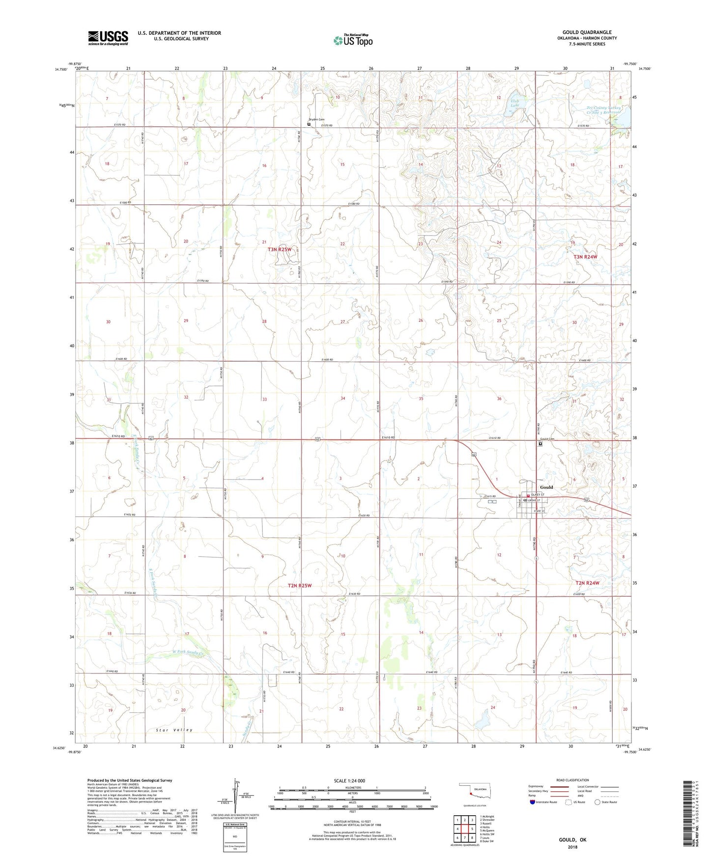
2022 topographic map quadrangle Gould in the state of Oklahoma. Scale: 1:24000. Based on the newly updated USGS 7.5' US Topo map series, this map is in the following counties: Harmon. The map contains contour data, water features, and other items you are used to seeing on USGS maps, but also has updated roads and other features. This is the next generation of topographic maps. Printed on high-quality waterproof paper with UV fade-resistant inks.
Quads adjacent to this one:
West: Hollis
Northwest: McKnight
North: Shrewder
Northeast: Russell
East: McQueen
Southeast: Duke SW
South: Louis
Southwest: Hollis SW
This map covers the same area as the classic USGS quad with code o34099f7.
Contains the following named places: Club Lake, Dryden Cemetery, Dryden Church, East Fork Sandy Creek, Gould, Gould Cemetery, Gould Division, Gould Post Office, Gould Volunteer Fire Department, Harmon County, Michael Airport, Town of Gould, Township of Coralea, Tri-County Turkey Creek Site 3 Reservoir, West Fork Sandy Creek