MyTopo
Locust Grove Oklahoma US Topo Map
Couldn't load pickup availability
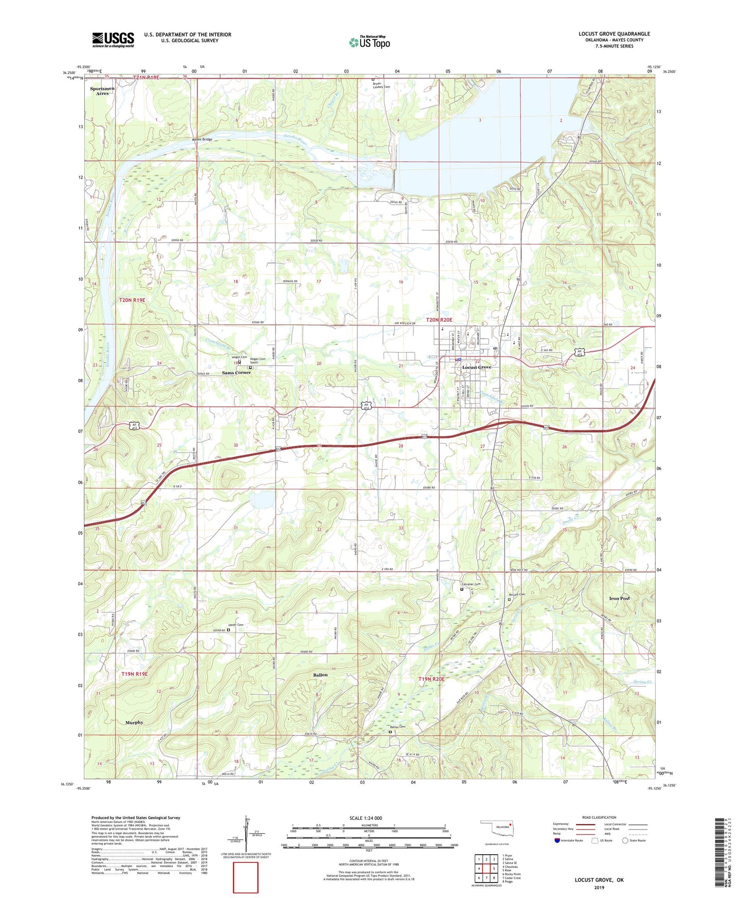
2019 topographic map quadrangle Locust Grove in the state of Oklahoma. Scale: 1:24000. Based on the newly updated USGS 7.5' US Topo map series, this map is in the following counties: Mayes. The map contains contour data, water features, and other items you are used to seeing on USGS maps, but also has updated roads and other features. This is the next generation of topographic maps. Printed on high-quality waterproof paper with UV fade-resistant inks.
Quads adjacent to this one:
West: Chouteau
Northwest: Pryor
North: Salina
Northeast: Salina SE
East: Rose
Southeast: Peggs
South: Cedar Crest
Southwest: Rocky Point
Contains the following named places: Ballou, Ballou Branch, Ballou Cemetery, Ballou Census Designated Place, Ballou Church, Bryan-Lindsey Cemetery, Calvalier Cemetery, Camp Garland, Camp Scott, Cedar Crest Church, Chapel Branch, Cherokee Oklahoma Tribal Statistical Area, Crutchfield Branch, Earl Ward Park, Haner Cemetery, Hogan Cemetery, Hogan Cemetery South, Iron Post, Iron Post Census Designated Place, Iron Post Church, Lake Hudson, Locust Grove, Locust Grove Division, Locust Grove Early Learning Center, Locust Grove Fire Department, Locust Grove High School, Locust Grove Middle School, Locust Grove Police Department, Locust Grove Post Office, Locust Grove Upper Elementary School, Low Water Dam Public Use Area, Maner Church, Markham Ferry Church, Markham Ferry Dam, Mayes Bridge, Mayes Emergency Services Trust Authority Station 3, McLain Cemetery, Murphy, Murphy Census Designated Place, New Hogan Church, Open Door Church, Pryor Water Intake, Robert S Kerr Dam, Sams Corner, Sams Corner Census Designated Place, Snake Creek, Town of Locust Grove, Township of Bryan, ZIP Code: 74352