MyTopo
Salina SE Oklahoma US Topo Map
Couldn't load pickup availability
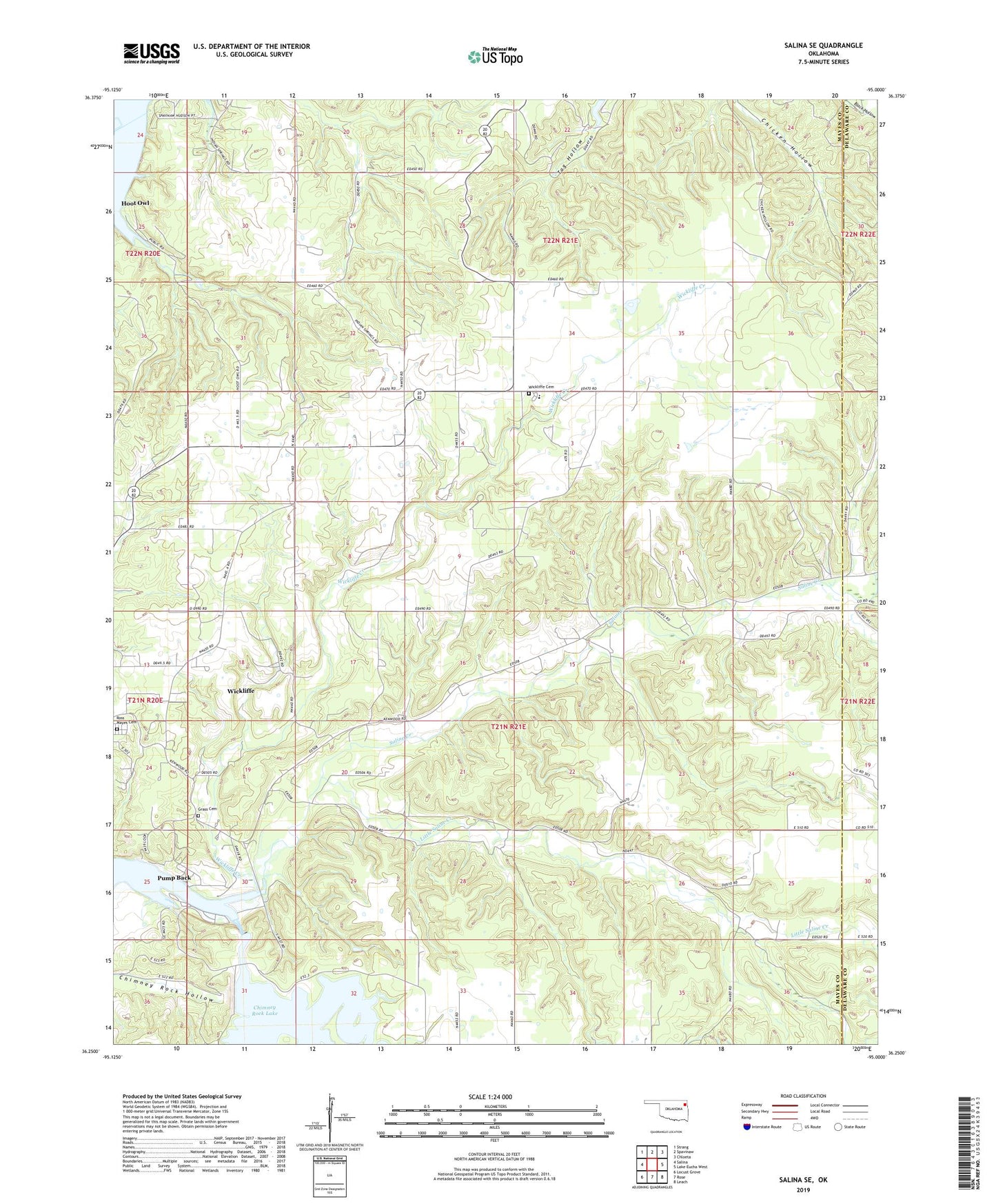
2022 topographic map quadrangle Salina SE in the state of Oklahoma. Scale: 1:24000. Based on the newly updated USGS 7.5' US Topo map series, this map is in the following counties: Mayes, Delaware. The map contains contour data, water features, and other items you are used to seeing on USGS maps, but also has updated roads and other features. This is the next generation of topographic maps. Printed on high-quality waterproof paper with UV fade-resistant inks.
Quads adjacent to this one:
West: Salina
Northwest: Strang
North: Spavinaw
Northeast: Chloeta
East: Lake Eucha West
Southeast: Leach
South: Rose
Southwest: Locust Grove
This map covers the same area as the classic USGS quad with code o36095c1.
Contains the following named places: Blue Springs Church, Chimney Rock Dam, Chimney Rock Reservoir, Grass Cemetery, Hoot Owl, Little Saline Creek, New Jordan Church, Pump Back, Pump Back Census Designated Place, Ross Mayes Cemetery, Saline Creek, Town of Hoot Owl, Township of Saline, Wickliffe, Wickliffe Cemetery, Wickliffe Census Designated Place, Wickliffe Creek, Wickliffe Elementary School, ZIP Code: 74365