MyTopo
Prettyhair Creek Oklahoma US Topo Map
Couldn't load pickup availability
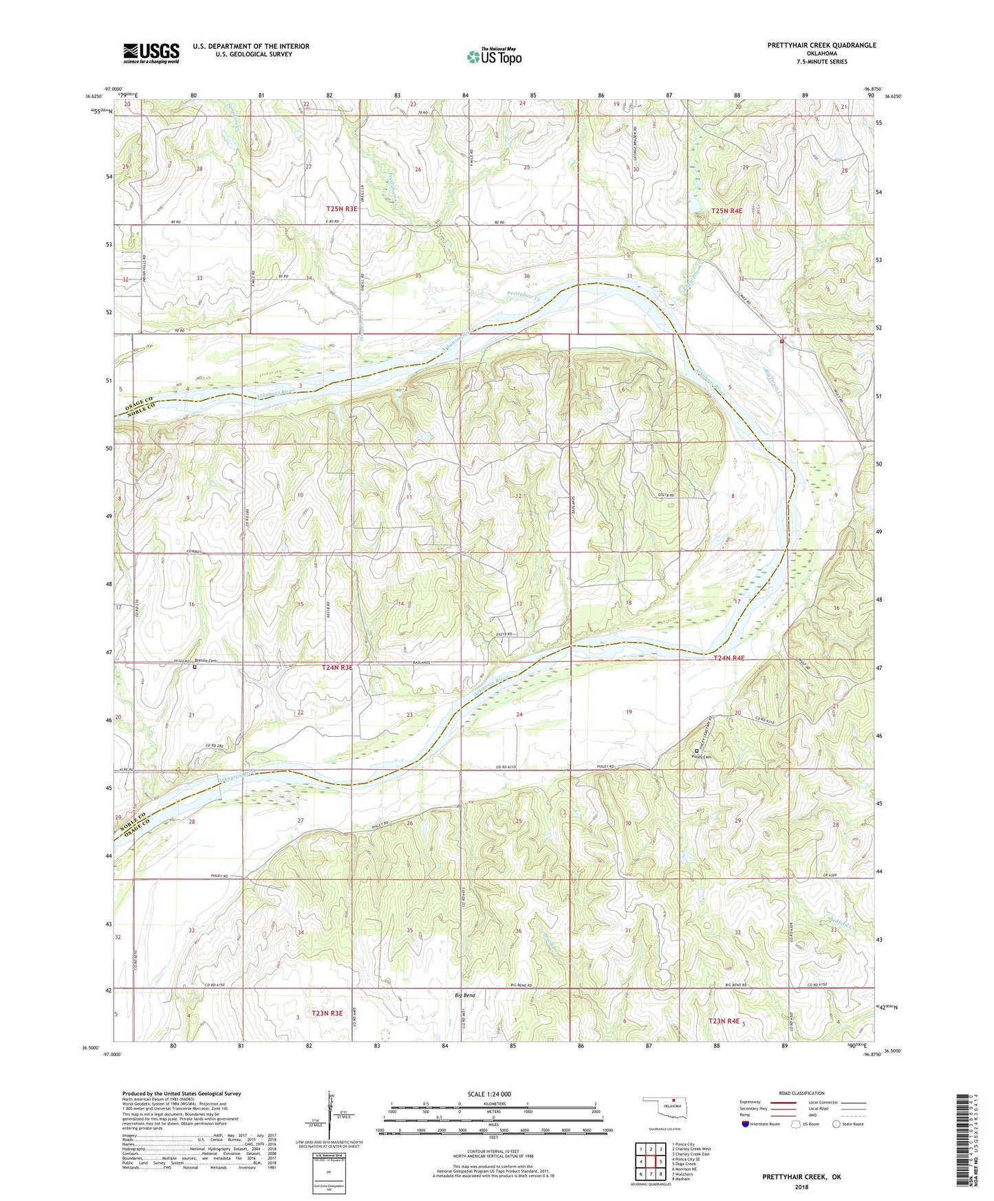
2018 topographic map quadrangle Prettyhair Creek in the state of Oklahoma. Scale: 1:24000. Based on the newly updated USGS 7.5' US Topo map series, this map is in the following counties: Osage, Noble. The map contains contour data, water features, and other items you are used to seeing on USGS maps, but also has updated roads and other features. This is the next generation of topographic maps. Printed on high-quality waterproof paper with UV fade-resistant inks.
Quads adjacent to this one:
West: Ponca City SE
Northwest: Ponca City
North: Charley Creek West
Northeast: Charley Creek East
East: Doga Creek
Southeast: Masham
South: Watchorn
Southwest: Morrison NE
Contains the following named places: Bar L Ranch, Big Bend, Big Drum Creek, Bressie Cemetery, Drum Creek Volunteer Fire Department, Little Drum Creek, Ochelata Lake, Ocheleta Dam, Oknoname 13904 Dam, Oknoname 13904 Reservoir, Osage Crossing Place, Pixley Cemetery, Prettyhair Creek, Simpkins Creek, Township of East Bressie