MyTopo
Charley Creek East Oklahoma US Topo Map
Couldn't load pickup availability
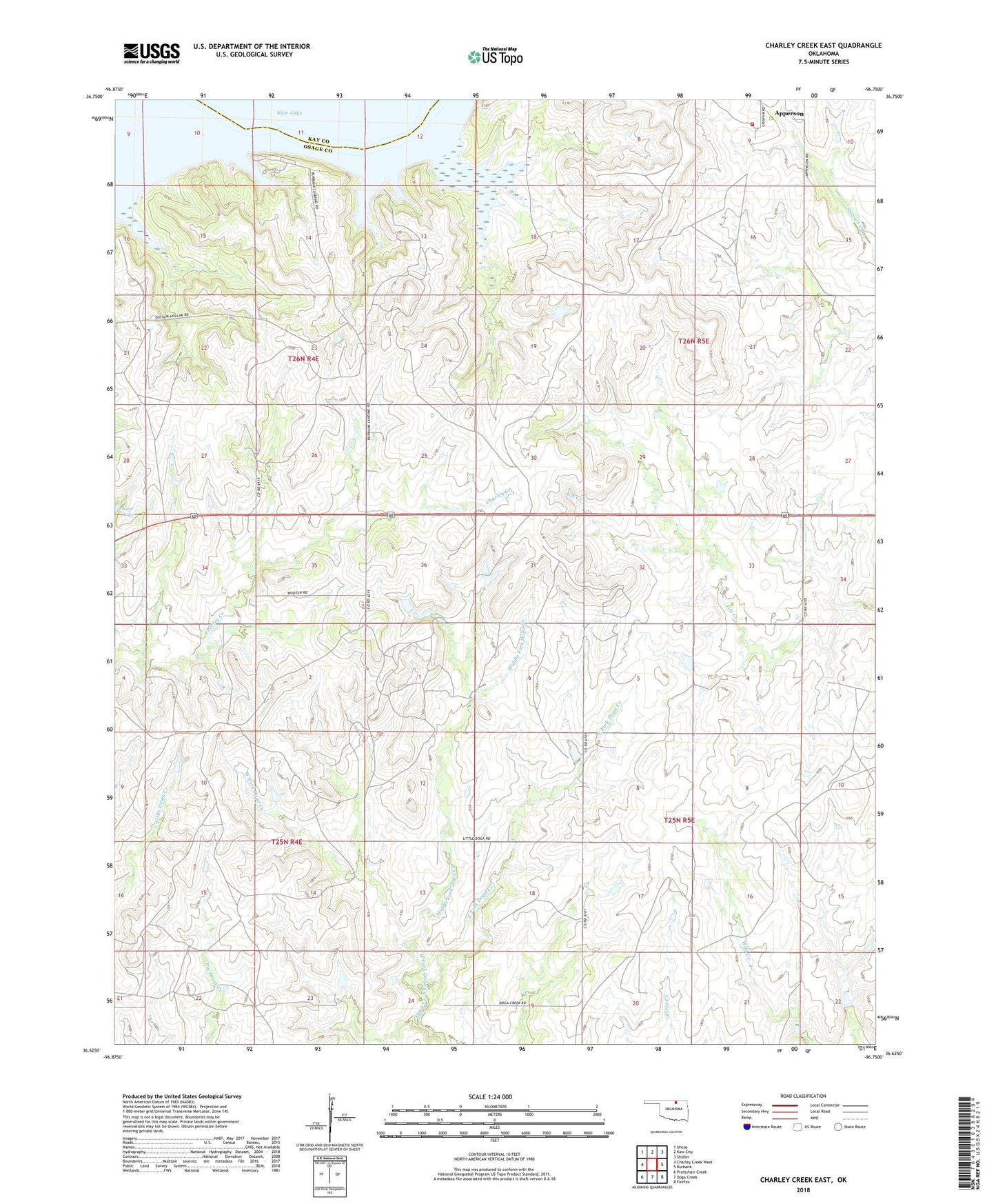
2022 topographic map quadrangle Charley Creek East in the state of Oklahoma. Scale: 1:24000. Based on the newly updated USGS 7.5' US Topo map series, this map is in the following counties: Osage, Kay. The map contains contour data, water features, and other items you are used to seeing on USGS maps, but also has updated roads and other features. This is the next generation of topographic maps. Printed on high-quality waterproof paper with UV fade-resistant inks.
Quads adjacent to this one:
West: Charley Creek West
Northwest: Uncas
North: Kaw City
Northeast: Shidler
East: Burbank
Southeast: Fairfax
South: Doga Creek
Southwest: Prettyhair Creek
This map covers the same area as the classic USGS quad with code o36096f7.
Contains the following named places: East Fork Doga Creek, Kaw Lake, Kaw Oil Field, Middle Fork Doga Creek, South Kaw Oil Field, Township of Big Hill, West Fork Doga Creek, ZIP Code: 74633