MyTopo
Razor Blade Mesa Oklahoma US Topo Map
Couldn't load pickup availability
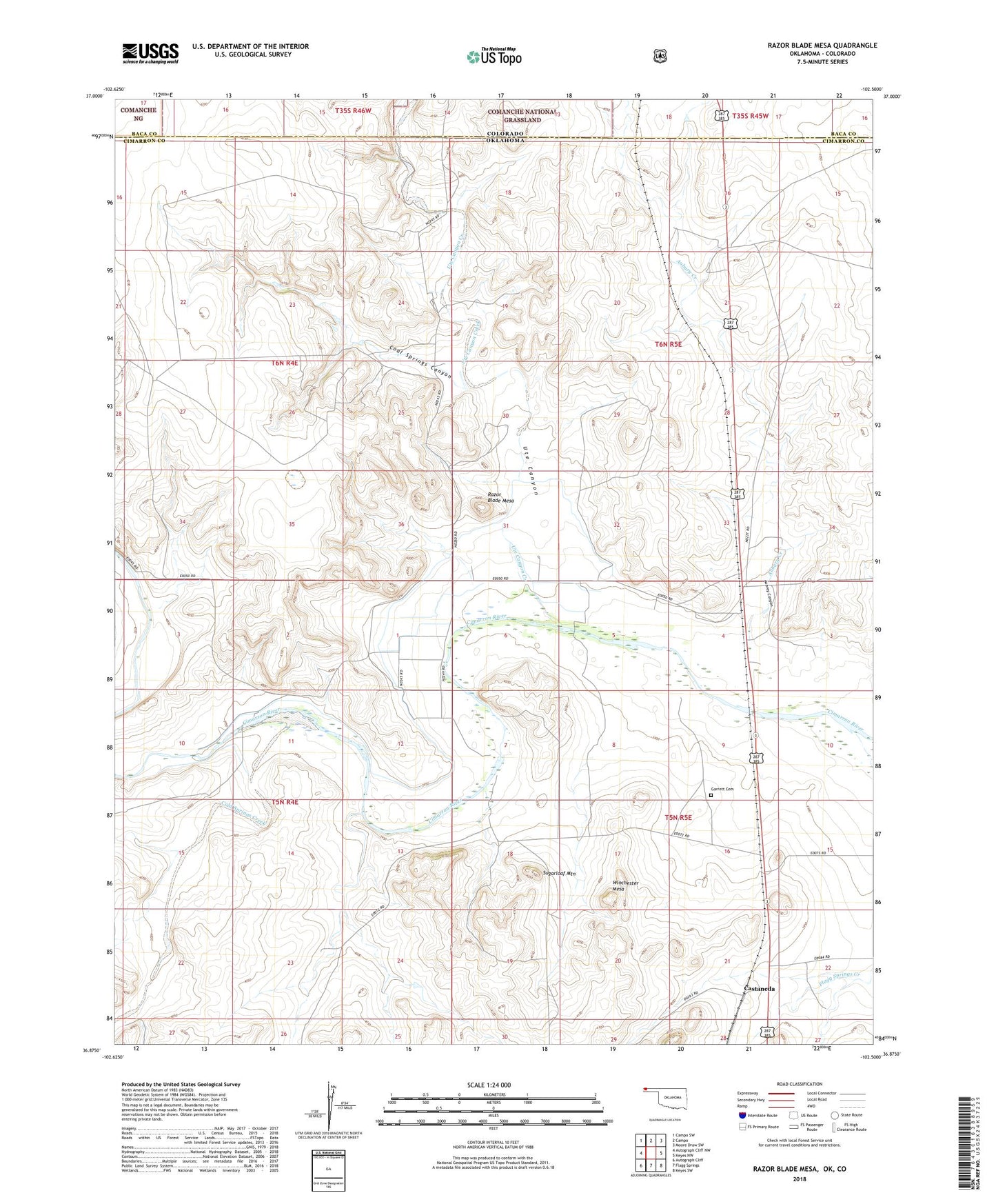
2018 topographic map quadrangle Razor Blade Mesa in the state of Oklahoma. Scale: 1:24000. Based on the newly updated USGS 7.5' US Topo map series, this map is in the following counties: Cimarron, Baca. The map contains contour data, water features, and other items you are used to seeing on USGS maps, but also has updated roads and other features. This is the next generation of topographic maps. Printed on high-quality waterproof paper with UV fade-resistant inks.
Quads adjacent to this one:
West: Autograph Cliff NW
Northwest: Campo SW
North: Campo
Northeast: Moore Draw SW
East: Keyes NW
Southeast: Keyes SW
South: Flagg Springs
Southwest: Autograph Cliff
Contains the following named places: Aubrey Canyon, Aubrey Creek, Aubury Creek, Castaneda, Coal Springs Canyon, Cold Springs Creek, Garrett Cemetery, Gaylor Ecd Number 1 Dam, Gaylor Ecd Number 1 Reservoir, Razor Blade Mesa, Sugarloaf Mountain, Ute Canyon, Ute Canyon Creek, Winchester Mesa