MyTopo
Salina Oklahoma US Topo Map
Couldn't load pickup availability
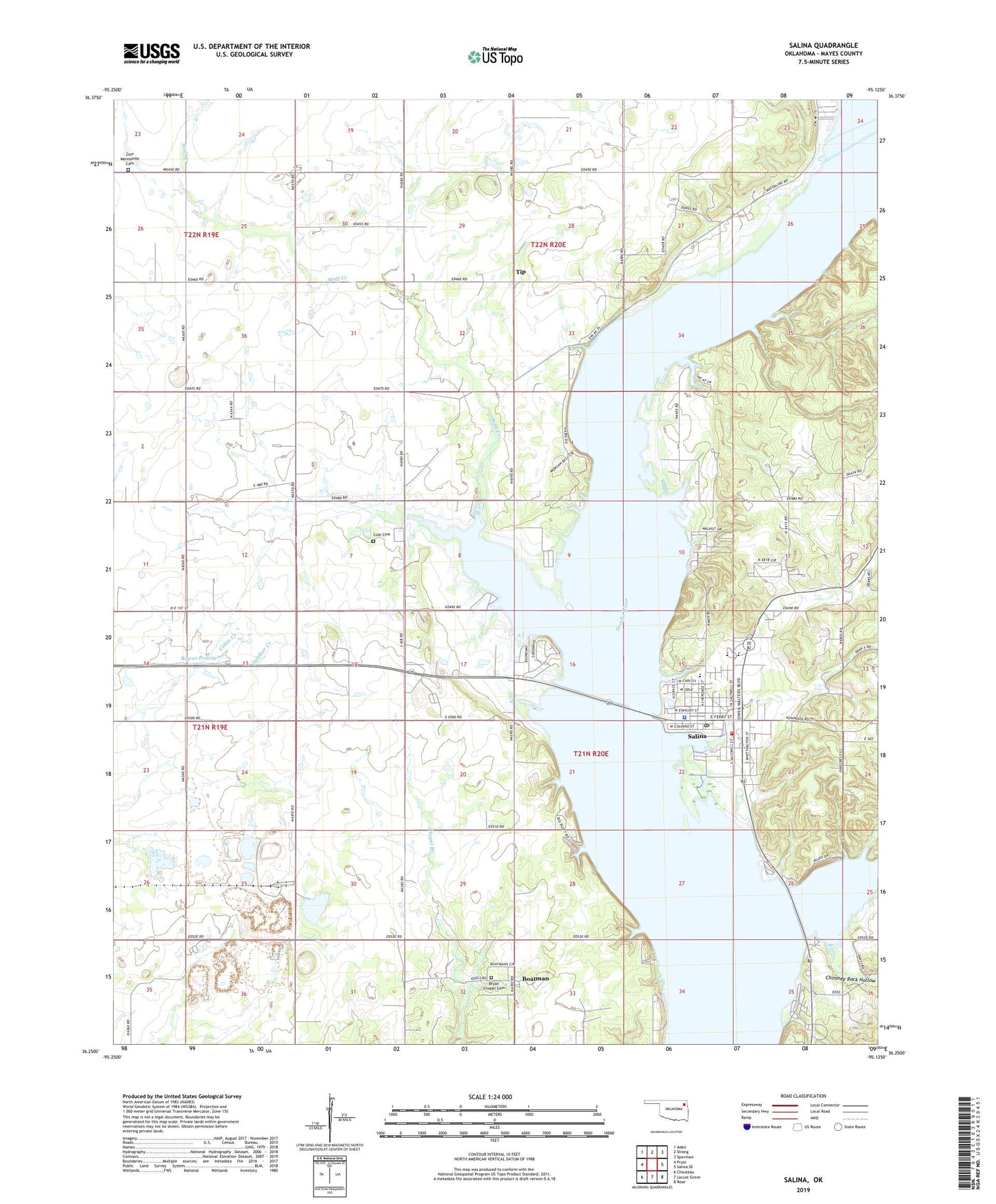
2019 topographic map quadrangle Salina in the state of Oklahoma. Scale: 1:24000. Based on the newly updated USGS 7.5' US Topo map series, this map is in the following counties: Mayes. The map contains contour data, water features, and other items you are used to seeing on USGS maps, but also has updated roads and other features. This is the next generation of topographic maps. Printed on high-quality waterproof paper with UV fade-resistant inks.
Quads adjacent to this one:
West: Pryor
Northwest: Adair
North: Strang
Northeast: Spavinaw
East: Salina SE
Southeast: Rose
South: Locust Grove
Southwest: Chouteau
Contains the following named places: Boatman, Bryan Chapel Cemetery, Chimney Rock Hollow, City of Tulsa Water Intake, Cole Cemetery, Cole Church, Cole School, Grand River Pumping Station, KEMX-FM (Locust Grove), Mayes County, Rowes Prairie, Salina, Salina Elementary School, Salina Fire Department, Salina High School, Salina Middle School, Salina Police Department, Salina Post Office, Salina School, Salina State Park, Snodale Recreation Area, Snowdale State Park, Standing Rock Church, Tip, Town of Salina, Township of Center, Welch Church, Wolf Creek, Zion Church, Zion Mennonite Cemetery