MyTopo
Sleeping Bear Creek Oklahoma US Topo Map
Couldn't load pickup availability
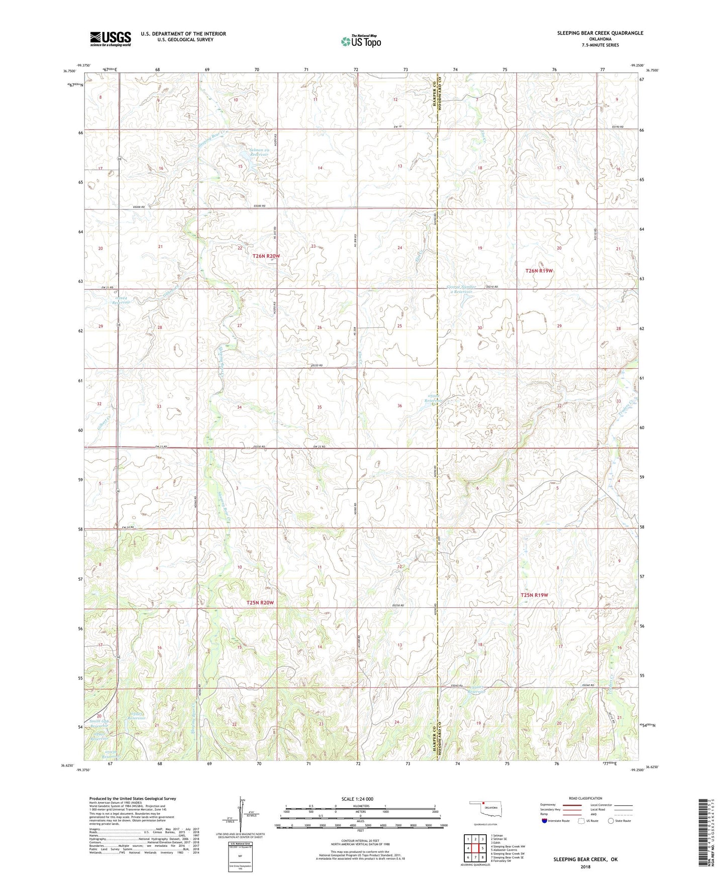
2018 topographic map quadrangle Sleeping Bear Creek in the state of Oklahoma. Scale: 1:24000. Based on the newly updated USGS 7.5' US Topo map series, this map is in the following counties: Harper, Woodward. The map contains contour data, water features, and other items you are used to seeing on USGS maps, but also has updated roads and other features. This is the next generation of topographic maps. Printed on high-quality waterproof paper with UV fade-resistant inks.
Quads adjacent to this one:
West: Sleeping Bear Creek NW
Northwest: Selman
North: Selman SE
Northeast: Edith
East: Alabaster Caverns
Southeast: Fairvalley SW
South: Sleeping Bear Creek SE
Southwest: Sleeping Bear Creek SW
Contains the following named places: George Kirten Number 2 Dam, George Number 2 Reservoir, Gilbert Creek, Oknoname 05917 Dam, Oknoname 05917 Reservoir, Oknoname 05919 Dam, Oknoname 05919 Reservoir, Oknoname 05921 Dam, Oknoname 05921 Reservoir, Oknoname 05924 Dam, Oknoname 05924 Reservoir, Oknoname 05925 Dam, Oknoname 05925 Reservoir, Oknoname 05936 Dam, Oknoname 153003 Dam, Oknoname 153003 Reservoir, Selman 29 Dam, Selman 29 Reservoir, Smith Gp6 Reservoir