MyTopo
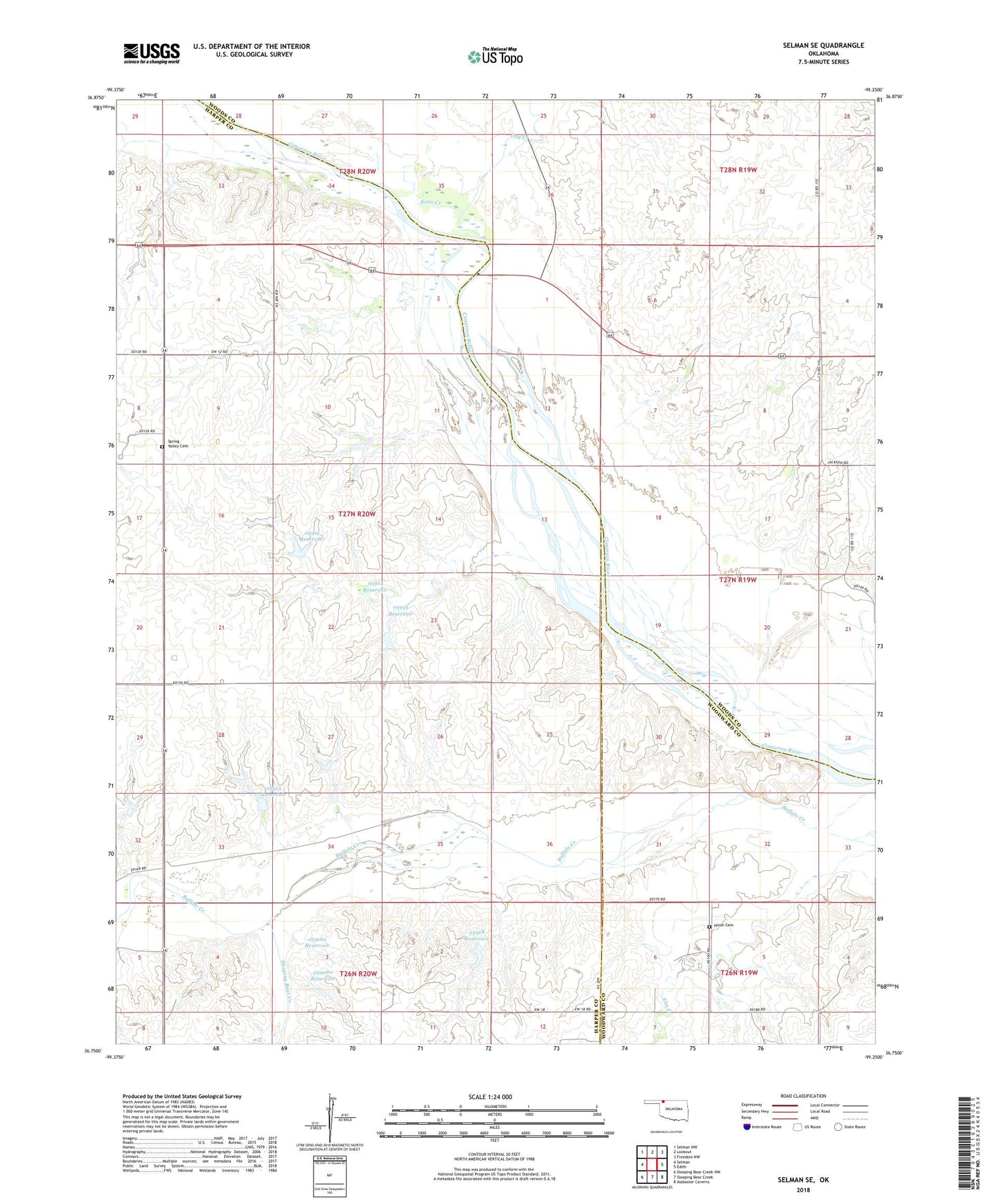
Selman SE Oklahoma US Topo Map
Couldn't load pickup availability
2022 topographic map quadrangle Selman SE in the state of Oklahoma. Scale: 1:24000. Based on the newly updated USGS 7.5' US Topo map series, this map is in the following counties: Harper, Woods, Woodward. The map contains contour data, water features, and other items you are used to seeing on USGS maps, but also has updated roads and other features. This is the next generation of topographic maps. Printed on high-quality waterproof paper with UV fade-resistant inks.
Quads adjacent to this one:
West: Selman
Northwest: Selman NW
North: Lookout
Northeast: Freedom NW
East: Edith
Southeast: Alabaster Caverns
South: Sleeping Bear Creek
Southwest: Sleeping Bear Creek NW
This map covers the same area as the classic USGS quad with code o36099g3.
Contains the following named places: Day Creek, Keno Creek, Nixon Cemetery, Oknoname 059058 Dam, Oknoname 059058 Reservoir, Oknoname 059060 Dam, Oknoname 059060 Reservoir, Oknoname 059061 Dam, Oknoname 059061 Reservoir, Oknoname 05912 Dam, Oknoname 05912 Reservoir, Oknoname 05913 Dam, Oknoname 05913 Reservoir, Oknoname 05914 Dam, Oknoname 05914 Reservoir, Oknoname 05915 Dam, Oknoname 05915 Reservoir, Oknoname 05916 Dam, Oknoname 05916 Reservoir, Oknoname 05918 Dam, Oknoname 05918 Reservoir, Salt Springs, Selman 9 Dam, Selman 9 Reservoir, Sleeping Bear Creek, Spring Valley Cemetery