MyTopo
Waurika East Oklahoma US Topo Map
Couldn't load pickup availability
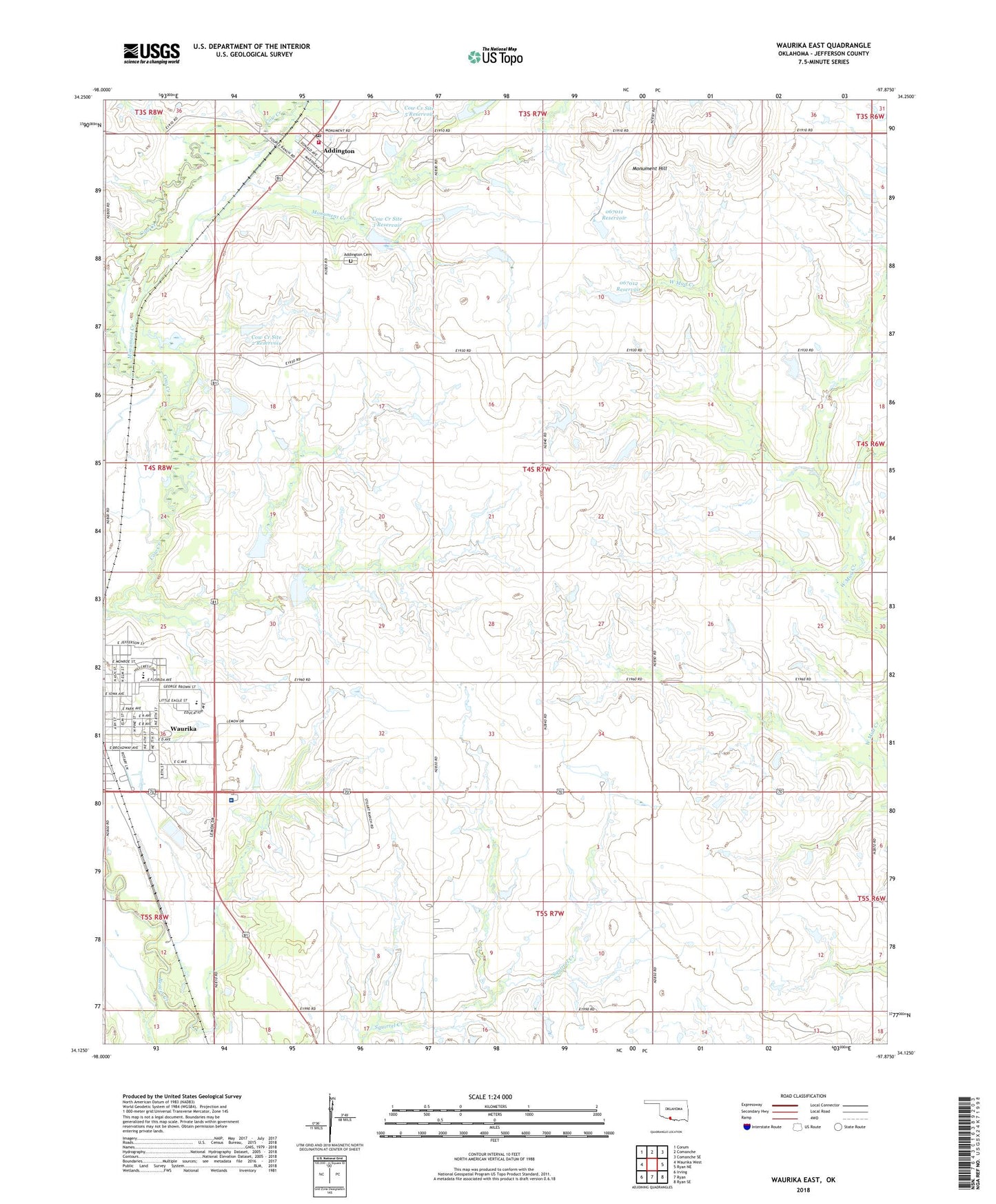
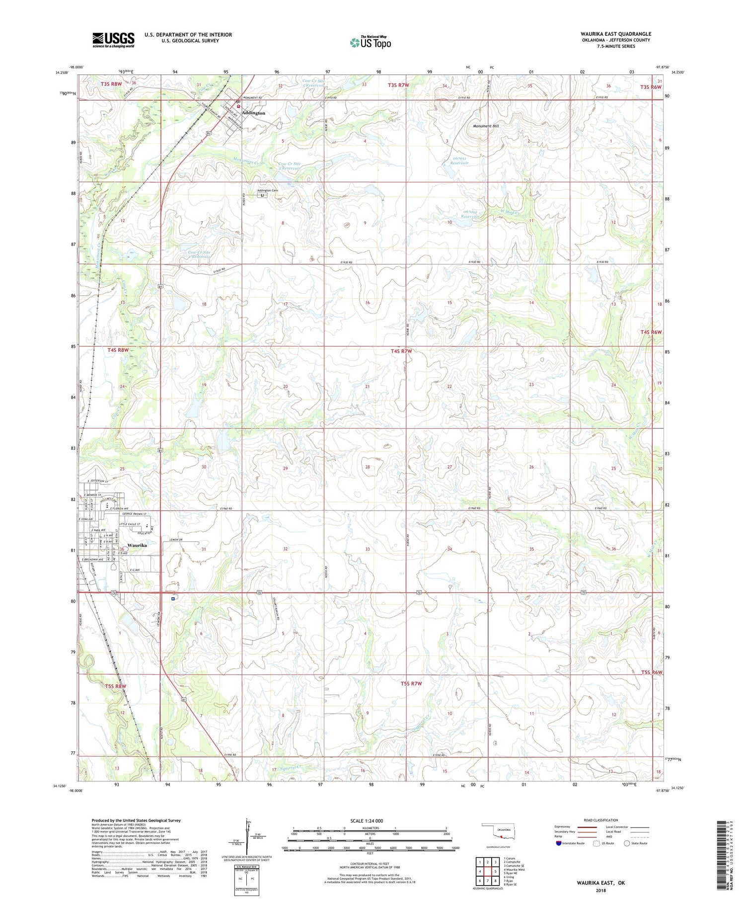
2018 topographic map quadrangle Waurika East in the state of Oklahoma. Scale: 1:24000. Based on the newly updated USGS 7.5' US Topo map series, this map is in the following counties: Jefferson. The map contains contour data, water features, and other items you are used to seeing on USGS maps, but also has updated roads and other features. This is the next generation of topographic maps. Printed on high-quality waterproof paper with UV fade-resistant inks.
Quads adjacent to this one:
West: Waurika West
Northwest: Corum
North: Comanche
Northeast: Comanche SE
East: Ryan NE
Southeast: Ryan SE
South: Ryan
Southwest: Irving
Contains the following named places: Addington, Addington Cemetery, Addington Post Office, Addington Volunteer Fire Department, Cow Creek Site 2 Dam, Cow Creek Site 2 Reservoir, Cow Creek Site 3 Dam, Cow Creek Site 3 Reservoir, Cow Creek Site 47 Dam, Cow Creek Site 47 Reservoir, Cow Creek Site 5 Dam, Cow Creek Site 5 Reservoir, Dry Creek, First Baptist Church, Jefferson County Hospital, Monument Creek, Monument Hill, Oknoname 067011 Dam, Oknoname 067011 Reservoir, Oknoname 067012 Dam, Oknoname 067012 Reservoir, Town of Addington, Waurika, Waurika Division, Waurika Elementary School, Waurika High School, Waurika Middle School, ZIP Code: 73573