MyTopo
Waurika West Oklahoma US Topo Map
Couldn't load pickup availability
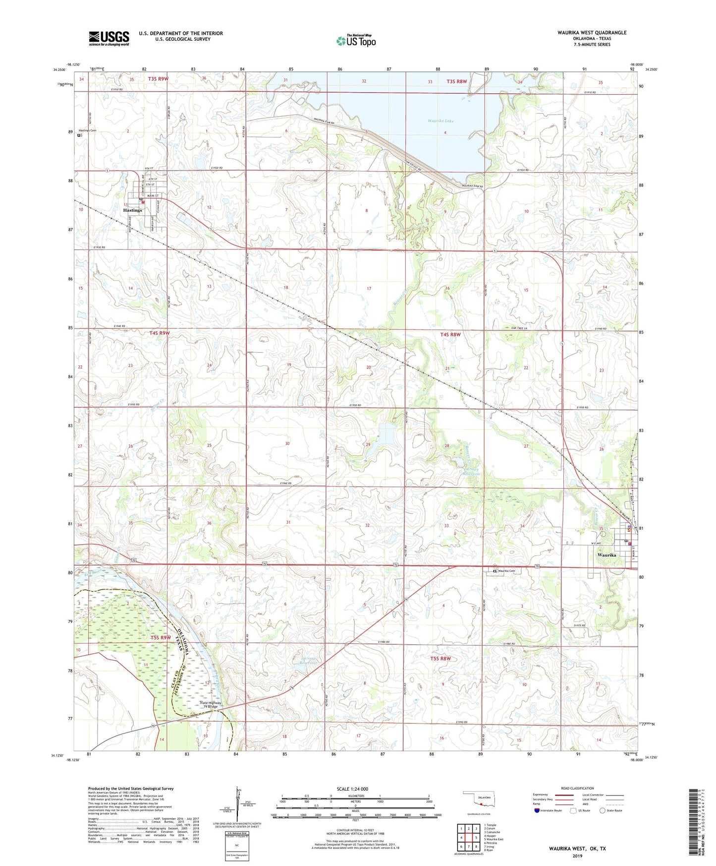
2022 topographic map quadrangle Waurika West in the states of Oklahoma, Texas. Scale: 1:24000. Based on the newly updated USGS 7.5' US Topo map series, this map is in the following counties: Jefferson, Clay. The map contains contour data, water features, and other items you are used to seeing on USGS maps, but also has updated roads and other features. This is the next generation of topographic maps. Printed on high-quality waterproof paper with UV fade-resistant inks.
Quads adjacent to this one:
West: Hooper
Northwest: Temple
North: Corum
Northeast: Comanche
East: Waurika East
Southeast: Ryan
South: Irving
Southwest: Petrolia
Contains the following named places: Beaver Creek Landing Park, City of Waurika, Cow Creek, Hastings, Hastings Cemetery, Hastings Post Office, Hastings Volunteer Fire Department, Japanese Beaver Lake Dam, Jefferson County Airport, Jefferson County Jail, Jefferson County Sheriff's Office, Kiowa Park Number 2, Moneka Park, Oknoname 067001 Dam, Oknoname 067001 Reservoir, Oknoname 067002 Dam, Oknoname 067002 Reservoir, Oknoname 067003 Dam, Oknoname 067003 Reservoir, Saline Creek, State Highway 79 Bridge, Terral Sheriff's Office, Town of Hastings, Township of Bourland, Waurika Cemetery, Waurika Dam, Waurika Emergency Medical Services, Waurika Police Department, Waurika Post Office, Waurika Volunteer Fire Department