MyTopo
Coffin Butte Oregon US Topo Map
Couldn't load pickup availability
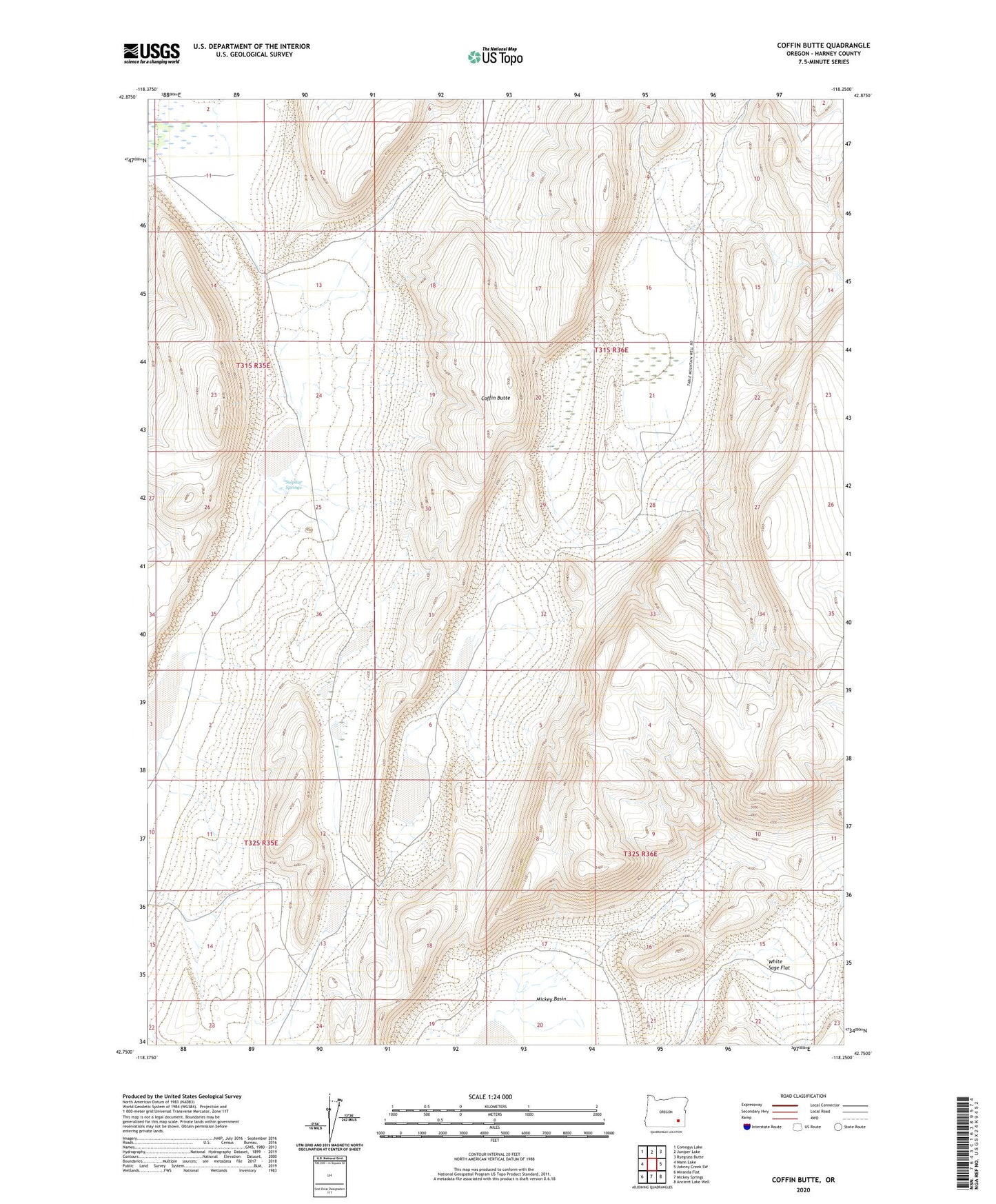
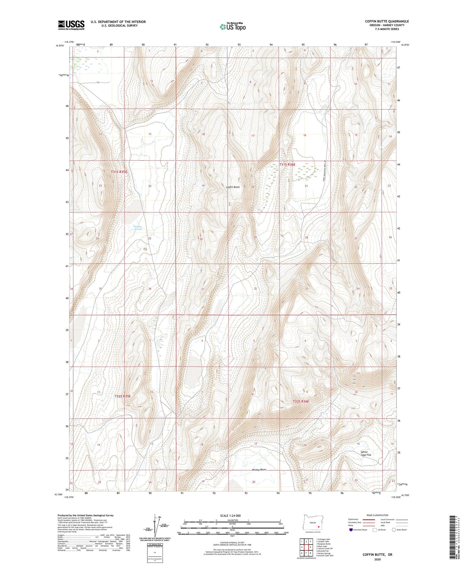
2020 topographic map quadrangle Coffin Butte in the state of Oregon. Scale: 1:24000. Based on the newly updated USGS 7.5' US Topo map series, this map is in the following counties: Harney. The map contains contour data, water features, and other items you are used to seeing on USGS maps, but also has updated roads and other features. This is the next generation of topographic maps. Printed on high-quality waterproof paper with UV fade-resistant inks.
Quads adjacent to this one:
West: Mann Lake
Northwest: Comegys Lake
North: Juniper Lake
Northeast: Ryegrass Butte
East: Johnny Creek SW
Southeast: Ancient Lake Well
South: Mickey Springs
Southwest: Miranda Flat
Contains the following named places: Coffin Butte, Pollock Well, Stonehouse Creek, Sulphur Springs, Summit Creek, White Sage Flat, White Sage Well