MyTopo
Mann Lake Oregon US Topo Map
Couldn't load pickup availability
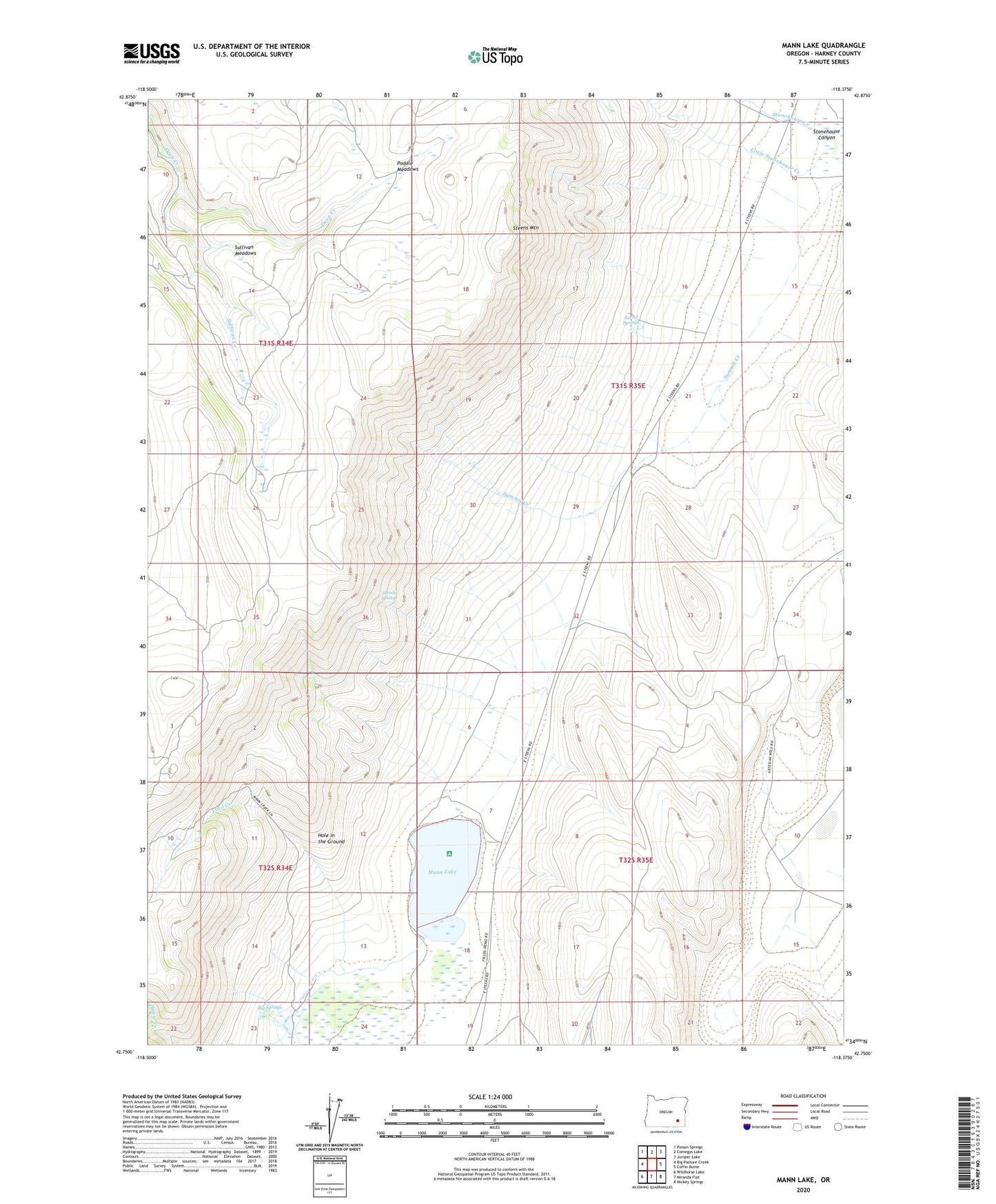
2023 topographic map quadrangle Mann Lake in the state of Oregon. Scale: 1:24000. Based on the newly updated USGS 7.5' US Topo map series, this map is in the following counties: Harney. The map contains contour data, water features, and other items you are used to seeing on USGS maps, but also has updated roads and other features. This is the next generation of topographic maps. Printed on high-quality waterproof paper with UV fade-resistant inks.
Quads adjacent to this one:
West: Big Pasture Creek
Northwest: Poison Springs
North: Comegys Lake
Northeast: Juniper Lake
East: Coffin Butte
Southeast: Mickey Springs
South: Miranda Flat
Southwest: Wildhorse Lake
This map covers the same area as the classic USGS quad with code o42118g4.
Contains the following named places: Alberson Station, Barrel Springs, Big Springs, East Mann Lake Boat Access, Hamilton Place, Hole in the Ground, House Creek, Little Stonehouse Creek, Mann Creek, Mann Lake, Mann Lake Cabin, Paddle Meadows, Stonehouse Canyon, Strode Springs, Sullivan Corral, Sullivan Creek, Sullivan Meadows, Thelake Post Office, Trail Creek, West Mann Lake Boat Access