MyTopo
Echo Oregon US Topo Map
Couldn't load pickup availability
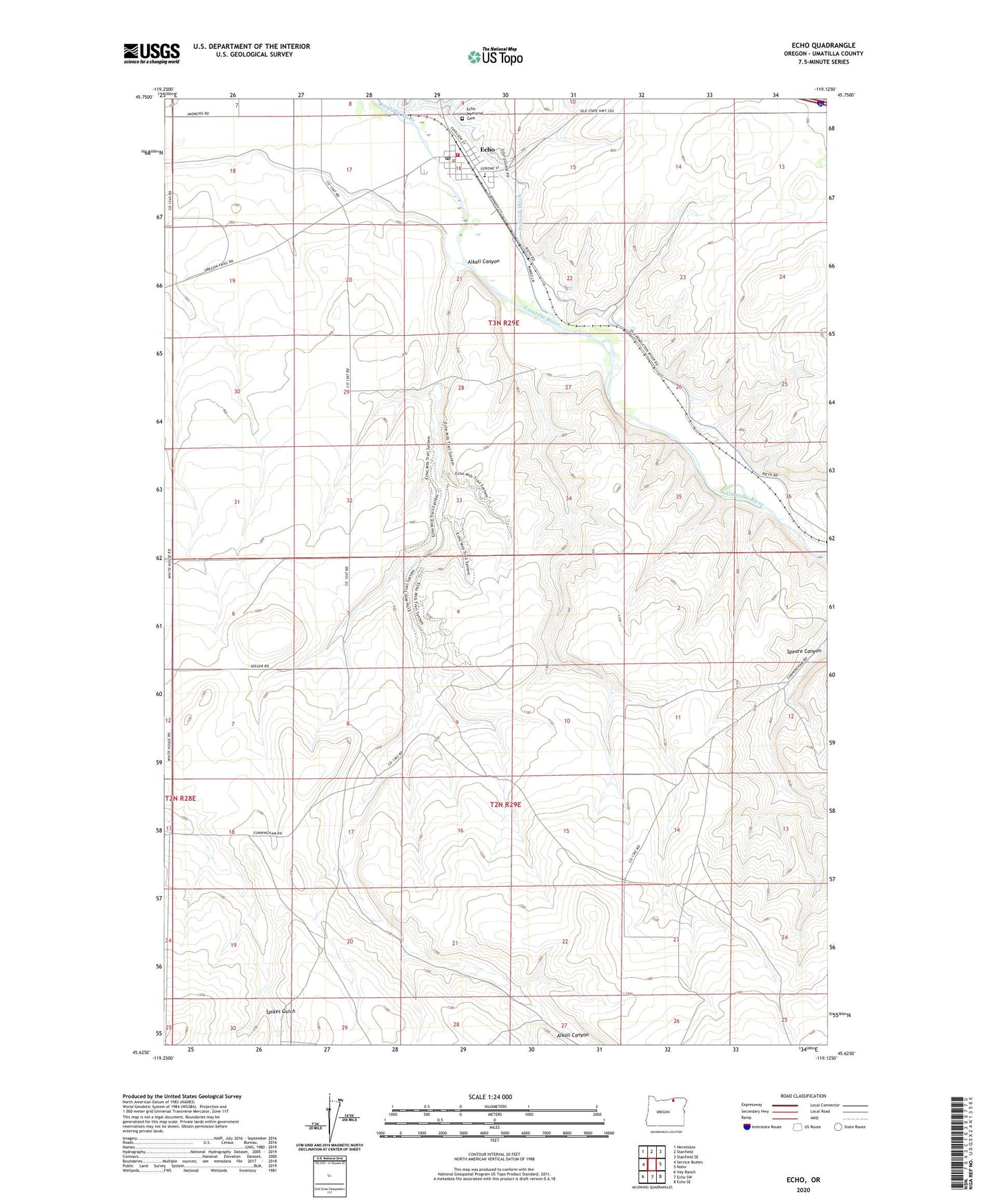
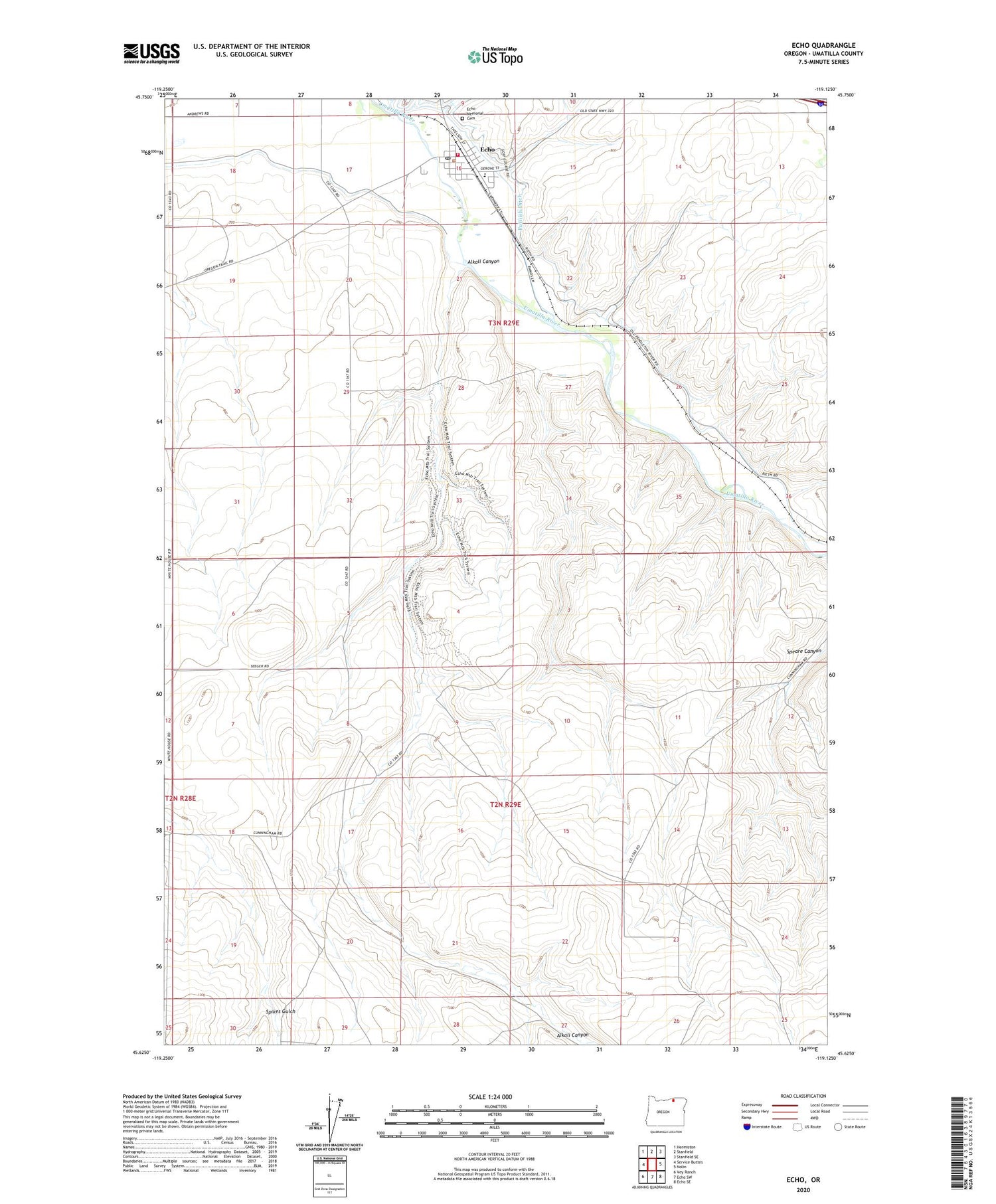
2020 topographic map quadrangle Echo in the state of Oregon. Scale: 1:24000. Based on the newly updated USGS 7.5' US Topo map series, this map is in the following counties: Umatilla. The map contains contour data, water features, and other items you are used to seeing on USGS maps, but also has updated roads and other features. This is the next generation of topographic maps. Printed on high-quality waterproof paper with UV fade-resistant inks.
Quads adjacent to this one:
West: Service Buttes
Northwest: Hermiston
North: Stanfield
Northeast: Stanfield SE
East: Nolin
Southeast: Echo SE
South: Echo SW
Southwest: Vey Ranch
Contains the following named places: Alkali Canyon, City of Echo, Cold Springs Diversion Dam, Echo, Echo City Hall, Echo Memorial Cemetery, Echo Municipal Court, Echo Post Office, Echo Public Library, Echo Public Works Department, Echo Rural Fire Protection District Station 1 Headquarters, Echo School, Fort Henrietta, Fort Henrietta and Chinese House, Fort Henrietta Park Echo, George Park, Oregon Trail Arboretum, Skate Park, Taylor Ditch, Westland Dam, ZIP Code: 97826