MyTopo
Stanfield Oregon US Topo Map
Couldn't load pickup availability
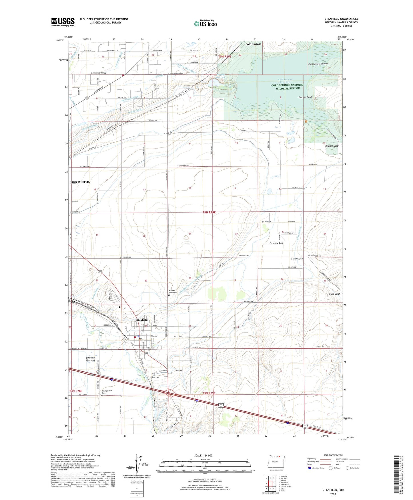
2023 topographic map quadrangle Stanfield in the state of Oregon. Scale: 1:24000. Based on the newly updated USGS 7.5' US Topo map series, this map is in the following counties: Umatilla. The map contains contour data, water features, and other items you are used to seeing on USGS maps, but also has updated roads and other features. This is the next generation of topographic maps. Printed on high-quality waterproof paper with UV fade-resistant inks.
Quads adjacent to this one:
West: Hermiston
Northwest: Umatilla
North: Hat Rock
Northeast: Juniper
East: Stanfield SE
Southeast: Nolin
South: Echo
Southwest: Service Buttes
This map covers the same area as the classic USGS quad with code o45119g2.
Contains the following named places: Bard Park, Baumgardner Cemetery, Charlotte Rauch Park, City of Stanfield, Coe Street Park, Cold Springs Canyon, Cold Springs Dam, Cold Springs National Wildlife Refuge, Cold Springs Reservoir, Columbia Grange Hall, Despain Gulch, Echo Wastewater Treatment Plant, Foster Cemetery, Fosters, Fourmile Gap, Furnish Ditch, Hermiston Fire and Emergency Services Station 2, L Canal, Lenz Lateral, Meadowville Post Office, Moorhouse Post Office, Pleasant View Cemetery, South Point Boat Launch, Stage Gulch, Stanfield, Stanfield Branch Furnish Ditch, Stanfield City Hall, Stanfield Drain, Stanfield Elementary School, Stanfield Fire Department, Stanfield Heights Park, Stanfield Junction, Stanfield Junior High School, Stanfield Municipal Court, Stanfield Police Department, Stanfield Post Office, Stanfield Public Library, Stanfield Public Works Department, Stanfield Secondary School, Stanfield Wastewater Treatment Facility, U S B Line Canal, Walchli Dam, Walchli Reservoir, West Stanfield School, ZIP Code: 97875