MyTopo
Ella Oregon US Topo Map
Couldn't load pickup availability
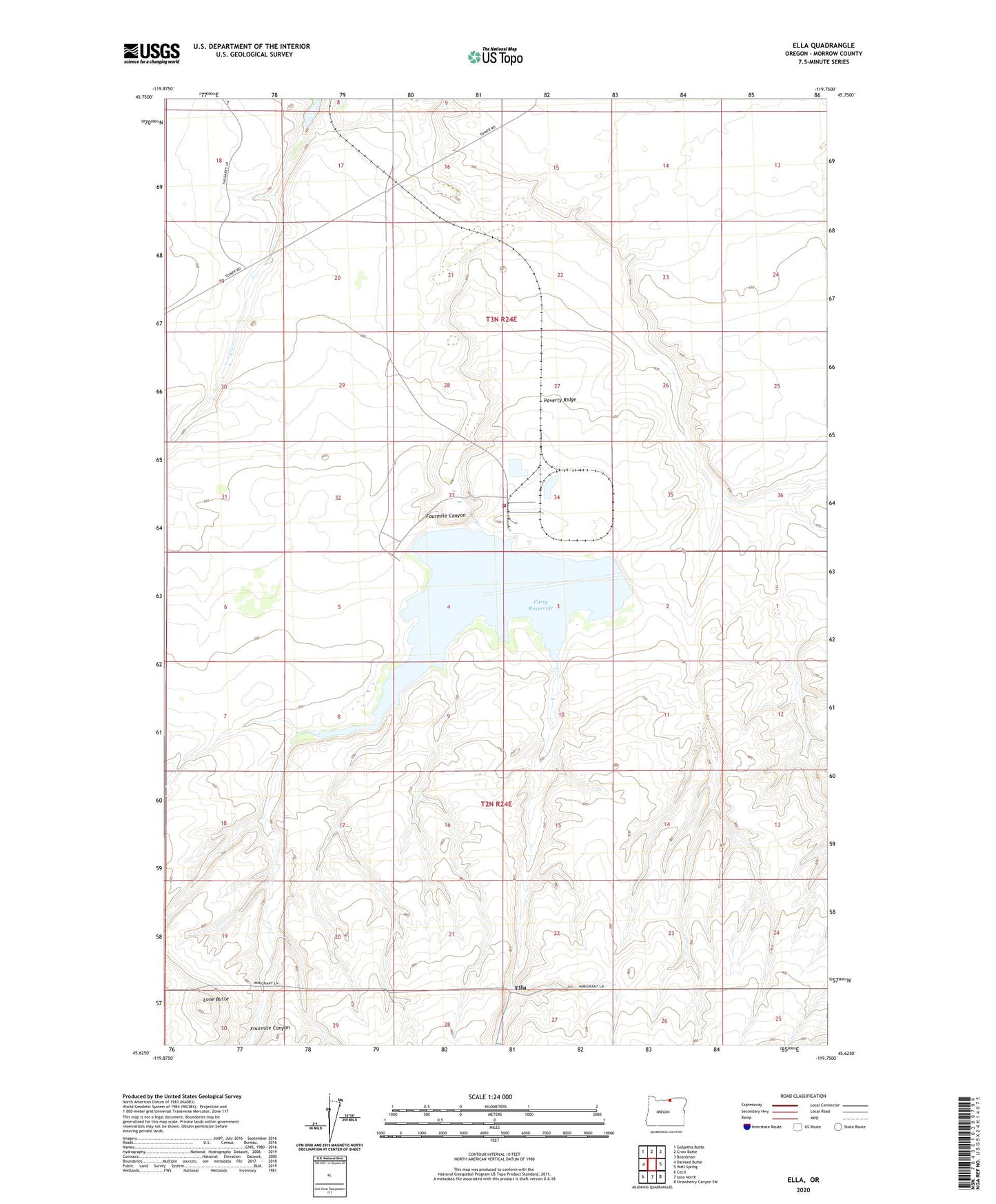
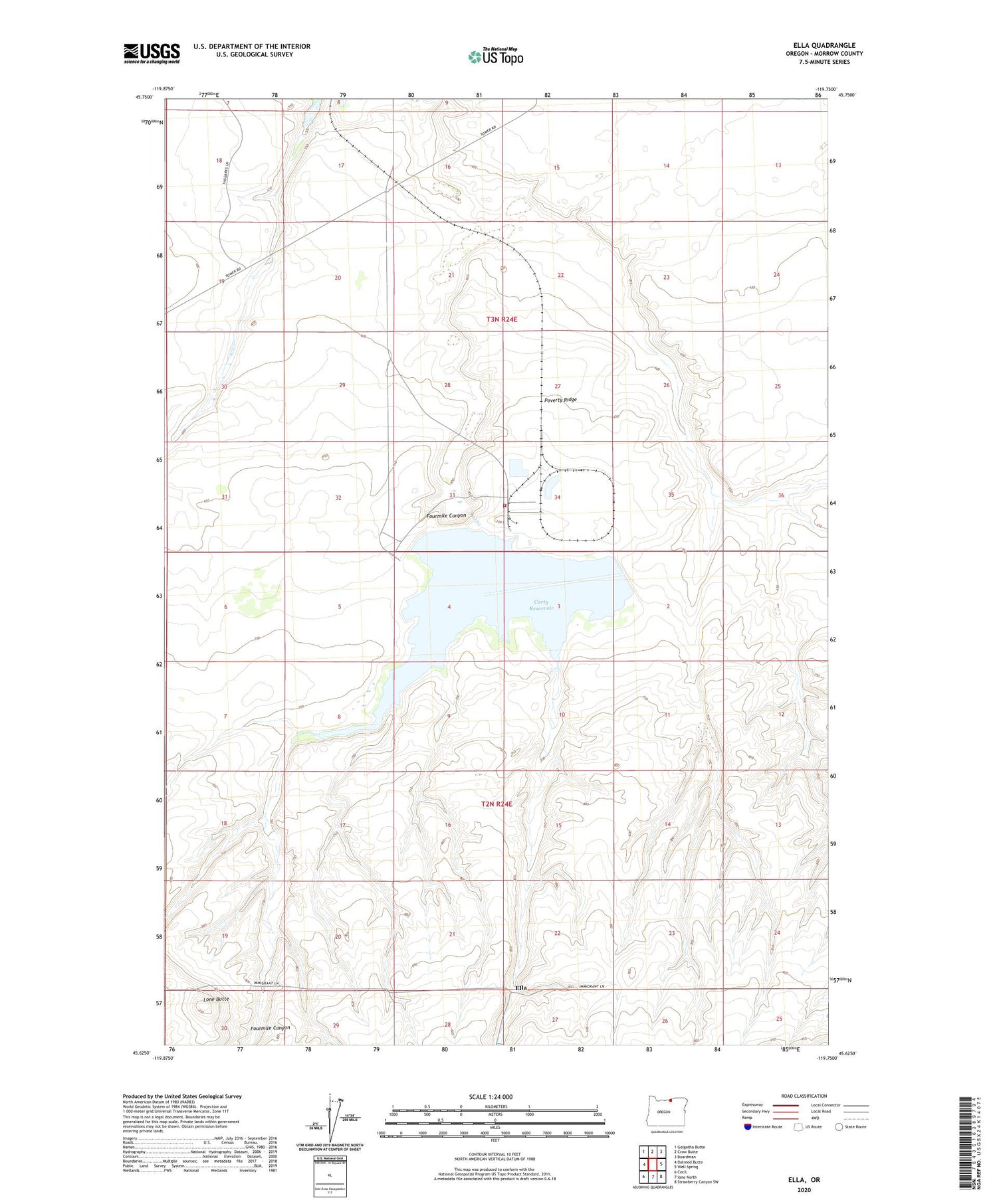
2020 topographic map quadrangle Ella in the state of Oregon. Scale: 1:24000. Based on the newly updated USGS 7.5' US Topo map series, this map is in the following counties: Morrow. The map contains contour data, water features, and other items you are used to seeing on USGS maps, but also has updated roads and other features. This is the next generation of topographic maps. Printed on high-quality waterproof paper with UV fade-resistant inks.
Quads adjacent to this one:
West: Dalreed Butte
Northwest: Golgotha Butte
North: Crow Butte
Northeast: Boardman
East: Well Spring
Southeast: Strawberry Canyon SW
South: Ione North
Southwest: Cecil
Contains the following named places: Boardman Rural Fire Protection District Station 2, Boeing Well, Carty Reservoir, Ella, Ella Post Office, Flowing Well, Fourmile Canyon, Lone Butte, Naval Bombing Range Boardman, Poverty Ridge, Poverty Ridge Well, Saddle Dam