MyTopo
Dalreed Butte Oregon US Topo Map
Couldn't load pickup availability
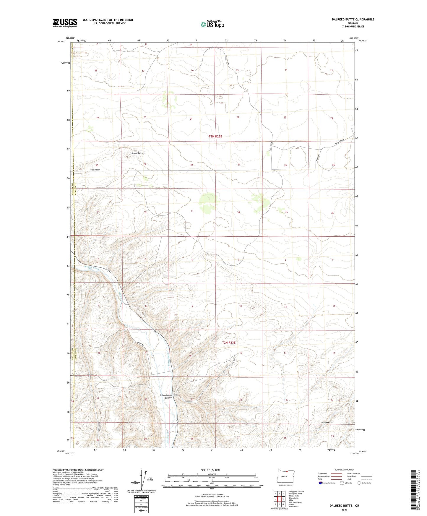
2023 topographic map quadrangle Dalreed Butte in the state of Oregon. Scale: 1:24000. Based on the newly updated USGS 7.5' US Topo map series, this map is in the following counties: Morrow, Gilliam. The map contains contour data, water features, and other items you are used to seeing on USGS maps, but also has updated roads and other features. This is the next generation of topographic maps. Printed on high-quality waterproof paper with UV fade-resistant inks.
Quads adjacent to this one:
West: Horn Butte
Northwest: Heppner Junction
North: Golgotha Butte
Northeast: Crow Butte
East: Ella
Southeast: Ione North
South: Cecil
Southwest: Hickland Butte
This map covers the same area as the classic USGS quad with code o45119f8.
Contains the following named places: Boeing Test Site, Dalreed Butte, Ewing, Ewing Ditch, Red Well, Schoolhouse Canyon