MyTopo
Grass Valley Oregon US Topo Map
Couldn't load pickup availability
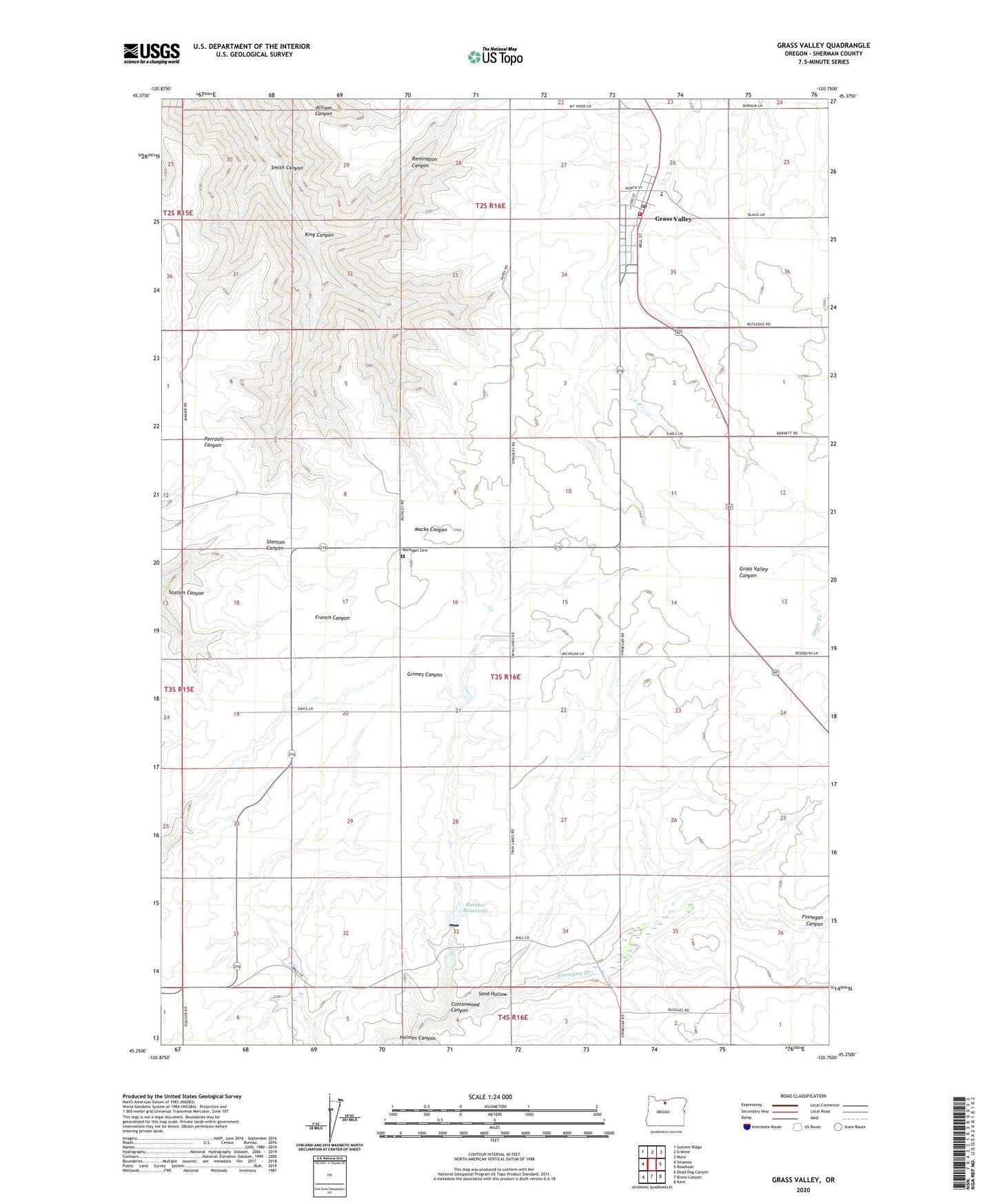
2020 topographic map quadrangle Grass Valley in the state of Oregon. Scale: 1:24000. Based on the newly updated USGS 7.5' US Topo map series, this map is in the following counties: Sherman. The map contains contour data, water features, and other items you are used to seeing on USGS maps, but also has updated roads and other features. This is the next generation of topographic maps. Printed on high-quality waterproof paper with UV fade-resistant inks.
Quads adjacent to this one:
West: Sinamox
Northwest: Summit Ridge
North: Erskine
Northeast: Moro
East: Rosebush
Southeast: Kent
South: Bronx Canyon
Southwest: Dead Dog Canyon
Contains the following named places: Buether Dam, Buether Reservoir, City of Grass Valley, Cooks Corner, Cottonwood Canyon, Coxs Corner, Draw Creek, Eakin, Finnegans Corner, Grass Valley, Grass Valley City Hall, Grass Valley City Park, Grass Valley Post Office, Grass Valley Public Works Department, Hodges Corner, Holmes Canyon, King Canyon, Michigan, Michigan Cemetery, Remington Canyon, Rickmans Corner, Sand Hollow, Schillings Corner, Smith Canyon, South Sherman Elementary School, South Sherman Fire Protection District Station 1, ZIP Code: 97029