MyTopo
Rosebush Oregon US Topo Map
Couldn't load pickup availability
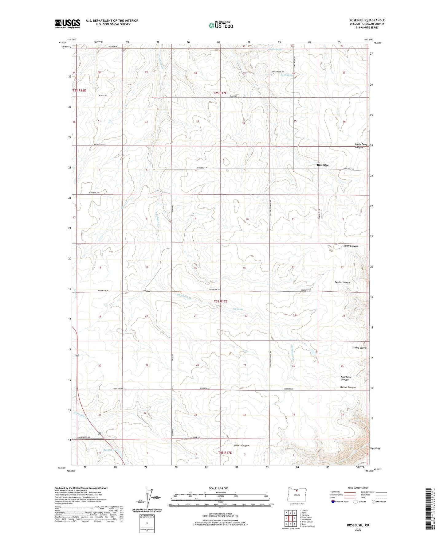
2023 topographic map quadrangle Rosebush in the state of Oregon. Scale: 1:24000. Based on the newly updated USGS 7.5' US Topo map series, this map is in the following counties: Sherman. The map contains contour data, water features, and other items you are used to seeing on USGS maps, but also has updated roads and other features. This is the next generation of topographic maps. Printed on high-quality waterproof paper with UV fade-resistant inks.
Quads adjacent to this one:
West: Grass Valley
Northwest: Erskine
North: Moro
Northeast: Harmony
East: Indian Cove
Southeast: Horseshoe Bend
South: Kent
Southwest: Bronx Canyon
This map covers the same area as the classic USGS quad with code o45120c6.
Contains the following named places: Borstel Pond, Bourbon, Hill Spring, Middle Spring, Moro Division, Oregon Raceway Park, Rosebush, Rutledge, Rutledge Post Office, South Spring