MyTopo
Hat Rock Oregon US Topo Map
Couldn't load pickup availability
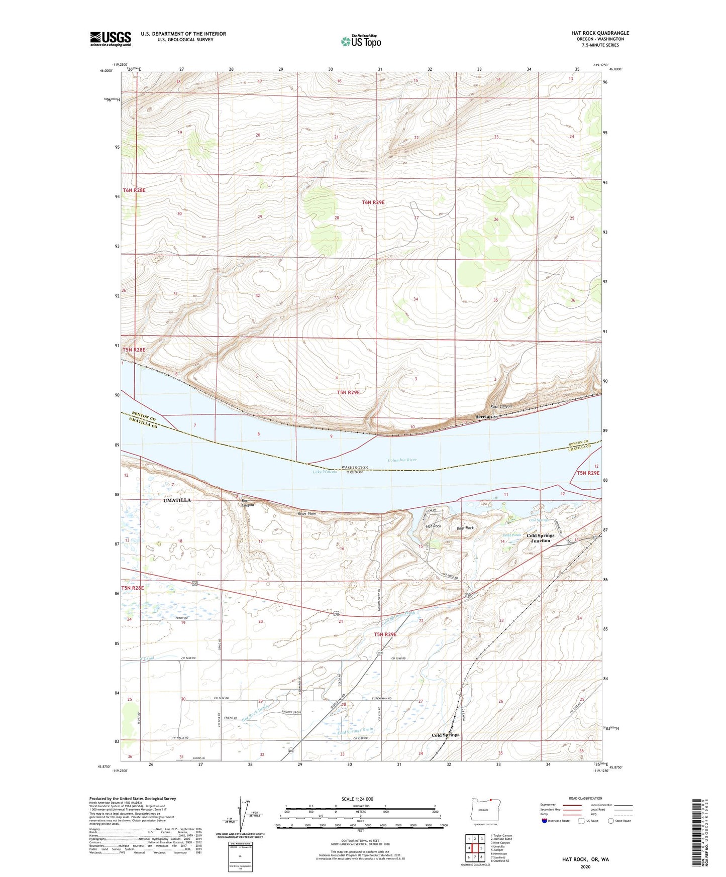
2020 topographic map quadrangle Hat Rock in the states of Washington, Oregon. Scale: 1:24000. Based on the newly updated USGS 7.5' US Topo map series, this map is in the following counties: Umatilla, Benton. The map contains contour data, water features, and other items you are used to seeing on USGS maps, but also has updated roads and other features. This is the next generation of topographic maps. Printed on high-quality waterproof paper with UV fade-resistant inks.
Quads adjacent to this one:
West: Umatilla
Northwest: Taylor Canyon
North: Johnson Butte
Northeast: Nine Canyon
East: Juniper
Southeast: Stanfield SE
South: Stanfield
Southwest: Hermiston
Contains the following named places: Beef City Feedlot, Berrian, Boat Rock, Box Canyon, Cold Springs, Cold Springs Drain, Cold Springs Junction, Cold Springs Wash, Dodd Ponds, Hat Rock, Hat Rock Drain, Hat Rock State Park, Hat Rock State Park Boat Ramp, McNary Yacht Club Boat Ramp, McNary Yacht Club Marina, Memaloose Island, Mottinger, River View, Riverview, Rush Canyon, T Canal, Techumtas Island, Warehouse Beach Recreation Center