MyTopo
Juniper Canyon Oregon US Topo Map
Couldn't load pickup availability
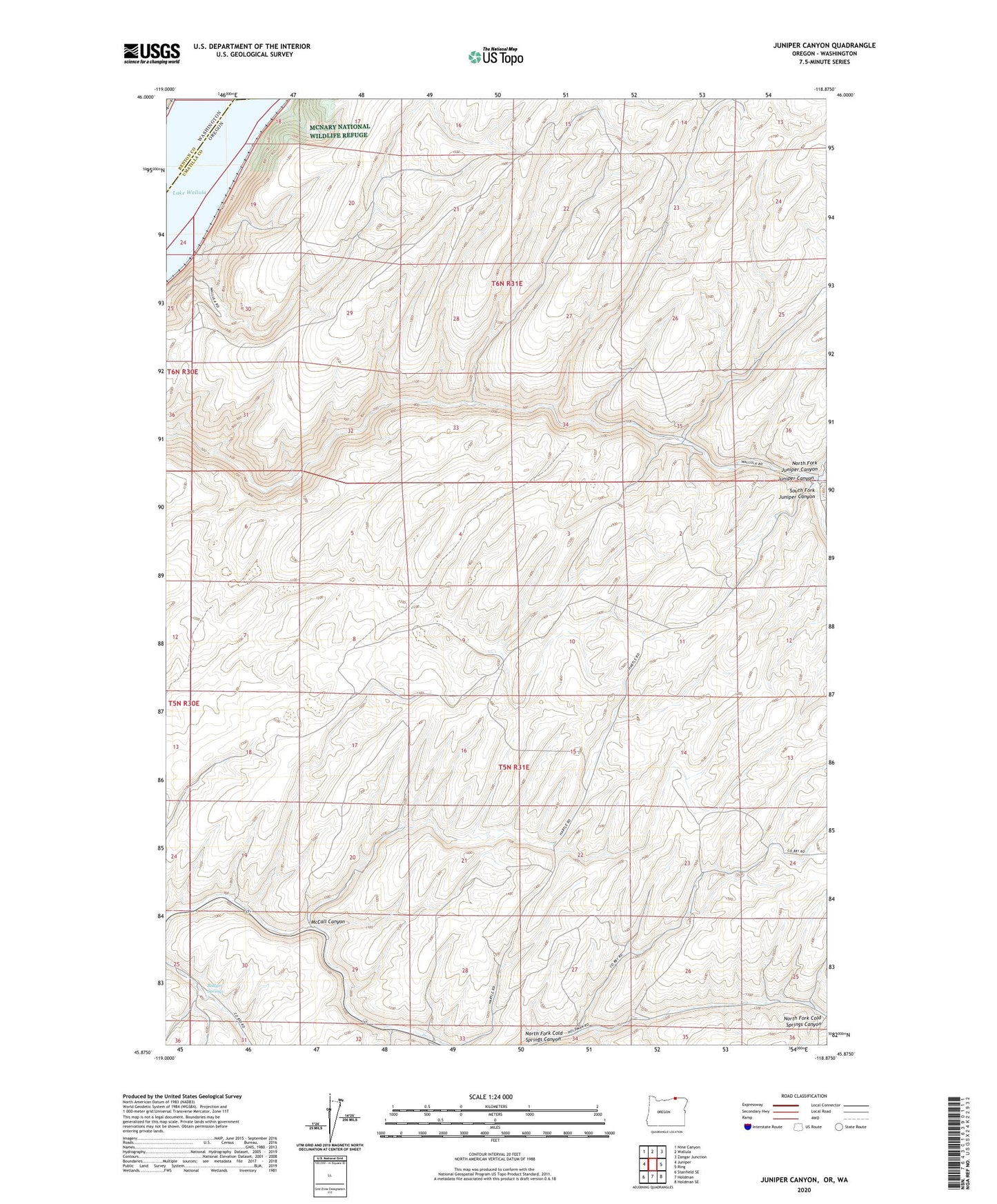
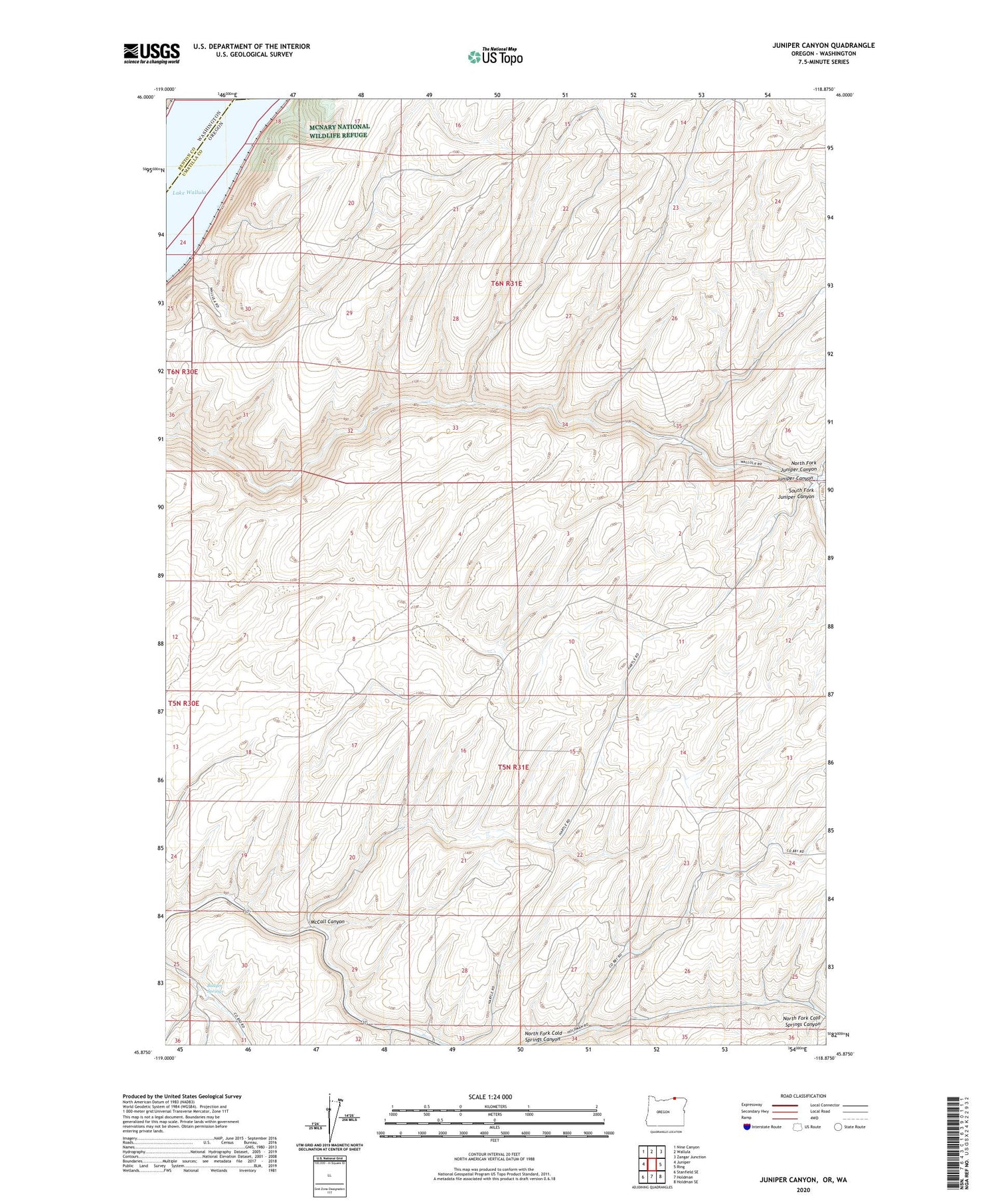
2020 topographic map quadrangle Juniper Canyon in the state of Oregon. Scale: 1:24000. Based on the newly updated USGS 7.5' US Topo map series, this map is in the following counties: Umatilla, Benton, Walla Walla. The map contains contour data, water features, and other items you are used to seeing on USGS maps, but also has updated roads and other features. This is the next generation of topographic maps. Printed on high-quality waterproof paper with UV fade-resistant inks.
Quads adjacent to this one:
West: Juniper
Northwest: Nine Canyon
North: Wallula
Northeast: Zangar Junction
East: Ring
Southeast: Holdman SE
South: Holdman
Southwest: Stanfield SE
Contains the following named places: Badger Springs, Hilton Post Office, Juniper, McCall Canyon, North Fork Juniper Canyon, North Post Office, South Fork Juniper Canyon