MyTopo
Wallula Washington US Topo Map
Couldn't load pickup availability
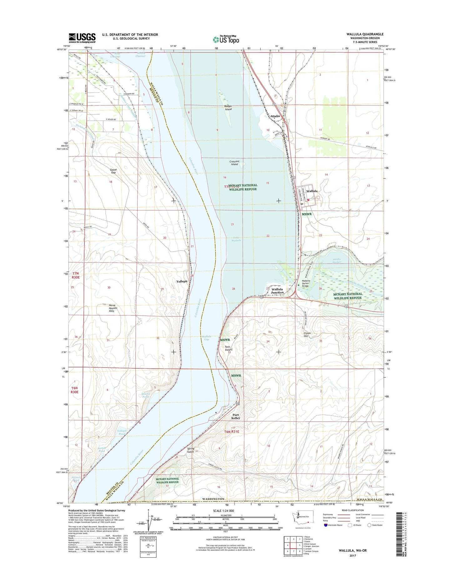
2023 topographic map quadrangle Wallula in the state of Washington. Scale: 1:24000. Based on the newly updated USGS 7.5' US Topo map series, this map is in the following counties: Walla Walla, Benton, Umatilla. The map contains contour data, water features, and other items you are used to seeing on USGS maps, but also has updated roads and other features. This is the next generation of topographic maps. Printed on high-quality waterproof paper with UV fade-resistant inks.
Quads adjacent to this one:
West: Nine Canyon
Northwest: Pasco
North: Humorist
Northeast: Slater
East: Zangar Junction
Southeast: Ring
South: Juniper Canyon
Southwest: Juniper
This map covers the same area as the classic USGS quad with code o46118a8.
Contains the following named places: Attalia, Badger Island, Broetge Orchards, Clover Hill, Crescent Island, Fort Walla Walla Historical Monument, Goose Gap, Hover, Hover Park, Hunt, Lake Wallula, Lasts Island, Madame Dorion Bridge, Madame Dorion Memorial Park, McNary National Wildlife Refuge, Mound Pond, Palmer Pond, Port Kelley, Port of Walla Walla, Smiths Harbor, Spring Gulch, Switch Pond, Twin Sisters, Walla Walla County Fire District 5 Station 52, Walla Walla River, Wallula, Wallula Census Designated Place, Wallula Gap, Wallula Junction, Wallula Post Office, Wallula State Park, Wallula Station, Yellepit, Yellepit Pond, ZIP Code: 99363