MyTopo
Lake of the Woods North Oregon US Topo Map
Couldn't load pickup availability
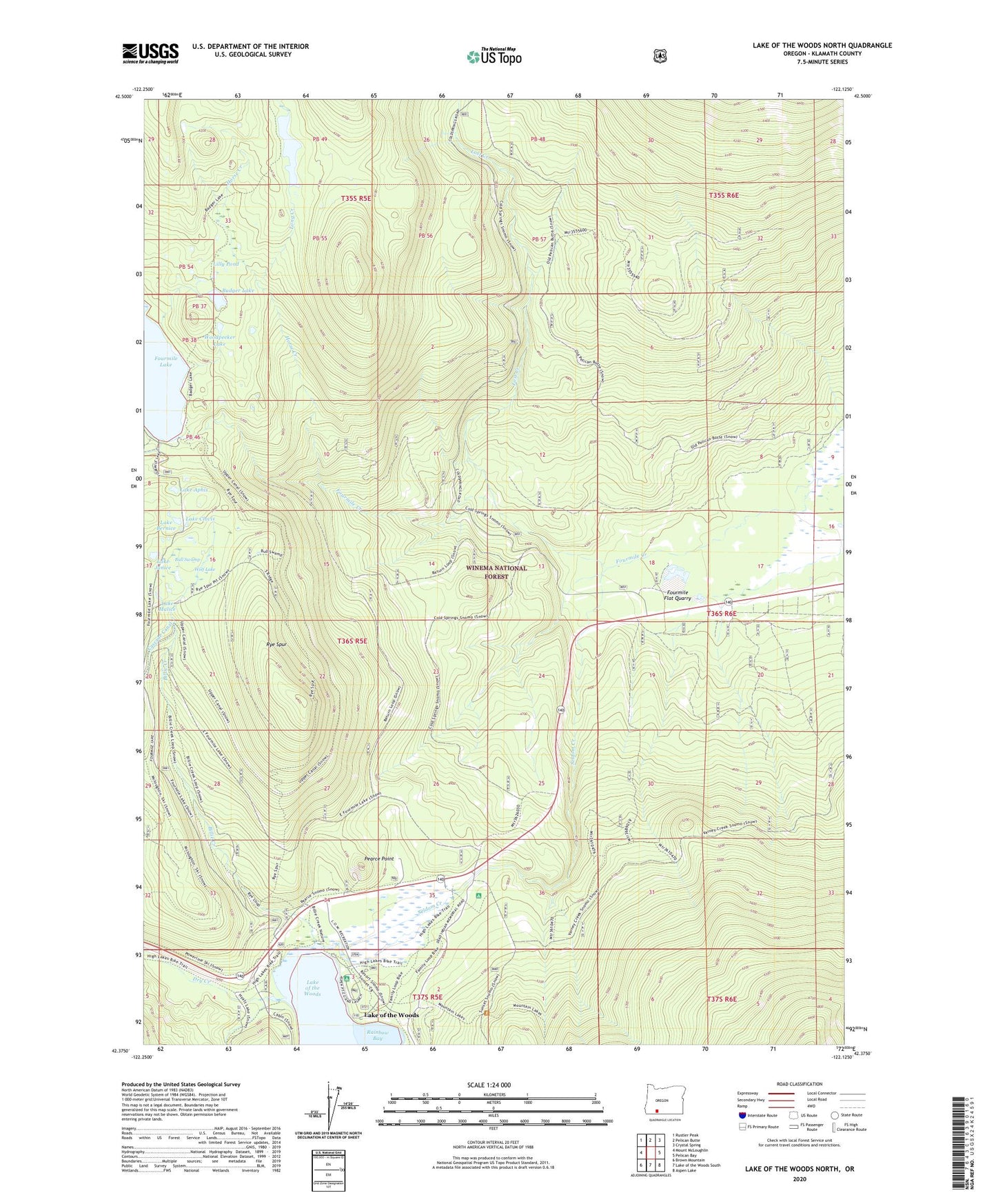
2020 topographic map quadrangle Lake of the Woods North in the state of Oregon. Scale: 1:24000. Based on the newly updated USGS 7.5' US Topo map series, this map is in the following counties: Klamath. The map contains contour data, water features, and other items you are used to seeing on USGS maps, but also has updated roads and other features. This is the next generation of topographic maps. Printed on high-quality waterproof paper with UV fade-resistant inks.
Quads adjacent to this one:
West: Mount McLoughlin
Northwest: Rustler Peak
North: Pelican Butte
Northeast: Crystal Spring
East: Pelican Bay
Southeast: Aspen Lake
South: Lake of the Woods South
Southwest: Brown Mountain
Contains the following named places: Aspen Point Campground Boat Ramp, Aspen Point Recreation Site, Badger Lake, Billie Creek, Bull Swamp, Camp McLoughlin, Cascade Canal, Cottonwood Camp, Dry Creek, Four Mile Lake Trail, Fourmile Flat Quarry, Fourmile Lake Boat Ramp, Fourmile Lake Dam, Fourmile Lake Recreation Site, Fourmile Rock Pit, Great Meadows Recreation Site, Greylock Mountain Trail, Horse Creek, Lake Aphis, Lake Bernice, Lake Clovis, Lake Janice, Lake Malice, Lake of the Woods, Lake of the Woods Post Office, Lake of the Woods Resort, Lake of the Woods Resort Marina, Lilly Pond, Long Creek, Long Lake, Long Lake Camp, Lost Creek, Lost Creek Cinder Pit, Lost Peak Trail, Pearce Point, Rainbow Bay Boat Launch, Rainbow Bay Recreation Site, Rye Spur, Rye Spur Trail, Seldom Creek, White Pine Campground, Wolf Lake, Woodpecker Lake