MyTopo
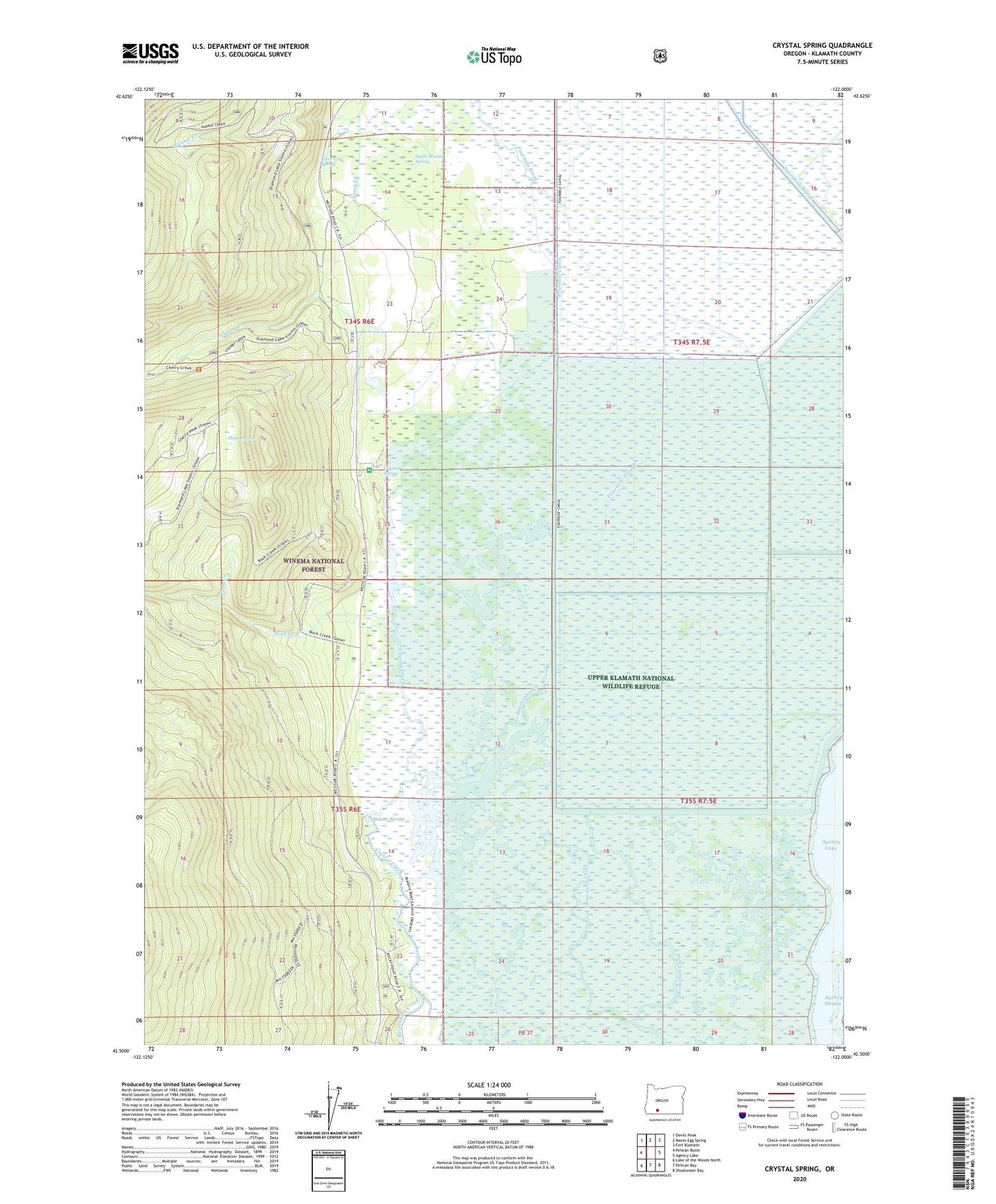
Crystal Spring Oregon US Topo Map
Couldn't load pickup availability
Also explore the Crystal Spring Forest Service Topo of this same quad for updated USFS data
2024 topographic map quadrangle Crystal Spring in the state of Oregon. Scale: 1:24000. Based on the newly updated USGS 7.5' US Topo map series, this map is in the following counties: Klamath. The map contains contour data, water features, and other items you are used to seeing on USGS maps, but also has updated roads and other features. This is the next generation of topographic maps. Printed on high-quality waterproof paper with UV fade-resistant inks.
Quads adjacent to this one:
West: Pelican Butte
Northwest: Devils Peak
North: Mares Egg Spring
Northeast: Fort Klamath
East: Agency Lake
Southeast: Shoalwater Bay
South: Pelican Bay
Southwest: Lake of the Woods North
This map covers the same area as the classic USGS quad with code o42122e1.
Contains the following named places: Agency Straits, Crystal, Crystal Creek County Park, Crystal Post Office, Crystal Spring, Crystal Spring Trailhead, Crystal Springs Recreation Site, Fourmile Canal, Fourmile Creek, Fourmile Slough, Malone Spring, Malone Springs Boat Ramp, Malone Springs Recreation Site, Nannie Creek, Pelican Butte Trail, Penn Creek, Penn Prairie, Rock Creek, Rocky Point Trail, Sevenmile Canal Levee, South Mound Spring, Tiger Lily Spring, Upper Klamath National Wildlife Refuge, West Fork Thomason Creek