MyTopo
Sawed Horn Oregon US Topo Map
Couldn't load pickup availability
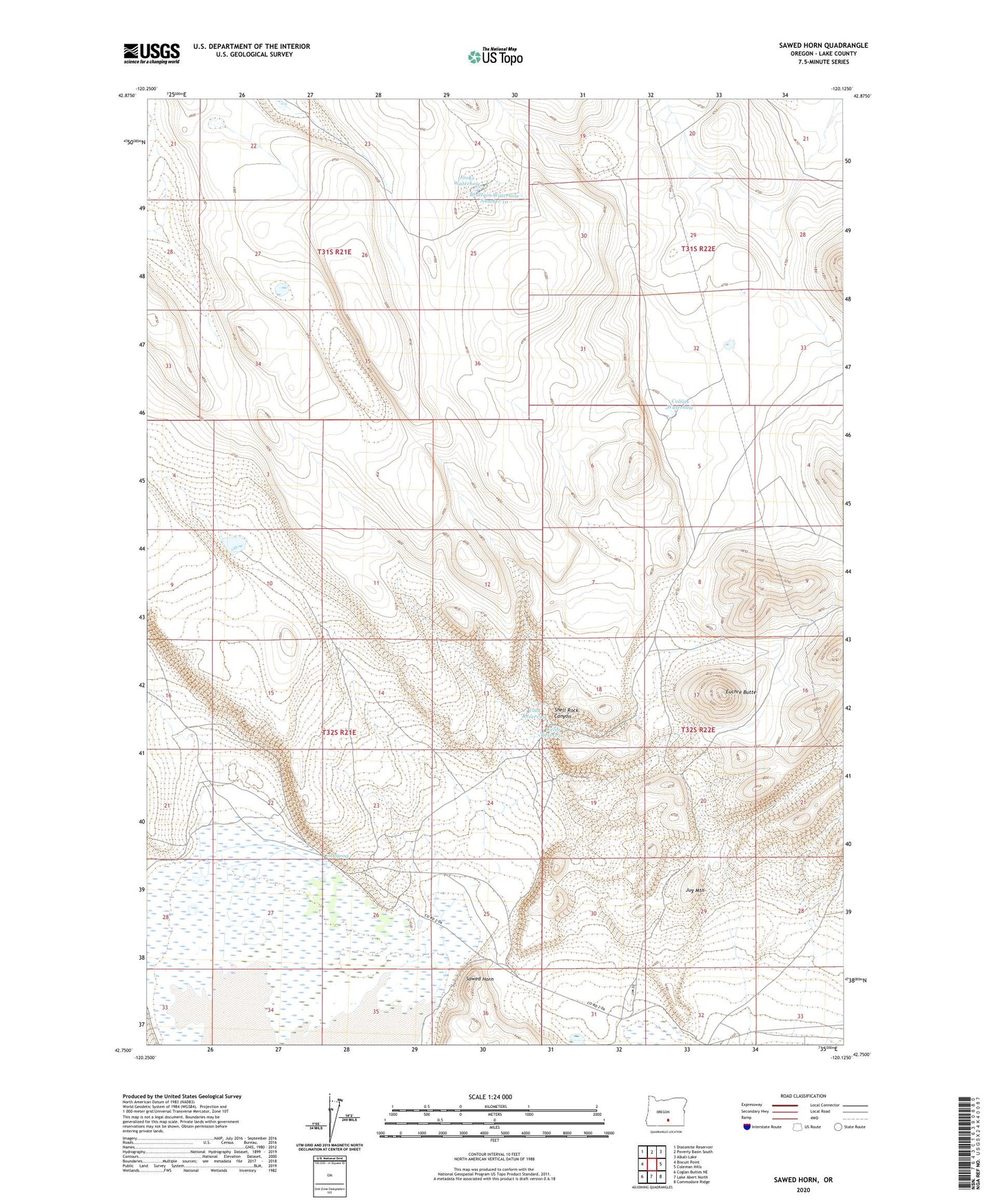
2020 topographic map quadrangle Sawed Horn in the state of Oregon. Scale: 1:24000. Based on the newly updated USGS 7.5' US Topo map series, this map is in the following counties: Lake. The map contains contour data, water features, and other items you are used to seeing on USGS maps, but also has updated roads and other features. This is the next generation of topographic maps. Printed on high-quality waterproof paper with UV fade-resistant inks.
Quads adjacent to this one:
West: Biscuit Point
Northwest: Diatomite Reservoir
North: Poverty Basin South
Northeast: Alkali Lake
East: Coleman Hills
Southeast: Commodore Ridge
South: Lake Abert North
Southwest: Coglan Buttes NE
Contains the following named places: Brattain Reservoir Number 13, Brattain Waterhole Number 10, Button Waterhole, Club Reservoir, Collins Waterhole, Duncan Place, Euchre Butte, Forks Waterhole, Kelso Reservoir, Sawed Horn, Shell Rock Canyon, XL Ranch, XL Spring