MyTopo
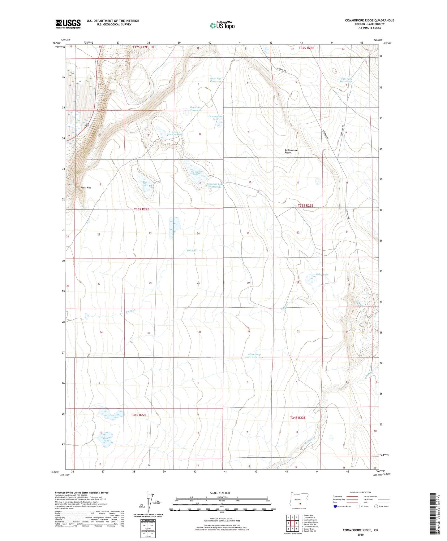
Commodore Ridge Oregon US Topo Map
Couldn't load pickup availability
2023 topographic map quadrangle Commodore Ridge in the state of Oregon. Scale: 1:24000. Based on the newly updated USGS 7.5' US Topo map series, this map is in the following counties: Lake. The map contains contour data, water features, and other items you are used to seeing on USGS maps, but also has updated roads and other features. This is the next generation of topographic maps. Printed on high-quality waterproof paper with UV fade-resistant inks.
Quads adjacent to this one:
West: Lake Abert North
Northwest: Sawed Horn
North: Coleman Hills
Northeast: Sagebrush Knoll
East: Rabbit Hills NW
Southeast: Rabbit Hills SW
South: Cooper Draw
Southwest: Lake Abert South
This map covers the same area as the classic USGS quad with code o42120f1.
Contains the following named places: Boy Lake Waterhole, Commodore Lake, Commodore Ridge, Dog Lake, Draw Fork Waterhole, Feather Bed Lake, Feather Bed Lake Waterhole, Foley Lake, Hard Pan Reservoir, Little Skookum Lake, Little Soup Lake Waterhole, Pike Ranch, Skookum Lake, Skookum Lake Waterhole, Soup Lake Waterhole, Soup Lakes, Twin Lakes