MyTopo
Wickiup Dam Oregon US Topo Map
Couldn't load pickup availability
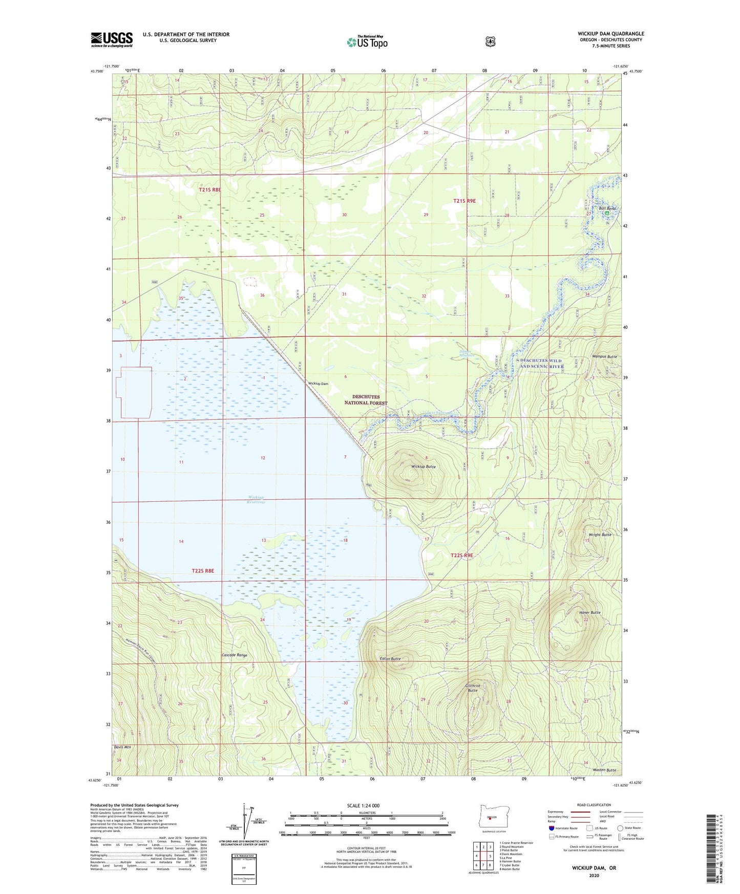
2020 topographic map quadrangle Wickiup Dam in the state of Oregon. Scale: 1:24000. Based on the newly updated USGS 7.5' US Topo map series, this map is in the following counties: Deschutes. The map contains contour data, water features, and other items you are used to seeing on USGS maps, but also has updated roads and other features. This is the next generation of topographic maps. Printed on high-quality waterproof paper with UV fade-resistant inks.
Quads adjacent to this one:
West: Davis Mountain
Northwest: Crane Prairie Reservoir
North: Round Mountain
Northeast: Pistol Butte
East: La Pine
Southeast: Masten Butte
South: Cryder Butte
Southwest: Hamner Butte
Contains the following named places: Bull Bend, Bull Bend Campground Boat Launch, Bull Bend Recreation Site, Davis Creek, Dilman Meadows, Eaton Butte, Gilchrist Butte, Haner Butte, Pringle Falls Experimental Forest, Pringle Falls Research Natural Area, Round Swamp Campground, Stagnant Lake, Tenino Boat Launch, Tenino Boating Site, Wampus Campground, Wickiup Butte, Wickiup Butte Boat Ramp, Wickiup Butte Recreation Site, Wickiup Dam, Wickiup Reservoir, Wickiups, Wright Butte