MyTopo
Pistol Butte Oregon US Topo Map
Couldn't load pickup availability
Also explore the Pistol Butte Forest Service Topo of this same quad for updated USFS data
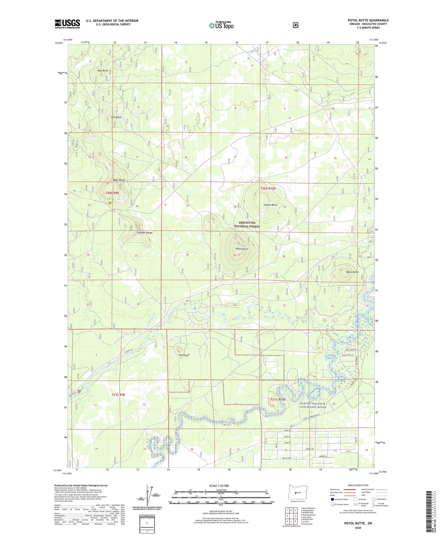
2023 topographic map quadrangle Pistol Butte in the state of Oregon. Scale: 1:24000. Based on the newly updated USGS 7.5' US Topo map series, this map is in the following counties: Deschutes. The map contains contour data, water features, and other items you are used to seeing on USGS maps, but also has updated roads and other features. This is the next generation of topographic maps. Printed on high-quality waterproof paper with UV fade-resistant inks.
Quads adjacent to this one:
West: Round Mountain
Northwest: Mount Bachelor
North: Wanoga Butte
Northeast: Benham Falls
East: Anns Butte
Southeast: Finley Butte
South: La Pine
Southwest: Wickiup Dam
This map covers the same area as the classic USGS quad with code o43121g5.
Contains the following named places: Bates Butte, Bates Ranch, Big Tree, Deschutes National Forest, Fall River, Fall River Falls, Fall River Fish Hatchery, Fall River Fish Hatchery Airport, Fall River Lodge, Fall River Recreation Site, Fall River Trailhead, Foster Ranch, Indian Creek, Klak Butte, La Pine State Park, Lolo Butte, Pistol Butte, Sitkum Butte, Tetherow Recreation Site, The Dead Slough, The Rock, Wake Butte, Wake Butte Trailhead