MyTopo
Williams Prairie Oregon US Topo Map
Couldn't load pickup availability
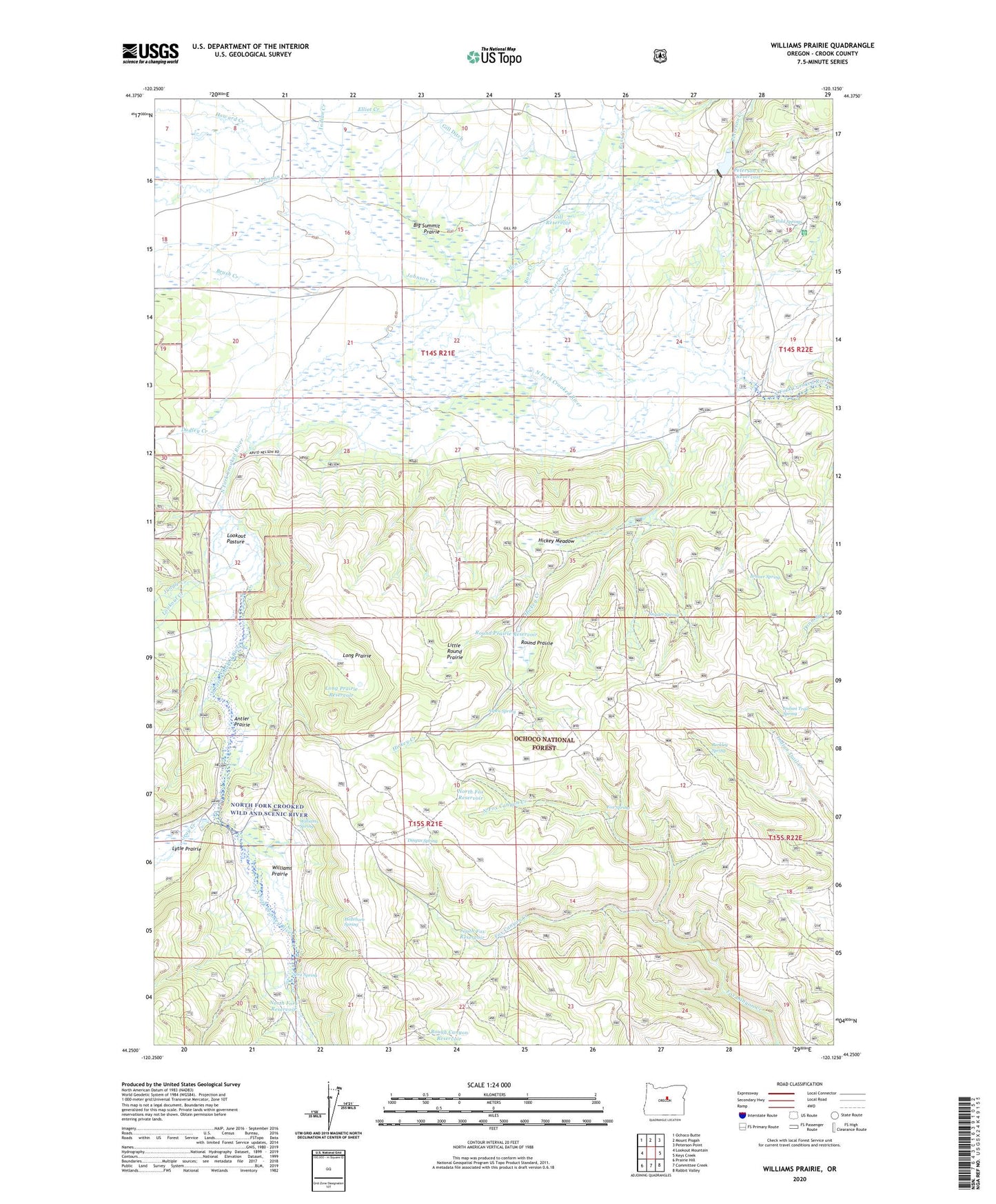
2020 topographic map quadrangle Williams Prairie in the state of Oregon. Scale: 1:24000. Based on the newly updated USGS 7.5' US Topo map series, this map is in the following counties: Crook. The map contains contour data, water features, and other items you are used to seeing on USGS maps, but also has updated roads and other features. This is the next generation of topographic maps. Printed on high-quality waterproof paper with UV fade-resistant inks.
Quads adjacent to this one:
West: Lookout Mountain
Northwest: Ochoco Butte
North: Mount Pisgah
Northeast: Peterson Point
East: Keys Creek
Southeast: Rabbit Valley
South: Committee Creek
Southwest: Prairie Hill
Contains the following named places: Allen Creek, Antler Prairie, Aspen Spring, Berkley Spring, Big Summit Prairie, Bruner Spring, Bruner Spring Reservoir, Brush Creek, Cold Spring Guard Station Landing Field, Cold Springs, Cold Springs Guard Station, Cram Creek, Crescent Post Office, Dingus Spring, Dudley Creek, Elliot Creek, Faith Reservoir, Fox Spring, Gill Ditch, Gill Ranch, Gill Reservoir, Gray Creek, Hellebore Spring, Hickey Creek, Hickey Meadow, Hickey Reservoir, Hope Reservoir, Howard Creek, Howard Ranch, Indian Creek, Indian Trail Spring, Johnson Creek, Jungle Creek, Little Round Prairie, Long Prairie, Long Prairie Reservoir, Lookout Creek, Lookout Pasture, Lucky Reservoir, Lytle Prairie, Meadow Post Office, North Fork Reservoir, North Fox Canyon Creek, North Fox Reservoir, Peterson Creek, Peterson Creek Dam, Peterson Creek Reservoir, Ross Creek, Rough Canyon Reservoir, Round Prairie, Round Prairie Reservoir, Sera Spring, Shovel Reservoir, Snyder Spring, South Fox Reservoir, Summit Prairie School, Williams Prairie, Williams Spring