MyTopo
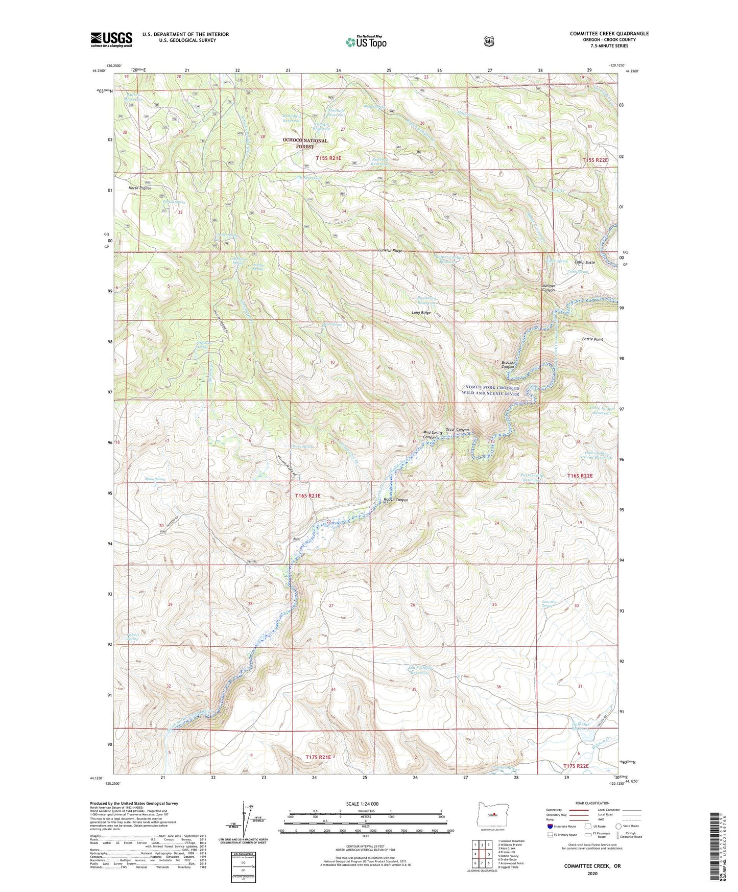
Committee Creek Oregon US Topo Map
Couldn't load pickup availability
Also explore the Committee Creek Forest Service Topo of this same quad for updated USFS data
2024 topographic map quadrangle Committee Creek in the state of Oregon. Scale: 1:24000. Based on the newly updated USGS 7.5' US Topo map series, this map is in the following counties: Crook. The map contains contour data, water features, and other items you are used to seeing on USGS maps, but also has updated roads and other features. This is the next generation of topographic maps. Printed on high-quality waterproof paper with UV fade-resistant inks.
Quads adjacent to this one:
West: Prairie Hill
Northwest: Lookout Mountain
North: Williams Prairie
Northeast: Keys Creek
East: Rabbit Valley
Southeast: Liggett Table
South: Arrowwood Point
Southwest: Drake Butte
This map covers the same area as the classic USGS quad with code o44120b2.
Contains the following named places: Basin Spring, Battle Point, Booton Spring, Boundary Reservoir, Bracket Canyon, Cabin Butte, Cabin Spring, Cherry Spring, Committee Creek, Committee Spring, Federal Spring, Fly Reservoir, Funeral Ridge, Gate One Reservoir, Hail Creek, Hole-in-the-Ground Reservoir, Juniper Canyon, Juniper Canyon Reservoir, Juniper Spring, Little Juniper Reservoir, Lone Pine Spring, Long Ridge, Lower Falls, Lutsey Reservoir, Mud Spring, Mud Spring Canyon, Mudhole Reservoir, North Fork Crooked Wild and Scenic River, Old Faithful Reservoir, Oscar Canyon, Partnership Reservoir, Rimrock Reservoir, Rough Canyon, Rough Canyon Creek, Rough Spring, Swamp Creek, Teater Spring, Teaters Ranch, Telephone Springs, Tohatin Reservoir, Veason Spring, Watson Creek