MyTopo
Amaranth Pennsylvania US Topo Map
Couldn't load pickup availability
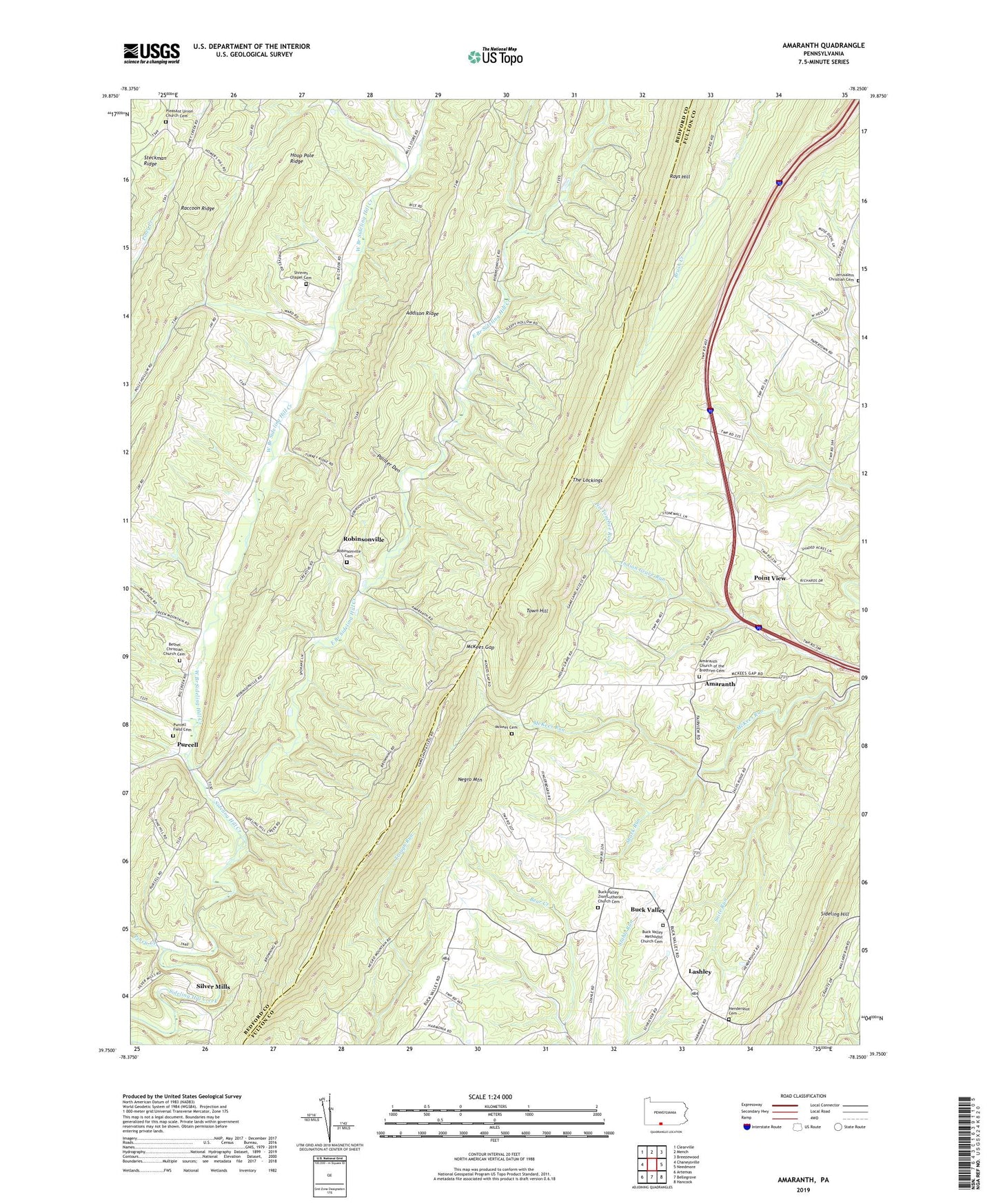
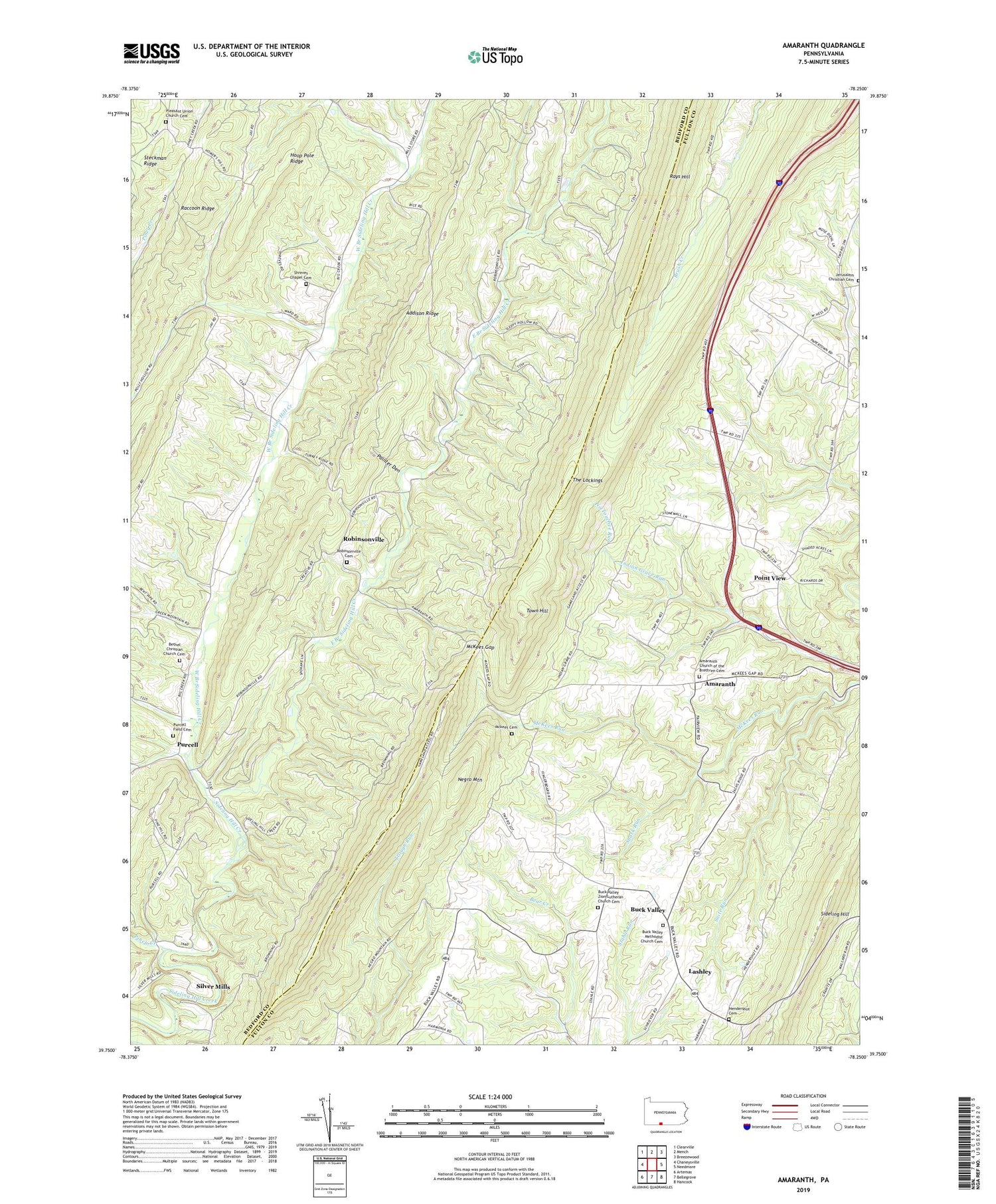
2019 topographic map quadrangle Amaranth in the state of Pennsylvania. Scale: 1:24000. Based on the newly updated USGS 7.5' US Topo map series, this map is in the following counties: Fulton, Bedford. The map contains contour data, water features, and other items you are used to seeing on USGS maps, but also has updated roads and other features. This is the next generation of topographic maps. Printed on high-quality waterproof paper with UV fade-resistant inks.
Quads adjacent to this one:
West: Chaneysville
Northwest: Clearville
North: Mench
Northeast: Breezewood
East: Needmore
South: Bellegrove
Southwest: Artemas
Contains the following named places: Addison Ridge, Amaranth, Amaranth Church of the Brethren Cemetery, Bethel Christian Church Cemetery, Bethel Church, Big Flat Trail, Buck Valley, Buck Valley Methodist Church Cemetery, Buck Valley Zion Lutheran Church Cemetery, Center School, East Branch Sideling Hill Creek, Greater Breezewood Regional Airport, Hendershot Cemetery, Hoop Pole Ridge, Jerusalem Christian Cemetery, Lashley, Mckees Cemetery, McKees Gap, Mills Store, Negro Mountain, No Touchee Run, Oak Grove School, Painter Den, Pine Ridge, Piney Creek, Pleasant Union Church, Pleasant Union Church Cemetery, Point Pleasant School, Point View, Purcell, Purcell Field Cemetery, Raccoon Ridge, Robinsonville, Robinsonville Cemetery, Shark Run, Shreves Chapel, Shreves Chapel Cemetery, Silver Mills, Snite Run, State Game Lands Number 49, Summit School, The Lockings, Township of Union, Wards Church, West Branch Sideling Hill Creek, Zacks Ridge School