MyTopo
Clearville Pennsylvania US Topo Map
Couldn't load pickup availability
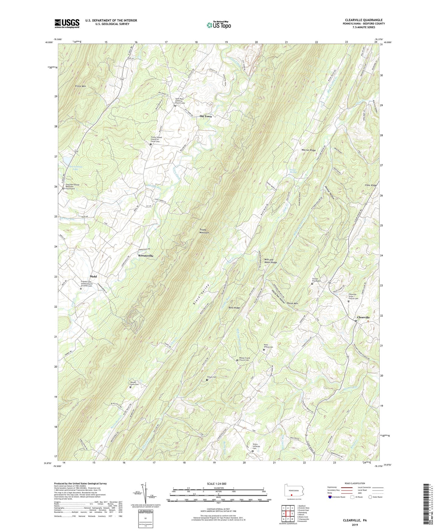
2023 topographic map quadrangle Clearville in the state of Pennsylvania. Scale: 1:24000. Based on the newly updated USGS 7.5' US Topo map series, this map is in the following counties: Bedford. The map contains contour data, water features, and other items you are used to seeing on USGS maps, but also has updated roads and other features. This is the next generation of topographic maps. Printed on high-quality waterproof paper with UV fade-resistant inks.
Quads adjacent to this one:
West: Rainsburg
Northwest: Bedford
North: Everett West
Northeast: Everett East
East: Mench
Southeast: Amaranth
South: Chaneysville
Southwest: Beans Cove
This map covers the same area as the classic USGS quad with code o39078h4.
Contains the following named places: Bethel Frame Church Cemetery, Bittle School, Black Valley Church, Bone Yard Hollow, Buck Ridge, Cessna School, Clear Ridge, Clearville, Clearville Post Office, Clearville Union Church Cemetery, Cornell Graveyard, Deep Hollow, Deep Hollow Run, Deer Lick Hollow Run, Diehl, Frame Church, Friends Cove Church, Friends Cove United Church of Christ Cemetery, Gander Run, Gillam Cemetery, Grace Church, Grace Lutheran Cemetery, Homler Hollow, Horse Pen Hollow, Indian Springs, Indian Springs Cemetery, Indian Springs School, Koontzville, Mann-Monroe School, Maple Grove School, Milk and Water Creek, Milk and Water Ridge, Mount Spruce School, Ott Town, Pennel Farm Cemetery, Peter O'Neal Cemetery, Pine Grove School, Pine Lick Hollow, Saint Mark Lutheran Church Cemetery, Saint Marks Church, Sportsmans Lake, Springville, State Game Lands Number 97, Steckman, Swamp Run, Township of Monroe, Trans Run Church, Trans Run United Methodist Churchyard, Trinity Church, Trinity United Church of Christ Cemetery, Union Church, Warrior Ridge School