MyTopo
Centerville Pennsylvania US Topo Map
Couldn't load pickup availability
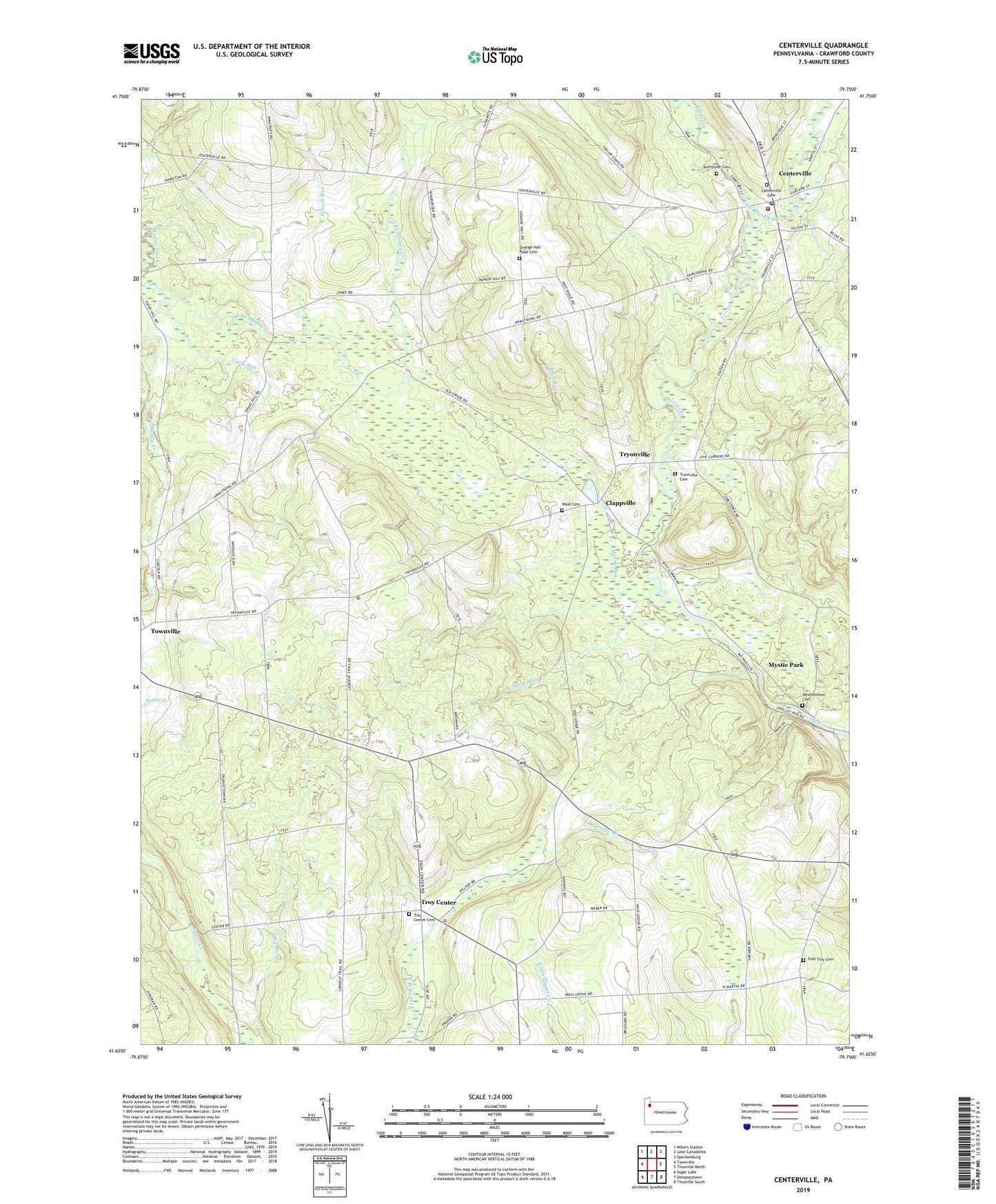
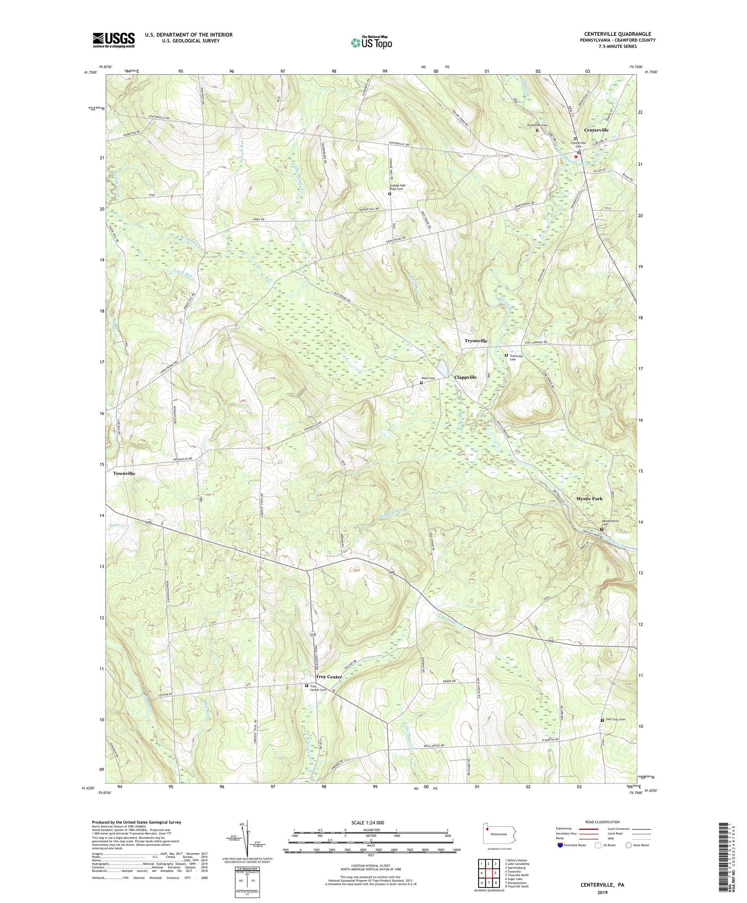
2019 topographic map quadrangle Centerville in the state of Pennsylvania. Scale: 1:24000. Based on the newly updated USGS 7.5' US Topo map series, this map is in the following counties: Crawford. The map contains contour data, water features, and other items you are used to seeing on USGS maps, but also has updated roads and other features. This is the next generation of topographic maps. Printed on high-quality waterproof paper with UV fade-resistant inks.
Quads adjacent to this one:
West: Townville
Northwest: Millers Station
North: Lake Canadohta
Northeast: Spartansburg
East: Titusville North
Southeast: Titusville South
South: Dempseytown
Southwest: Sugar Lake
Contains the following named places: Altenburg Corners, Beardsley School, Borough of Centerville, Boyles Corners, Brier Hill School, Center School, Centerville, Centerville Cemetery, Centerville Post Office, Centerville Volunteer Fire Department 6, Clappville, Dannart Corners, DeWolfe Run, Drake Corners, East Branch Muddy Creek, East Branch Oil Creek, East Troy Cemetery, East Troy Church, Grange Hall Road Cemetery, Grays Mills Station, Green Acres Golf Course, Hatch School, Hawthorne Corners, Highway Tabernacle, Koochogey Corners, Lonetot Corners, Markley Corners, Marsh Run, McCurdy School, McGinnet Corners, Melvin School, Morehead Corners, Moss Grove Corners, Moss Grove School, Mystic Park, Navy Run, Newtontown Cemetery, Potash Run, Smith Corners, State Game Lands Number 122, State Game Lands Number 199, Steuben Corners, Steuben School, Sunnyside Cemetery, Township of Athens, Township of Steuben, Township of Troy, Troy Center, Troy Center Cemetery, Tryonville, Tryonville Cemetery, Tryonville Station, Twomile Creek, Waid Cemetery, Wheelock Corners, White School, Whitman Corners, Whitman School, ZIP Code: 16404