MyTopo
Millers Station Pennsylvania US Topo Map
Couldn't load pickup availability
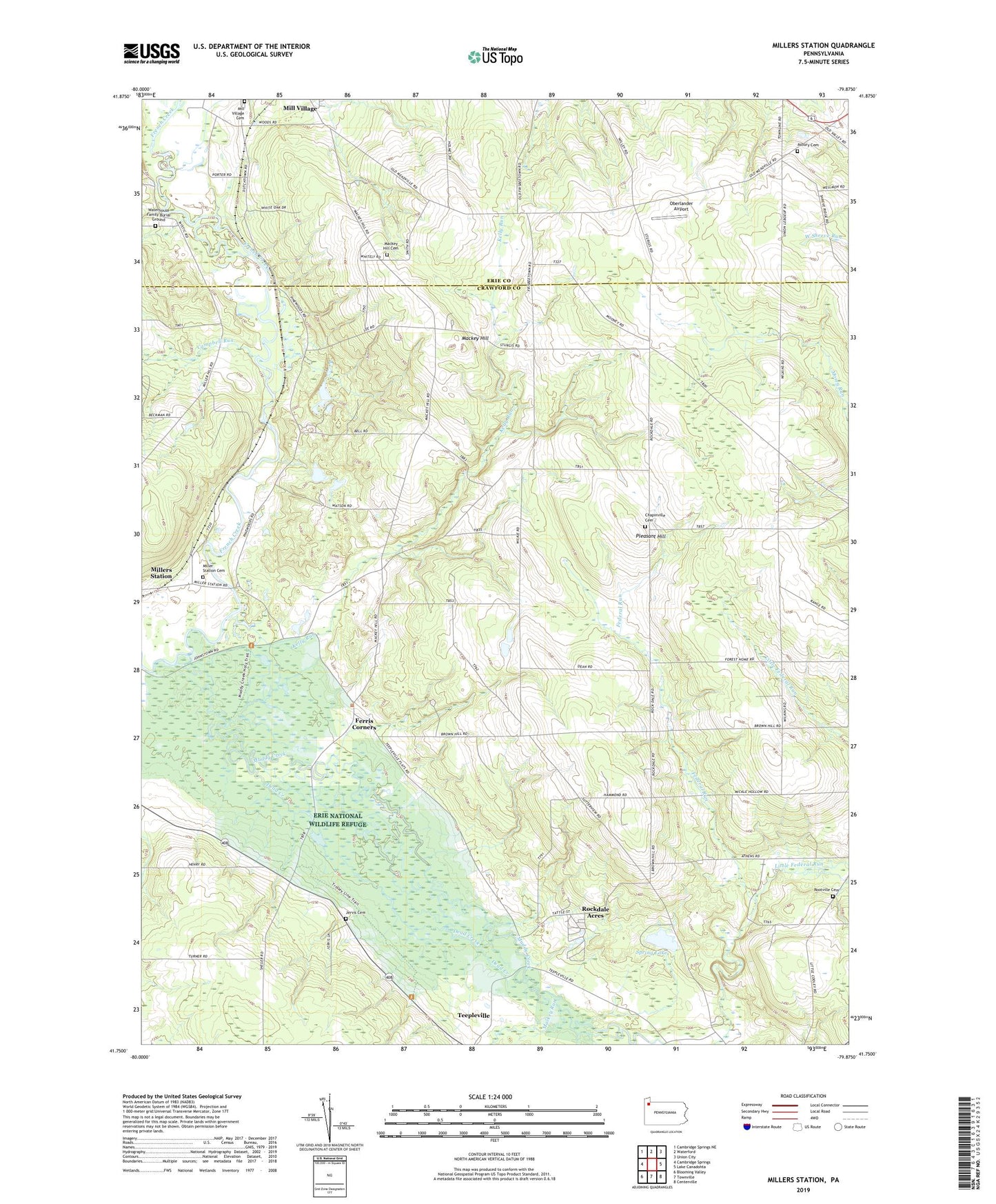
2023 topographic map quadrangle Millers Station in the state of Pennsylvania. Scale: 1:24000. Based on the newly updated USGS 7.5' US Topo map series, this map is in the following counties: Crawford, Erie. The map contains contour data, water features, and other items you are used to seeing on USGS maps, but also has updated roads and other features. This is the next generation of topographic maps. Printed on high-quality waterproof paper with UV fade-resistant inks.
Quads adjacent to this one:
West: Cambridge Springs
Northwest: Cambridge Springs NE
North: Waterford
Northeast: Union City
East: Lake Canadohta
Southeast: Centerville
South: Townville
Southwest: Blooming Valley
This map covers the same area as the classic USGS quad with code o41079g8.
Contains the following named places: Asbury Cemetery, Brown Hill, Camp Mystic, Campbell Run, Chapinville Cemetery, Crabs Corners, Dead Creek, Dobbs School, Eaton Corners, Everwind Ranch, Ferris Corners, Forest Home Corners, Foxburg Corners, Glover Corners, Hinkley Corners, Horton School, Jervis Cemetery, Jervis Church, Jervis Corners, Kelly Run, Kings Corners, Little Federal Run, Mackey Hill, Mackey Hill Cemetery, Mackey Hill Church, Mackey Run, Mill Village Cemetery, Miller Station Cemetery, Millers Station, Muddy Creek, Oberlander Airport, Pleasant Hill, Rockdale Acres, Rockdale Center High School, Rocky Top Farm, Rootville Cemetery, Spring Lake, State Game Lands Number 85, Sturgis Corners, Teepleville, Township of Rockdale, Troyer Dam, Waterhouse Family Burial Ground, Weston School, Wilkins Church, Willey School