MyTopo
Dempseytown Pennsylvania US Topo Map
Couldn't load pickup availability
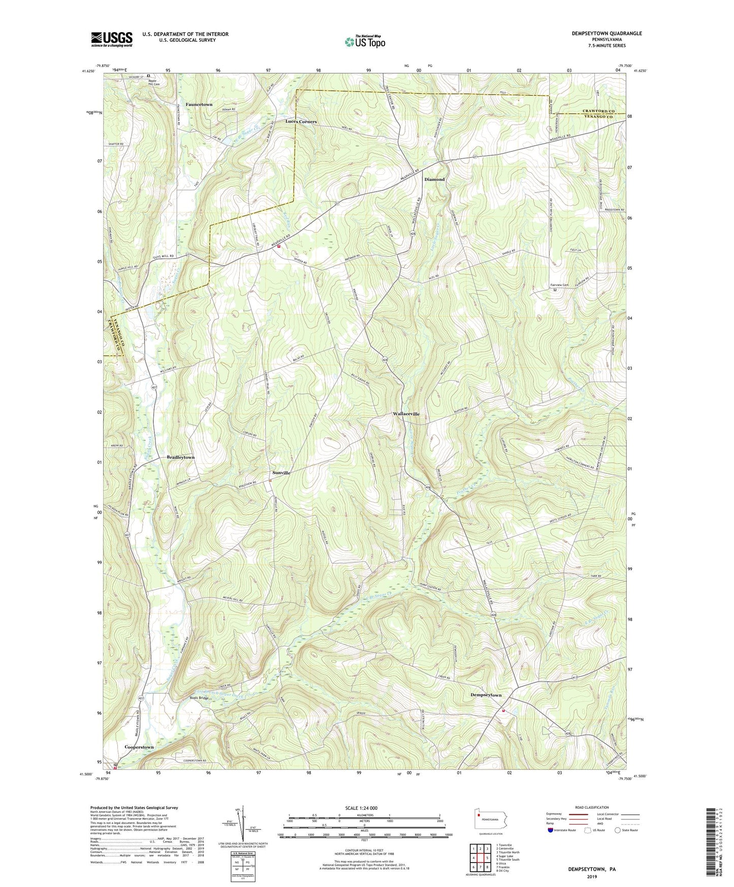
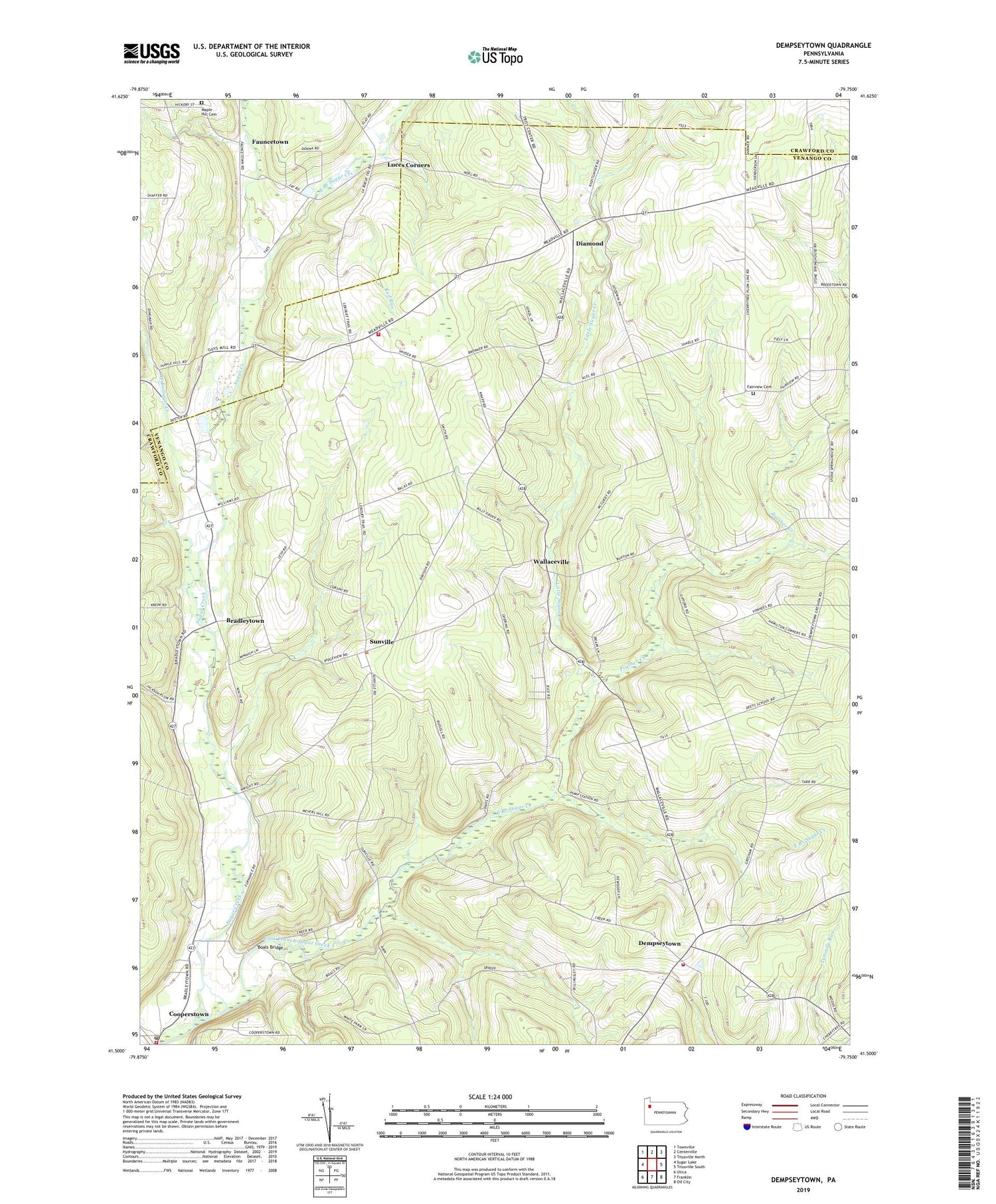
2019 topographic map quadrangle Dempseytown in the state of Pennsylvania. Scale: 1:24000. Based on the newly updated USGS 7.5' US Topo map series, this map is in the following counties: Venango, Crawford. The map contains contour data, water features, and other items you are used to seeing on USGS maps, but also has updated roads and other features. This is the next generation of topographic maps. Printed on high-quality waterproof paper with UV fade-resistant inks.
Quads adjacent to this one:
West: Sugar Lake
Northwest: Townville
North: Centerville
Northeast: Titusville North
East: Titusville South
Southeast: Oil City
South: Franklin
Southwest: Utica
Contains the following named places: Alcorn School, Baums Corners, Boals Bridge, Boat School, Boyd Center Corners, Bradleytown, Bradleytown Church, Chapmanville, Chapmanville Volunteer Fire Department, Cooperstown Volunteer Fire Department Station 5, Copperstown Post Office, Dempseytown, Dets School, Diamond, Dry Run, East Branch Sugar Creek, Fairview Cemetery, Fauncetown, Hamilton Corners, Little Sugar Creek, Luces Corners, Maple Hill Cemetery, Mount Carmel Church, Oakland Corners, Oakland Township Volunteer Fire Department Station 13, Plum Center School, Plum Corner, Plum Post Office, Prather Creek, Propers Corners, Prospect Hill Church, Red Run, State Game Lands Number 96, Sunville, Sunville Post Office, Township of Oakland, Township of Plum, Trinity Church, Valley School, Wallaceville, Wallaceville Church, Wallaceville Post Office, West Branch Sugar Creek, ZIP Code: 16317