MyTopo
Oil City Pennsylvania US Topo Map
Couldn't load pickup availability
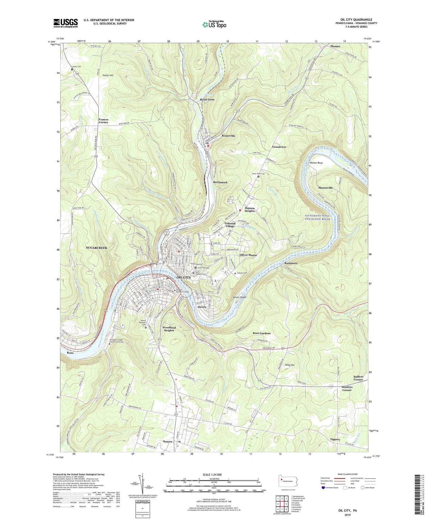
2023 topographic map quadrangle Oil City in the state of Pennsylvania. Scale: 1:24000. Based on the newly updated USGS 7.5' US Topo map series, this map is in the following counties: Venango. The map contains contour data, water features, and other items you are used to seeing on USGS maps, but also has updated roads and other features. This is the next generation of topographic maps. Printed on high-quality waterproof paper with UV fade-resistant inks.
Quads adjacent to this one:
West: Franklin
Northwest: Dempseytown
North: Titusville South
Northeast: Pleasantville
East: President
Southeast: Kossuth
South: Cranberry
Southwest: Kennerdell
This map covers the same area as the classic USGS quad with code o41079d6.
Contains the following named places: Ahrensville, Alcorn Island, Assumption School, Borough of Rouseville, Calaboose Run, Calvary Cemetery, Carney Run, Charley Run, Cherry Run, Cherrytree Run, City of Oil City, Colonial Village, Cornplanter Municipal Building, Cornplanter Run, Cornplanter Volunteer Fire Department, Cranberry Area High School, Darvassy Airport, Foster Hill, Foster Hill School, Fosters Corner, Gay Street School, Grandview, Grant Street School, Grove Hill Cemetery, Hasson Heights, Hasson Heights Census Designated Place, Hasson Heights Elementary School, Hoag Hill, Hoag Hill Church, Holiday Run, Horse Creek, Innis Street School, Lamb Run, Lamey Cemetery, Lamey Church, Lincoln Junior High School, McClintock, Mount Pleasant Cemetery, Oil City, Oil City Fire Department Station 1 Headquarters, Oil City Fire Department Station 3, Oil City Junior High School, Oil City Police Department, Oil City Post Office, Oil City Senior High School, Oil Creek, Oliver Manor, Panther Run, Pin Oak School, Plumer, Plumer Fire Tower, Reno Station, Rockmere, Rose Gardens, Rossman School, Rouseville, Rouseville Post Office, Rouseville Volunteer Fire Department, Rynd Farm, Sage Run, Saint Josephs Cemetery, Saint Josephs School, Saint Stephen Church, Saint Stephen School, Seneca, Seneca Census Designated Place, Seneca Post Office, Seneca Volunteer Fire Department, Seventh Street Elementary School, Shaw Farm Cemetery, Siverly, Slate Run, Stanleys Corner, Steffee Elementary School, Tippery, Tippery School, Township of Cornplanter, University of Pennsylvania Medical Center Northwest Seneca, Venango Campus, Venango High School, Walnut Bend, Wanango Country Club, Wolf Branch, Woodland Heights, Woodland Heights Census Designated Place, WOYL-AM (Oil City), WRJS-FM (Oil City), Wykle Run, ZIP Codes: 16344, 16346