MyTopo
Honesdale Pennsylvania US Topo Map
Couldn't load pickup availability
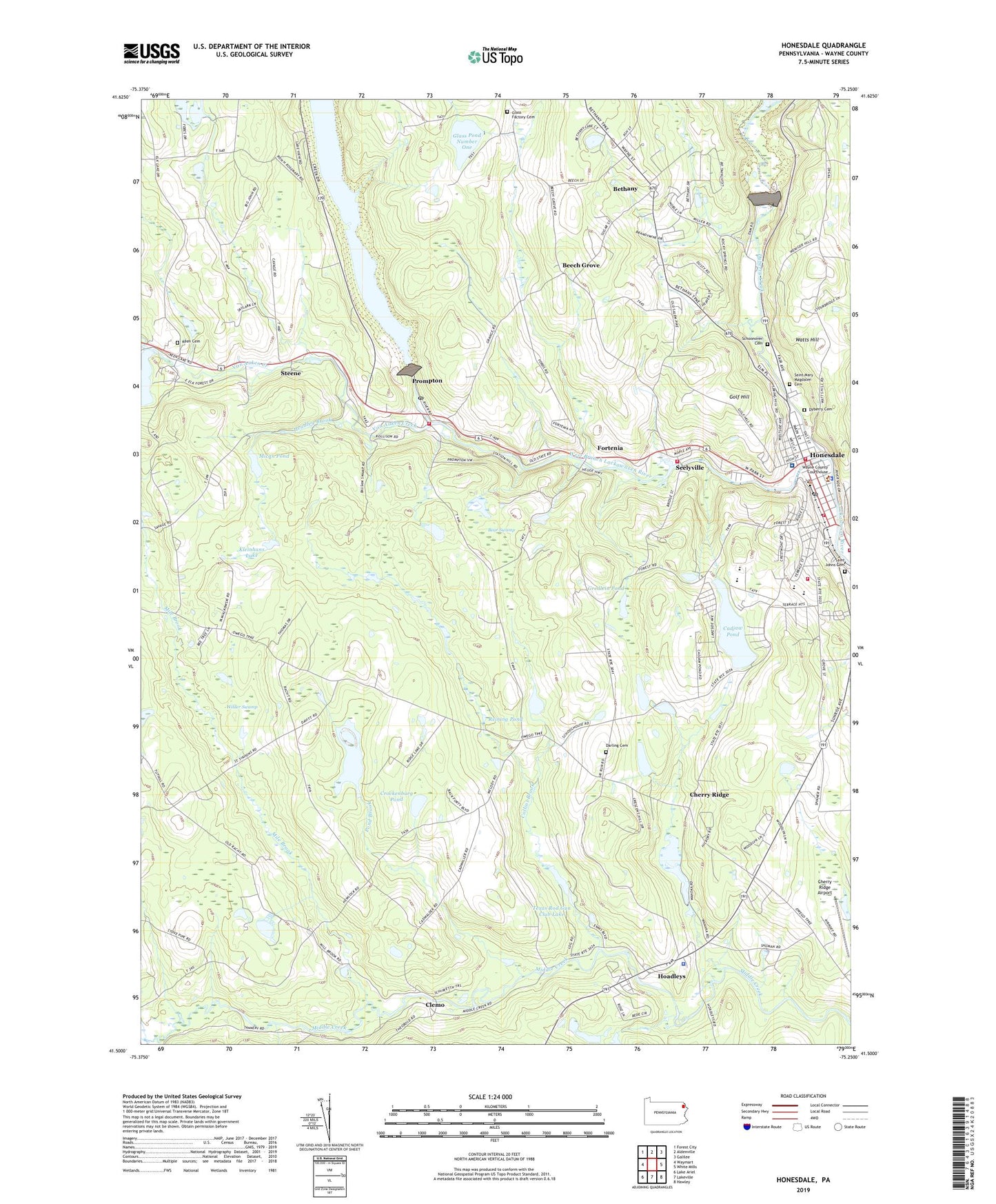
2019 topographic map quadrangle Honesdale in the state of Pennsylvania. Scale: 1:24000. Based on the newly updated USGS 7.5' US Topo map series, this map is in the following counties: Wayne. The map contains contour data, water features, and other items you are used to seeing on USGS maps, but also has updated roads and other features. This is the next generation of topographic maps. Printed on high-quality waterproof paper with UV fade-resistant inks.
Quads adjacent to this one:
West: Waymart
Northwest: Forest City
North: Aldenville
Northeast: Galilee
East: White Mills
Southeast: Hawley
South: Lakeville
Southwest: Lake Ariel
Contains the following named places: Bear Swamp, Beech Grove, Bethany, Borough of Bethany, Borough of Honesdale, Borough of Prompton, Burns Pond, Cadjaw Dam, Cadjaw Pond, Cadjaw Pond Dam, Cavage Personal Use Airport, Cherry Ridge, Cherry Ridge Airport, Clemo, Coggins Corner, Collins Brook, Collins Pond Dam, Crockenburg Pond, Darling Cemetery, Dyberry Cemetery, Dyberry Creek, East Cherry Ridge School, Elk Forest Resort Golf Course, Fermoy, Fermoy School, Fortenia, General Edgar Jadwin Dam, Glass Factory Cemetery, Glass Pond Dam Number One, Glass Pond Number One, Glass Pond Number Two Dam, Golf Hill, Gredlein Pond, Headley Brook, Hoadley School, Hoadleys, Honesdale, Honesdale Emergency Medical Services, Honesdale Fire Department, Honesdale Fire Department Alert Hook and Ladder Company 2, Honesdale Fire Department Hose Company 1, Honesdale Fire Department Protection Engine Company 3, Honesdale High School, Honesdale Police Department, Honesdale Post Office, Keen, Keen Cemetery, Keen Lake Dam, Lake Wanoka, Lincoln Elementary School, Mican Dam, Mican Pond, Mile Brook, Pennsylvania State Police Troop R Honesdale Station, Pond Brook, Prompton, Prompton Dam, Prompton Fire and Rescue Unit Station 94, Prompton Lake, Prompton Post Office, Prompton State Park, Reining Dam, Reining Pond, Richard Dam, Saint Mary Magdalen Cemetery, Saint Patricks Church, Schoonover Cemetery, Seelyville, Seelyville Fire Company Station 12, Steene, Stourbridge Elementary School, Texas Rod Gun Club Dam, Texas Rod Gun Club Lake, Township of Cherry Ridge, Van Auken Creek, Watts Hill, Wayne County Sheriff's Office, Wayne Highlands Middle School, Wayne Memorial Hospital, WDNH-AM (Honesdale), West Branch Lackawaxen River, Wilder Swamp, Woolen Mill Dam, ZIP Codes: 18431, 18456