MyTopo
Galilee Pennsylvania US Topo Map
Couldn't load pickup availability
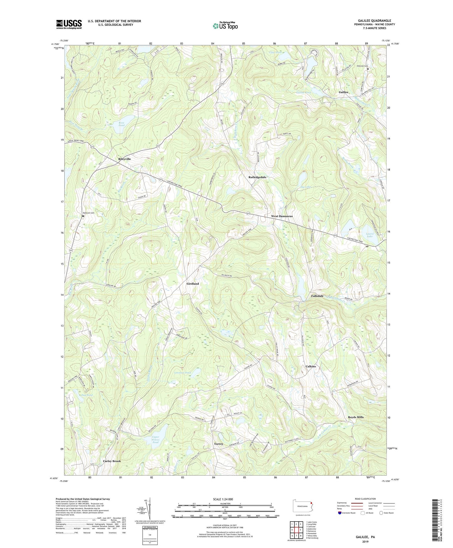
2023 topographic map quadrangle Galilee in the state of Pennsylvania. Scale: 1:24000. Based on the newly updated USGS 7.5' US Topo map series, this map is in the following counties: Wayne. The map contains contour data, water features, and other items you are used to seeing on USGS maps, but also has updated roads and other features. This is the next generation of topographic maps. Printed on high-quality waterproof paper with UV fade-resistant inks.
Quads adjacent to this one:
West: Aldenville
Northwest: Lake Como
North: Long Eddy
Northeast: Callicoon
East: Damascus
Southeast: Narrowsburg
South: White Mills
Southwest: Honesdale
This map covers the same area as the classic USGS quad with code o41075f2.
Contains the following named places: Alder Marsh Dam, Alder Marsh Pond, Barnes Dam, Beaver Lake, Bolkcom Cemetery, Boyds Mills, Brussell and Brunner Dam, Burcher School, Calkins, Calkins Union Church, Camp Chicopee, Canfield School, Carley Brook, Cline Pond, Day Pond, Fallsdale, Fallsdale Pond, Galilee, Galilee Pond, Girdland, Hillcrest Cemetery, Kellow Lake Dam, Kesler School, Laurel Lake, Lovelace Pond, Lovelass Dam, Rileyville, Rileyville Church, Rose Pond, Rutledgedale, Saint Josephs Church, Silver Lake, Sky Lake, Torrey, Township of Damascus, Township of Oregon, Tyler Hill Post Office, Upper Wilcox Pond, West Damascus, ZIP Code: 18469