
MyTopo
Lake Canadohta Pennsylvania US Topo Map
Couldn't load pickup availability
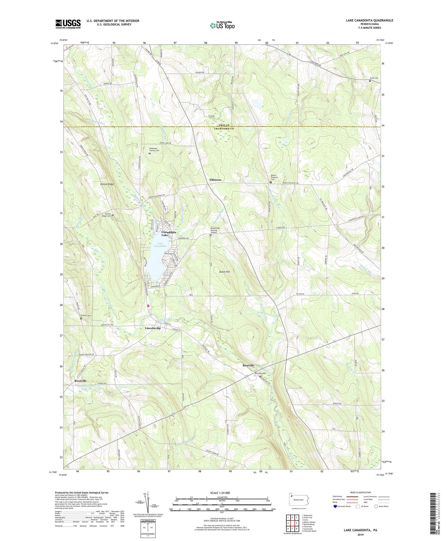
2019 topographic map quadrangle Lake Canadohta in the state of Pennsylvania. Scale: 1:24000. Based on the newly updated USGS 7.5' US Topo map series, this map is in the following counties: Crawford, Erie. The map contains contour data, water features, and other items you are used to seeing on USGS maps, but also has updated roads and other features. This is the next generation of topographic maps. Printed on high-quality waterproof paper with UV fade-resistant inks.
Quads adjacent to this one:
West: Millers Station
Northwest: Waterford
North: Union City
Northeast: Corry
East: Spartansburg
Southeast: Titusville North
South: Centerville
Southwest: Townville
Contains the following named places: Aldorf Corners, Ames Cemetery, Bentley School, Blakeslee Family Cemetery, Bloomfield Burying Ground, Bloomfield Run, Bloomfield School, Bloomfield Township Volunteer Fire Department 1, Brimstone Corners, Canadohta Lake, Canadohta Lake Census Designated Place, Canadohta Ski Slope, Clements Corners, Cottage Hill Church, Dutch Hill, East Shreve Run, Lady of Fatima Chapel, Lake Canadohta, Lake Canadohta Post Office, Lakeville, Lincolnville, Lincolnville Census Designated Place, Loomis Cemetery, Maple Grove Church, Mosey Run, Mount Pleasant Cemetery, Mount Pleasant Church, Pages Corners, Pine Hollow Run, Puckerbrush Lake, Riceville, Riceville Cemetery, Riceville Census Designated Place, Rootville, Saint Church, Shreve Ridge, Shreve Ridge Cemetery, Shreve Ridge Church, Shreve School, State Game Lands Number 202, Taylor Strand School, Tillotson, Township of Bloomfield, Union City Country Club, Union City Golf Course, WCTL-FM (Union City), West Shreve Run


