MyTopo
Lakeville Pennsylvania US Topo Map
Couldn't load pickup availability
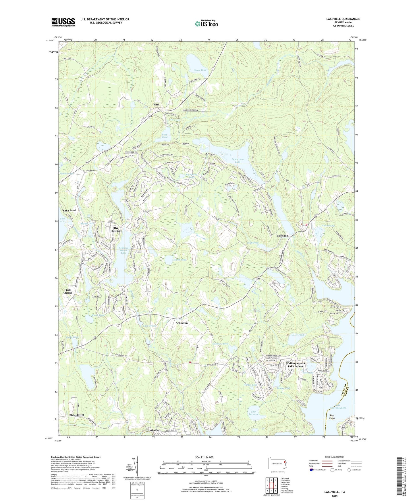
2019 topographic map quadrangle Lakeville in the state of Pennsylvania. Scale: 1:24000. Based on the newly updated USGS 7.5' US Topo map series, this map is in the following counties: Wayne, Pike. The map contains contour data, water features, and other items you are used to seeing on USGS maps, but also has updated roads and other features. This is the next generation of topographic maps. Printed on high-quality waterproof paper with UV fade-resistant inks.
Quads adjacent to this one:
West: Lake Ariel
Northwest: Waymart
North: Honesdale
Northeast: White Mills
East: Hawley
Southeast: Promised Land
South: Newfoundland
Southwest: Sterling
Contains the following named places: Ammermanton School, Ariel Creek, Arlington, Arlington School, Avoy, Beaver Lake, Beaver Lake Dam, Big Spring Pond, Briar Hill, Brooks Lake, Butler Pond, C H Mack Dam, Centerville School, Clemo Pond, Cobb Pond, Cooks Pond, Craft Pond, Craft Pond Dam, Croft Dam, Deer Lake, Deer Lake Dam, Finn Swamp, Five Mile Point, Goose Pond, Hazzard Dam, Herrman Dam, Hidden Lake, Janoske Dam, Kipp Island, Kuehners Pond, Lake Ariel Dam, Lake Clemo Dam, Lake Ellyn Dam, Lake Genero, Lake Lacawac, Lake Moc a tek Dam, Lake Paupackan Dam, Lakeville, Lakeville Volunteer Fire Department, Ledgedale Volunteer Fire Department, Little Chapel, Locklin Pond, Locklin Pond Dam, Mang Dam, Mang Pond, Marsh Pond, Moc-a-Tek Lake, Paupackan Lake, Pink, Purdy Creek, Purdytown, Roaming Woods Lake, Roaming Woods Lake Dam, Saint Marys Church, The Hideout, The Hideout Census Designated Place, Tisdale Cemetery, Township of Paupack, Township of Salem, Wallenpaupack Lake Estates, Wallenpaupack Lake Estates Census Designated Place, Wangum Lake, Waynewood Lake, Whitney Lake, Wildwood Lake, Wildwood Lake Dam, ZIP Code: 18438