MyTopo
Promised Land Pennsylvania US Topo Map
Couldn't load pickup availability
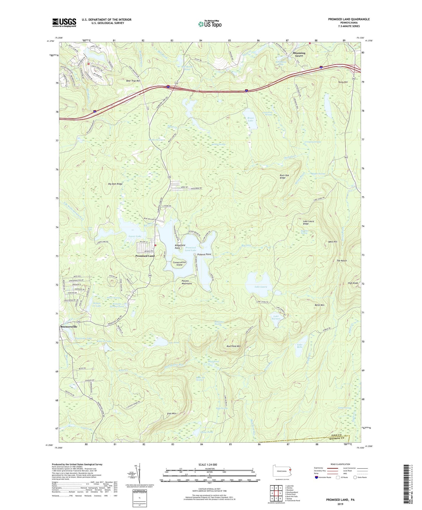
2023 topographic map quadrangle Promised Land in the state of Pennsylvania. Scale: 1:24000. Based on the newly updated USGS 7.5' US Topo map series, this map is in the following counties: Pike, Monroe. The map contains contour data, water features, and other items you are used to seeing on USGS maps, but also has updated roads and other features. This is the next generation of topographic maps. Printed on high-quality waterproof paper with UV fade-resistant inks.
Quads adjacent to this one:
West: Newfoundland
Northwest: Lakeville
North: Hawley
Northeast: Rowland
East: Pecks Pond
Southeast: Twelvemile Pond
South: Skytop
Southwest: Buck Hill Falls
This map covers the same area as the classic USGS quad with code o41075c2.
Contains the following named places: Balsam Swamp, Bear Trap Mountain, Belle Mountain, Big Dam Ridge, Big Inlet, Big Inlet Swamp, Black Ash Swamp, Blooming Grove, Blooming Grove Fire Department Substation, Blooming Grove School, Boundary Trail, Brown Trail, Bruce Lake, Bruce Lake Natural Area, Bruce Lake Trail, Burley Inlet Trail, Company Swamp, Conservation Island, Dark Hollow Run, East Branch Bruce Lake Trail, East Mountain, Egypt Creek, Egypt Meadow Dam, Egypt Meadow Lake, Fairview Outlet, Good Shepherd Church, Goose Pond, Gumble Brothers Dam, Horseshoe Swamp, Icks Pond, Indian Swamp, Kintz Creek, Kintz Creek Dam, Kintz Creek Lake, Kleinhans Lake, Lake Belle, Lake Earnest, Lake Laura, Lake Laura Dam, Lake Laura Ridge, Lake Laura Trail, Lake Scott, Lake Wynooska Dam, Little Falls, Long Pond Swamp, Long Swamp, Lower Lake, Lower Lake Dam, Lumber Company Dam, Mill Brook Pond, Mozette Creek, Mud Pond, Mud Pond Mountain, Notch Brook, Number Three Dam, Panther Swamp, Perch Run, Pickerel Point, Pocono Mountains, Promised Land, Promised Land Dam, Promised Land Lake, Promised Land State Park, Promised Land Volunteer Fire Station and Ambulance 35, Ridgefield Point, Rock Oak Ridge, Rock Oak Trail, Roemersville, Shaffer Swamp, Sky View Lake, Snow Shanty Trail, Spring Brook, Tafton Fire Department Substation, Tanglewood Estate, Tanglewood Golf Course, Tarey Hill, Telephone Trail, The Notch, West Branch Bruce Lake Trail, West Hill, Whittaker Trail, Wilson Creek, Wilson Creek Dam, Wilson Creek Lake, Wilson Swamp, Wilsons Swamp Pond, Wyler Dam, Wynooska Lake, ZIP Code: 18426