MyTopo
Mason and Dixon Pennsylvania US Topo Map
Couldn't load pickup availability
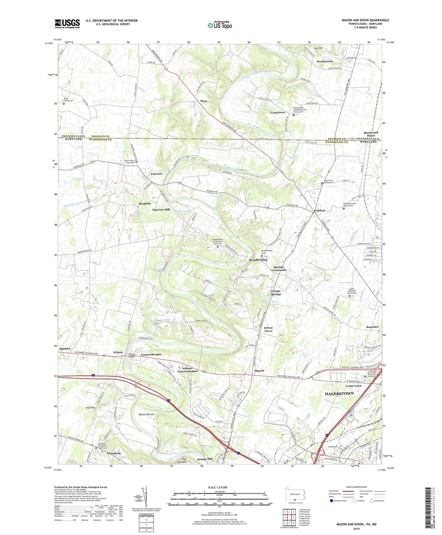
2019 topographic map quadrangle Mason and Dixon in the states of Maryland, Pennsylvania. Scale: 1:24000. Based on the newly updated USGS 7.5' US Topo map series, this map is in the following counties: Franklin, Washington. The map contains contour data, water features, and other items you are used to seeing on USGS maps, but also has updated roads and other features. This is the next generation of topographic maps. Printed on high-quality waterproof paper with UV fade-resistant inks.
Quads adjacent to this one:
West: Clear Spring
Northwest: Mercersburg
North: Williamson
Northeast: Greencastle
East: Hagerstown
Southeast: Funkstown
South: Williamsport
Southwest: Hedgesville
Contains the following named places: Arboranda Estates, Bethel Church of God, Bostetter, Broadfording, Broadfording Bible Brethren Church, Broadfording Cemetery, Broadfording Christian Academy, Broadfording Church of God Cemetery, Cearfoss, Cearfoss Census Designated Place, Cedar Lawn, Cedar Lawn Memorial Park, Cedar Ridge School, Conococheague, Conococheague Elementary School, Coseytown, Cushwa Fish Hatchery, Deer Lodge Mobile Home Park, District 13 Maugansville, District 23 Wilsons, District 24 Cedar Lawn, District 25 Hagerstown, Dry Run, Fairview, Fairview Acres, Fairview Census Designated Place, Fairview Mill, Gardenspot, Grace Academy, Greenberry Hills, Gristmill Hill, Hagerstown Mennonite Fellowship, Hagerstown Raceway, Heritage Academy, High Germany, Hillside Mennonite School, Huyett, Huyetts Mennonite School, Independence School, Jamison Yard, Jones Chapel, Kemps Mill Census Designated Place, Kent Estates, Locust Hill School, Locust Level School, Martins Crossroads, Mason and Dixon, Meadow Brook, Mount Tabor Evangelical Church, Mount Tabor Graveyard, Mount Tabor United Brethren Church, Mount Zion Graveyard, Mount Zion United Methodist Church, Nova, Oak Hill House School, Oaklett Estates, Pine Hills, Pinesburg, Pinesburg Baptist Church, Pinesburg Census Designated Place, Pinesburg Mennonite Church Cemetery, Piper Lane Neighborhood Park, Pleasant Hill Church, Pleasant Hill United Brethren Church Cemetery, Reiff Mennonite Church Cemetery, Reiffs Church, Rockdale, Rockdale Run, Rush Run, Salem Reformed Church Cemetery, Salem Reformed United Church of Christ, Scar Hill, Sneckerberger School, Spickler, Spring Hill Estates, Stech Family Cemetery, Sunrise School, Sylvan Grove, Sylvan Grove School, Toms Run, Troupe Run, Troupe Springs, Valley Mall Shopping Center, Valley Plaza Shopping Center, Walnut Bottom, Walnut Point School, Washington County Business Center, Washington County Detention Center, Washington County Emergency Air Unit Company 25, Washington County Sheriff's Office, White Pine School, Williams Farm, Wilson, Wilson Bridge, Wilson Quarry, Wilson-Conococheague Census Designated Place, Worleytown