MyTopo
Mercersburg Pennsylvania US Topo Map
Couldn't load pickup availability
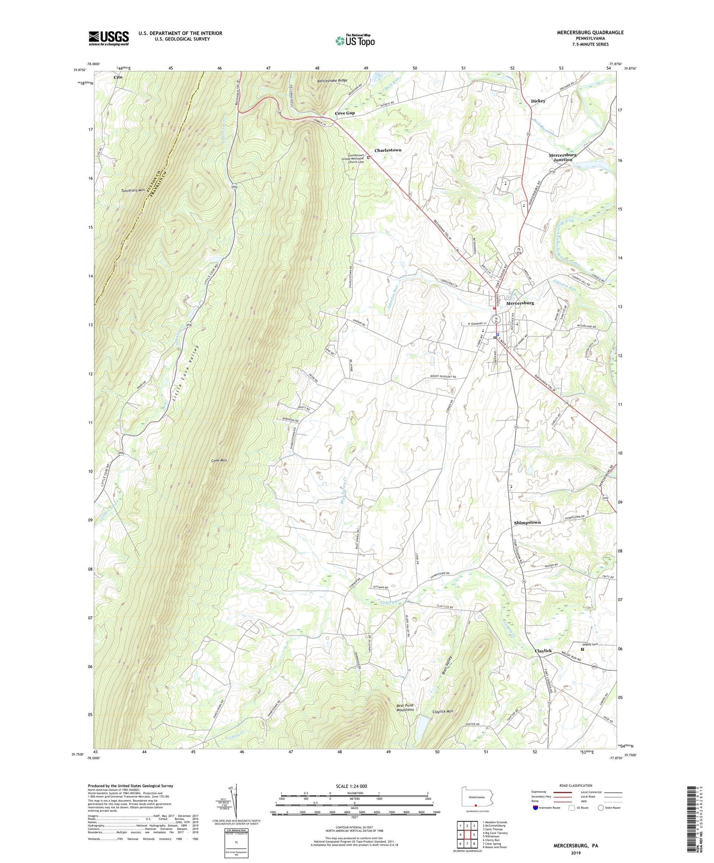
2023 topographic map quadrangle Mercersburg in the state of Pennsylvania. Scale: 1:24000. Based on the newly updated USGS 7.5' US Topo map series, this map is in the following counties: Franklin, Fulton. The map contains contour data, water features, and other items you are used to seeing on USGS maps, but also has updated roads and other features. This is the next generation of topographic maps. Printed on high-quality waterproof paper with UV fade-resistant inks.
Quads adjacent to this one:
West: Big Cove Tannery
Northwest: Meadow Grounds
North: McConnellsburg
Northeast: Saint Thomas
East: Williamson
Southeast: Mason and Dixon
South: Clear Spring
Southwest: Cherry Run
This map covers the same area as the classic USGS quad with code o39077g8.
Contains the following named places: Blair Valley, Blue Spring, Blue Spring Creek, Blue Spring School, Borough of Mercersburg, Buchanan School, Buchanans Birthplace, Buchanan's Birthplace State Park, Buck Run, Buck Run Dam, Charlestown, Charlestown United Methodist Church Cemetery, Claylick, Claylick Mountain, Claylick School, Cove Gap, Cove Mountain, Dickey, James Buchanan Middle School, James Buchanan Senior High School, Johnston Run, Lafayette School, Lenwood Heights, Little Cove Valley, Mercersburg, Mercersburg - Montgomery - Peters - Warren Volunteer Fire Department - Company 9, Mercersburg Academy, Mercersburg Elementary School, Mercersburg Junction, Mercersburg Police Department, Mercersburg Post Office, Montgomery Elementary School, Montpelier School, Mount Pleasant School, Negley Cemetery, Rattlesnake Ridge, Sher Lee Farm, Shimpstown, Shimpstown School, Township of Montgomery, Township of Peters, Upper West Conococheague Church, ZIP Code: 17236