MyTopo
Mench Pennsylvania US Topo Map
Couldn't load pickup availability
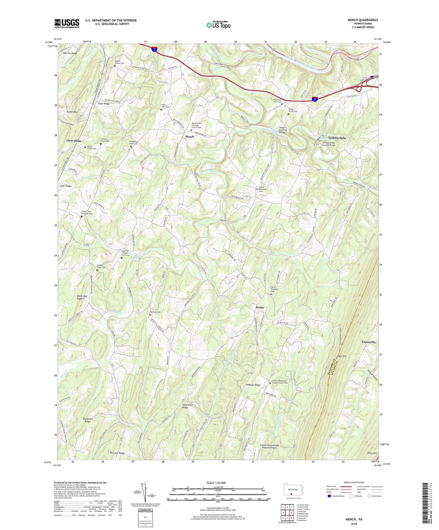
2019 topographic map quadrangle Mench in the state of Pennsylvania. Scale: 1:24000. Based on the newly updated USGS 7.5' US Topo map series, this map is in the following counties: Bedford, Fulton. The map contains contour data, water features, and other items you are used to seeing on USGS maps, but also has updated roads and other features. This is the next generation of topographic maps. Printed on high-quality waterproof paper with UV fade-resistant inks.
Quads adjacent to this one:
West: Clearville
Northwest: Everett West
North: Everett East
Northeast: Wells Tannery
East: Breezewood
Southeast: Needmore
South: Amaranth
Southwest: Chaneysville
Contains the following named places: Baughman Church, Baughman Union Cemetery, Blackhart Farm Cemetery, Brush Creek, Buchanan School, Calhoun Farm Cemetery, Calhoun School, Cedar Grove Cemetery, Cedar Grove Church, Chapman Run, Cherry Lane Brethren Cemetery, Cherry Lane Church, Clark School, Clear Creek Church, Clear Ridge, Cooper Farm Cemetery, Dibert Farm Cemetery, Emerson, Felten's Covered Bridge, Jackson Mills, Jackson's Mill Covered Bridge, James O'Neal Cemetery, Juniata Crossing, Kagarise - Burger Farm Cemetery, Mattie, Mench, Mount Pleasant Cemetery, Mount Pleasant Church, Mount Union Christian Church Cemetery, Mount Union Church, Oak Grove School, Rays Hill, Rock Hill Church, Rockhill Cemetery, Shaffer Creek, Sparks Family Cemetery, Stevens Chapel, Stevens Methodist Chapel Church Cemetery, Township of West Providence, Union Memorial Cemetery, Union Memorial Church, Weimer Run, Wesley Chapel, Wildcat Hollow, Woodbush School