
MyTopo
Spartansburg Pennsylvania US Topo Map
Couldn't load pickup availability
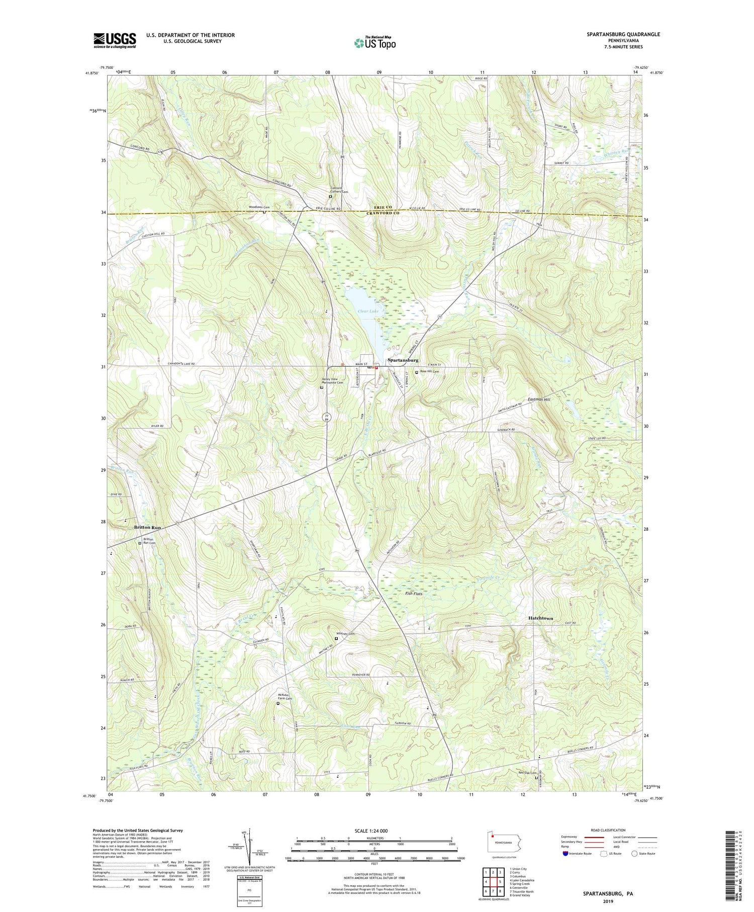
2019 topographic map quadrangle Spartansburg in the state of Pennsylvania. Scale: 1:24000. Based on the newly updated USGS 7.5' US Topo map series, this map is in the following counties: Crawford, Erie. The map contains contour data, water features, and other items you are used to seeing on USGS maps, but also has updated roads and other features. This is the next generation of topographic maps. Printed on high-quality waterproof paper with UV fade-resistant inks.
Quads adjacent to this one:
West: Lake Canadohta
Northwest: Union City
North: Corry
Northeast: Columbus
East: Spring Creek
Southeast: Grand Valley
South: Titusville North
Southwest: Centerville
Contains the following named places: Blakeslee Corners, Borough of Spartansburg, Brannon Run, Britton Run, Britton Run Cemetery, Buell Corners, Clear Lake, Clear Lake Dam, Coil School, Concord Corners, Concord Corners Cemetery, Coon Run, Daytown School, Eastman Hill, Enterprise School, Fairview Church, Fish Flats, Fivemile Creek, Glynden, Harbor Hall School, Harbor Valley Farm, Harper Hill Church, Hatchtown, Lind Farm, Lindsey School, McKuhn Farm Cemetery, Merchant Corners, Northrop Egg Farm, Oil Creek Chapel, Our Lady of Victory Church, Oxbow School, Patrick Run, Red Oak Cemetery, Red Oak School, Rose Hill Cemetery, Skiff Farms, Spartansburg, Spartansburg Post Office, Spartansburg Volunteer Fire Department, State Game Lands Number 144, State Lot Corners, Stranahan Run, Summit School, Township of Sparta, Valley View Church, Valley View Mennonite Cemetery, Vance Farm, Whitney Cemetery, Woodlawn Cemetery, ZIP Code: 16434


