MyTopo
Spring Creek Pennsylvania US Topo Map
Couldn't load pickup availability
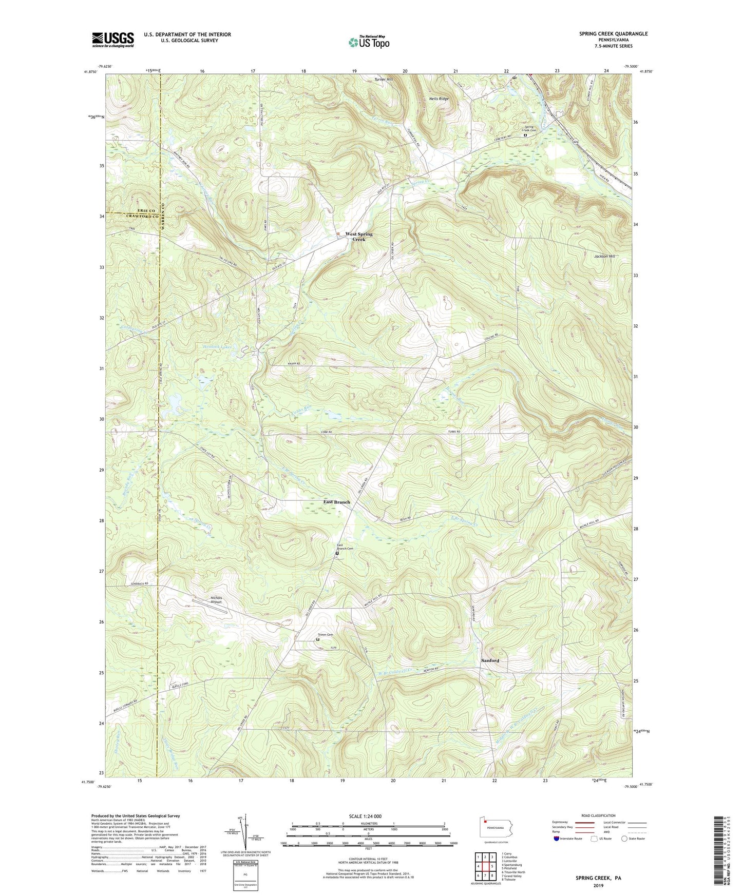
2023 topographic map quadrangle Spring Creek in the state of Pennsylvania. Scale: 1:24000. Based on the newly updated USGS 7.5' US Topo map series, this map is in the following counties: Warren, Crawford, Erie. The map contains contour data, water features, and other items you are used to seeing on USGS maps, but also has updated roads and other features. This is the next generation of topographic maps. Printed on high-quality waterproof paper with UV fade-resistant inks.
Quads adjacent to this one:
West: Spartansburg
Northwest: Corry
North: Columbus
Northeast: Lottsville
East: Pittsfield
Southeast: Tidioute
South: Grand Valley
Southwest: Titusville North
This map covers the same area as the classic USGS quad with code o41079g5.
Contains the following named places: Armitage School, Brandy Run, Cobbs Corners, Cobbs Run, Coldspring Creek, Eagle, East Branch, East Branch Cemetery, East Branch Spring Creek, Eastman School, Ferrin Run, Hemlock Lakes, Jackson Hill, Mickel Hill Church, Neils Ridge, Nichols Airport, Rays Corners, Ross Corners, Sanford, Spring Creek, Spring Creek Cemetery, Spring Creek Post Office, Spring Creek School, Spring Creek Township Volunteer Fire Department Station 64, Township of Spring Creek, Trimm Cemetery, Trimms Corners, Tubbs School, West Spring Creek, White Chapel, Whitney Run, ZIP Code: 16436