MyTopo
Sybertsville Pennsylvania US Topo Map
Couldn't load pickup availability
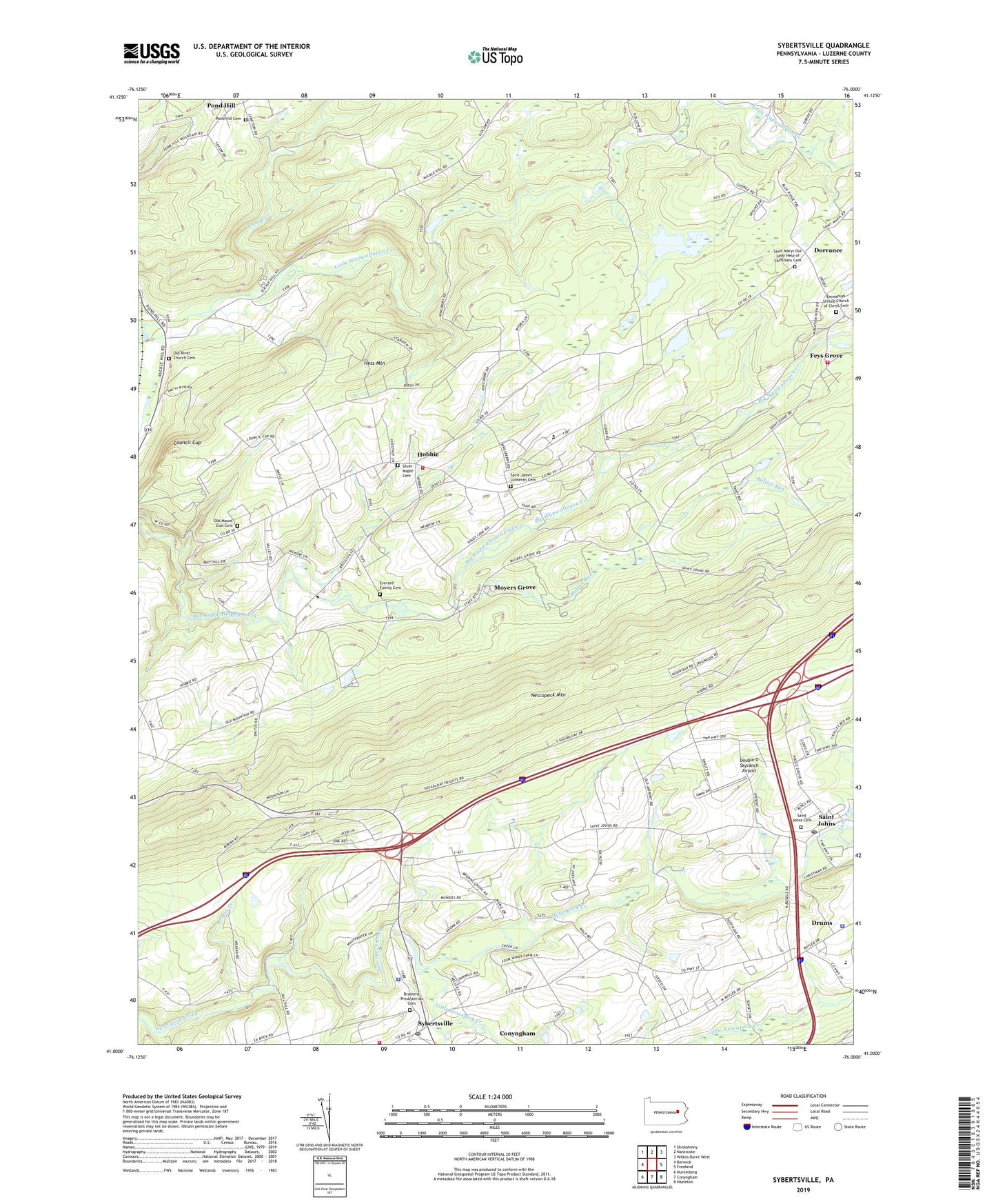
2019 topographic map quadrangle Sybertsville in the state of Pennsylvania. Scale: 1:24000. Based on the newly updated USGS 7.5' US Topo map series, this map is in the following counties: Luzerne. The map contains contour data, water features, and other items you are used to seeing on USGS maps, but also has updated roads and other features. This is the next generation of topographic maps. Printed on high-quality waterproof paper with UV fade-resistant inks.
Quads adjacent to this one:
West: Berwick
Northwest: Shickshinny
North: Nanticoke
Northeast: Wilkes-Barre West
East: Freeland
Southeast: Hazleton
South: Conyngham
Southwest: Nuremberg
Contains the following named places: Balliet Run, Brainerd Church, Brainerd Presbyterian Cemetery, Butler Township Police Department, Camp Keller, Clarks Hill Airport, Council Cup, Council Cup Scenic Overlook, Dorrance, Dorrance Township Volunteer Fire Department Station 124, Double D Skyranch Airport, Emmanuel Church, Emmanuel United Church of Christ Cemetery, Everard Family Cemetery, Feys Grove, Good School, Hess Mountain, Hobbie, Kester Creek, Kinsey School, Little Nescopeck Creek, Long Run, Moyers Grove, Old Mount Zion Cemetery, Old River Church Cemetery, Pond Creek, Pond Hill Cemetery, River Church, Saint James Church, Saint James Lutheran Cemetery, Saint Johns, Saint Johns Cemetery, Saint Johns Post Office, Saint Marys Our Lady Help of Christians Cemetery, Scanlin, Silver Maple Cemetery, Sugarloaf Fire Company Station 177, Sugarloaf Township Police Department, Sybertsville, Sybertsville Post Office, Township of Dorrance, Township of Hollenback, ZIP Codes: 18222, 18251, 18660