
MyTopo
Townville Pennsylvania US Topo Map
Couldn't load pickup availability
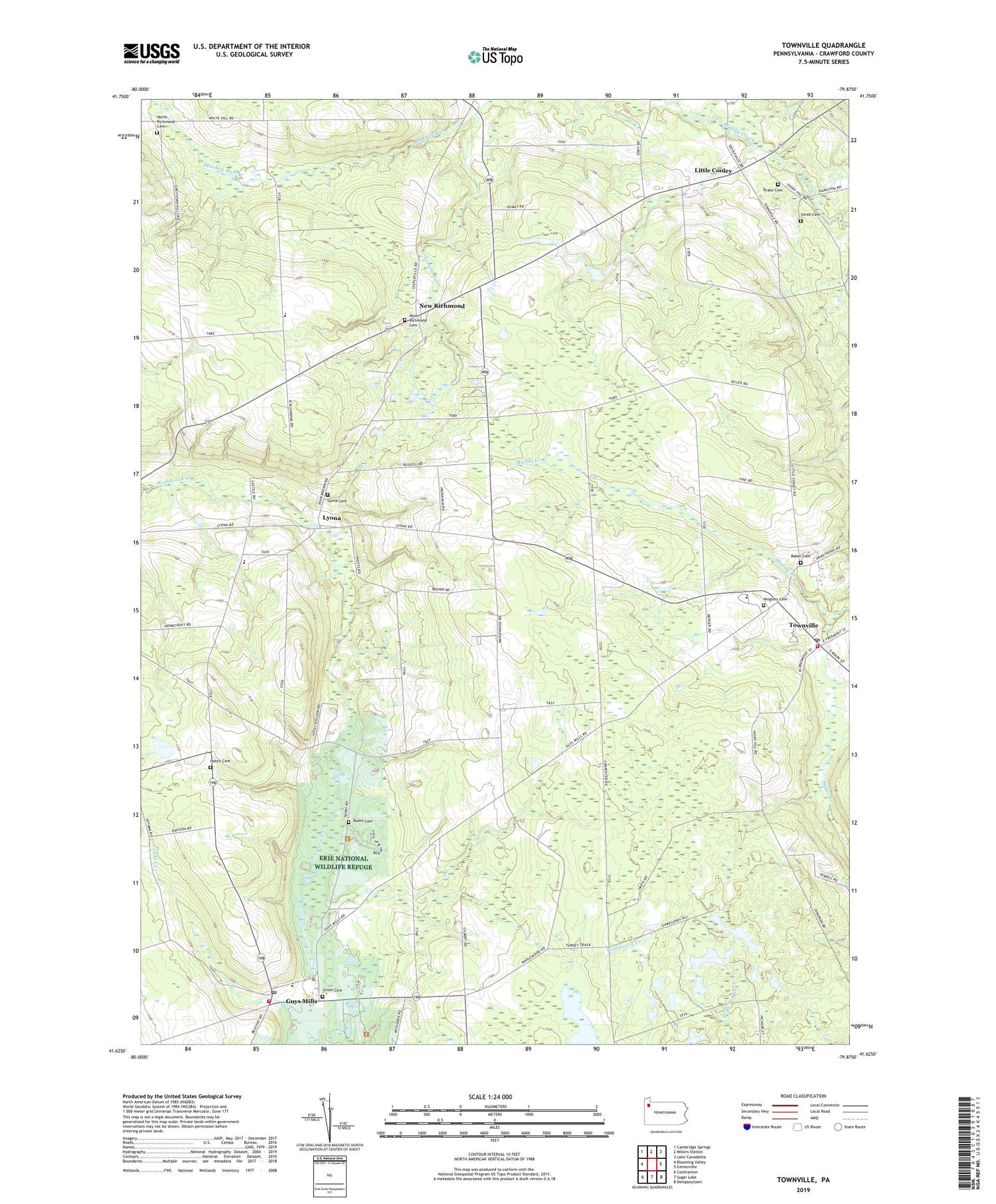
2019 topographic map quadrangle Townville in the state of Pennsylvania. Scale: 1:24000. Based on the newly updated USGS 7.5' US Topo map series, this map is in the following counties: Crawford. The map contains contour data, water features, and other items you are used to seeing on USGS maps, but also has updated roads and other features. This is the next generation of topographic maps. Printed on high-quality waterproof paper with UV fade-resistant inks.
Quads adjacent to this one:
West: Blooming Valley
Northwest: Cambridge Springs
North: Millers Station
Northeast: Lake Canadohta
East: Centerville
Southeast: Dempseytown
South: Sugar Lake
Southwest: Cochranton
Contains the following named places: Baker Cemetery, Barlow School, Basil Corners, Borough of Townville, Buckley Corners, Center School, Clarks Corners, Drake Cemetery, Federal Run, Gilbert Corners, Guys Mills, Guys Mills Census Designated Place, Guys Mills Post Office, Hatch Cemetery, Hatch School, Hickory Corners, Higby School, Jewel Corners, Kingsley Cemetery, Lamb School, Little Cooley, Lyona, Lyona Cemetery, Miles Corners, New Richmond, New Richmond Cemetery, North Richmond Cemetery, North Richmond Church, Oregon Corners, Radle Cemetery, Randolph Volunteer Fire Department 18, Randolph-East Mead High School, Root School, Sayre School, Smith Cemetery, South Richmond Corners, South Richmond School, State Game Lands Number 146, State Game Lands Number 200, State Game Lands Number 69, Temple Run, Township of Randolph, Township of Richmond, Townville, Townville Post Office, Townville Volunteer Fire Department 24, Turkey Track Corners, Union Cemetery, ZIP Codes: 16327, 16360


