MyTopo
Dalzell South Carolina US Topo Map
Couldn't load pickup availability
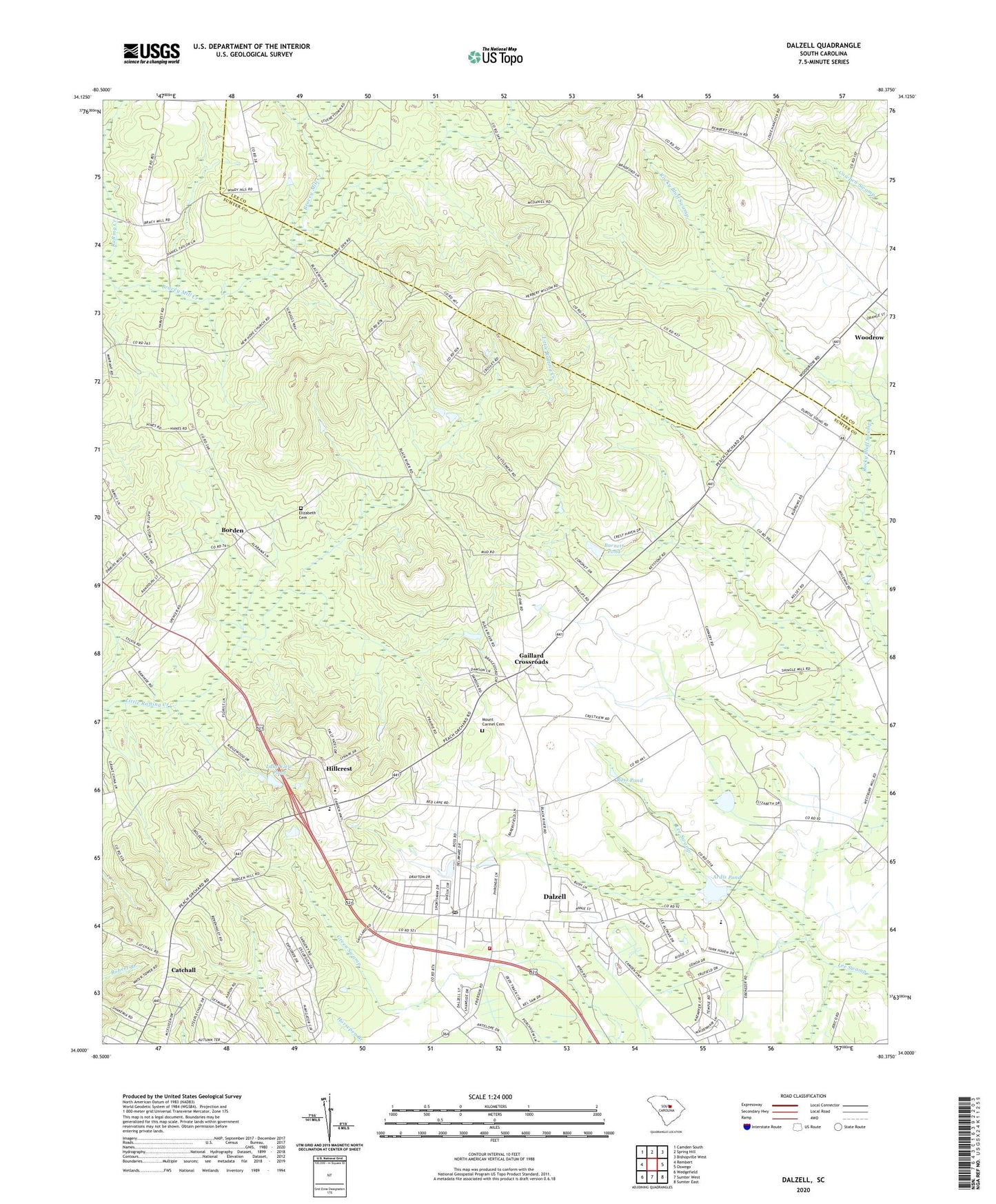
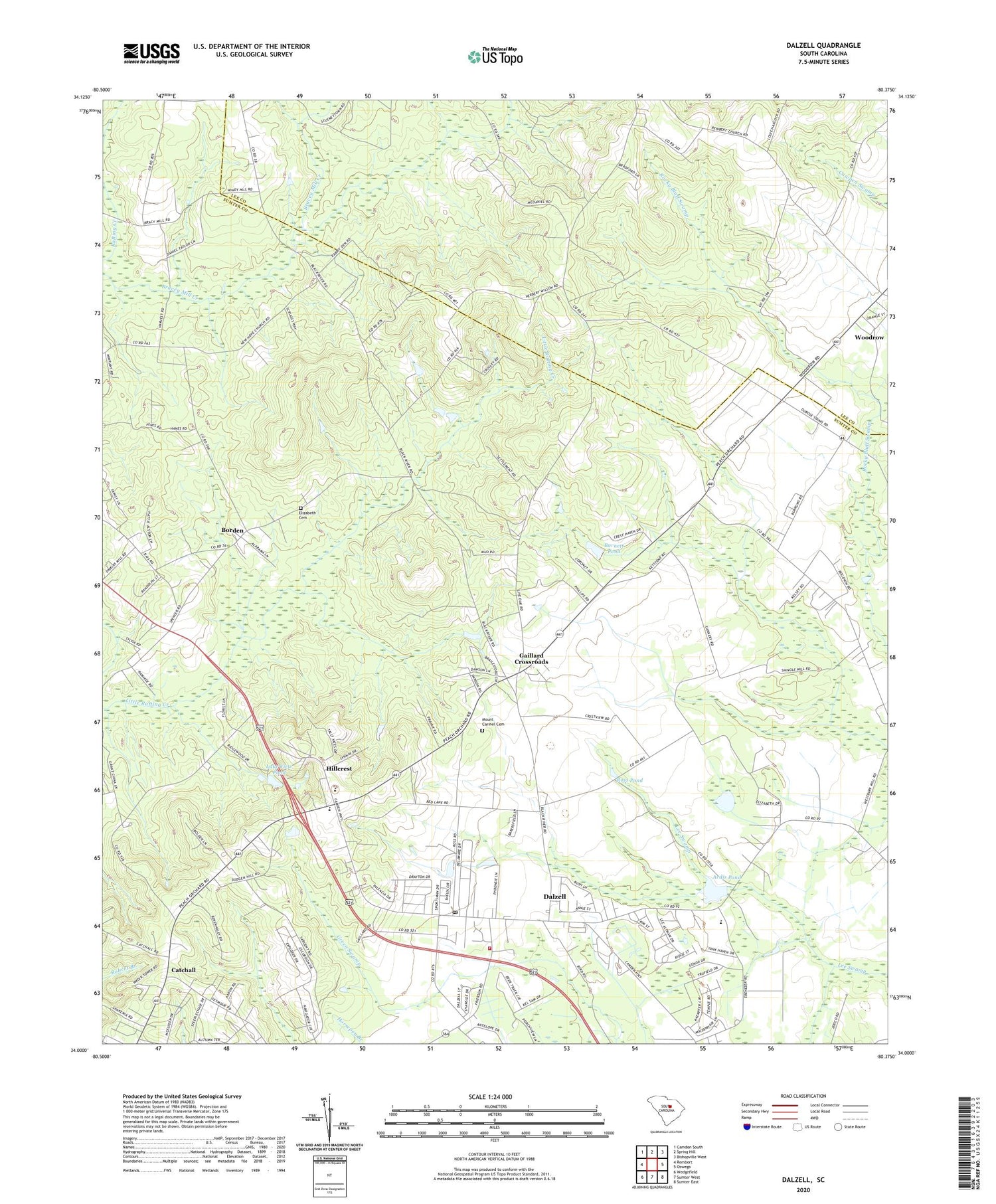
2020 topographic map quadrangle Dalzell in the state of South Carolina. Scale: 1:24000. Based on the newly updated USGS 7.5' US Topo map series, this map is in the following counties: Sumter, Lee. The map contains contour data, water features, and other items you are used to seeing on USGS maps, but also has updated roads and other features. This is the next generation of topographic maps. Printed on high-quality waterproof paper with UV fade-resistant inks.
Quads adjacent to this one:
West: Rembert
Northwest: Camden South
North: Spring Hill
Northeast: Bishopville West
East: Oswego
Southeast: Sumter East
South: Sumter West
Southwest: Wedgefield
Contains the following named places: Ardis Pond, Ardis Pond Dam D-1979, Barnett Pond, Barnett Pond Dam D-1976, Borden, Borden School, Bracey Mill Creek, Burrows Crossroads, Catchall, Dalzell, Dalzell Census Designated Place, Dalzell Post Office, Dalzell School, Ebenezer School, Elizabeth Cemetery, Elizabeth Church, Evenezer Church, Gaillard Crossroads, Grant Hill Church, Hillcrest, Hillcrest School, Hopewell Church, Horeb Church, Lake View Pond, Lake View Pond Dam D-1977, Mount Carmel Cemetery, Mount Joshua Church, Mount Joshua School, Mount Olive Church, Nebo School, New Hope Church, Norsworthy Pond, Norsworthy Pond Dam D-1975, Pecan Acres, Providence Church, Providence School, Rembert Memorial School, Rock Shed School, Ross Pond, Ross Pond Dam D-1978, Saint James Church, Saint James School, Saint Phillips Church, Sumter County Rural Fire Department Dalzell, Sumter North Division, Thomas Sumter Academy, Tirzah Presbyterian Church, Woodrow, ZIP Code: 29040